- Harwich, Massachusetts
Infobox Settlement
official_name = Harwich, Massachusetts
nickname =
motto =
imagesize =
image_caption = Harwich Town Hall
image_
mapsize = 250px
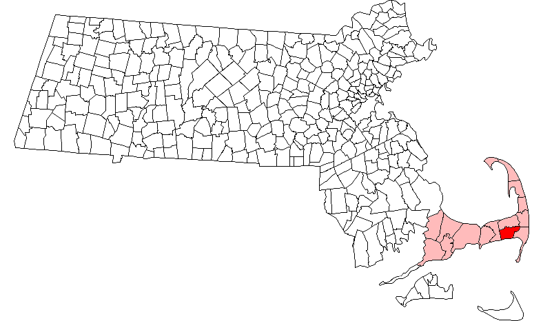
map_caption = Location in Barnstable County in Massachusetts
mapsize1 =
map_caption1 =
subdivision_type = Country
subdivision_name =United States
subdivision_type1 = State
subdivision_name1 =Massachusetts
subdivision_type2 = County
subdivision_name2 = Barnstable
established_title = Settled
established_date = 1670
established_title2 = Incorporated
established_date2 = 1694
established_title3 =
established_date3 =
government_type =Open town meeting
leader_title = Leader
leader_name =Town Administrator
leader_title1 =
leader_name1 =
area_magnitude =
area_total_km2 = 85.9
area_total_sq_mi = 33.2
area_land_km2 = 54.5
area_land_sq_mi = 21.0
area_water_km2 = 31.4
area_water_sq_mi = 12.1
population_as_of = 2000
settlement_type = Town
population_total = 12386
population_density_km2 = 227.3
population_density_sq_mi = 588.6
elevation_m = 17
elevation_ft = 55
timezone = Eastern
utc_offset = -5
timezone_DST = Eastern
utc_offset_DST = -4
latd = 41 |latm = 41 |lats = 10 |latNS = N
longd = 70 |longm = 04 |longs = 35 |longEW = W
website = [http://www.town.harwich.ma.us/ www.town.harwich.ma.us]
postal_code_type = ZIP code
postal_code = 02645
area_code = 508 / 774
blank_name = FIPS code
blank_info = 25-29020
blank1_name = GNIS feature ID
blank1_info = 0618254
footnotes =Harwich is a town on
Cape Cod , in Barnstable County in the state ofMassachusetts in theUnited States . Barnstable County is coextensive withCape Cod . The town is a popular vacation spot, located near theCape Cod National Seashore . Harwich's beaches are on "the Sound side" of Cape Cod; the shores that faceNantucket Sound . Harwich has 3 active harbors. Saquatucket, Wychmere and Allen Harbors are all in Harwich Port.The town is known for its many
cranberry salt bogs, which produce cranberries that are commercially farmed. Harwich also contains the largest lake on the Cape, called Long Pond, which serves as a private airport for planes with the ability to land on water.In the summer, the town is host to the
Harwich Mariners of theCape Cod Baseball League . The team plays at Whitehouse Field.For geographic and demographic information on specific parts of the town of Harwich, please see the articles on East Harwich, Harwich Center, Harwich Port, North Harwich and West Harwich.
History
Harwich was first settled in
1670 as the eastern parish of the town of Yarmouth. The town was officially incorporated in1694 , and originally included the lands of the current town of Brewster. Early industry involved fishing and farming. The town is considered by some to be the birthplace of the cranberry industry, with the first commercial operation opened in 1846. There are still many bogs in the town, although the economy is now more centered on tourism and as a residential/retirement community. The town is also the site of the start/finish line of the "Sail Around the Cape," which rounds the Cape counter-clockwise, returning via theCape Cod Canal . ["Cape Cod, Martha's Vineyard and Nantucket Street Atlas." South Easton, MA: Arrow Maps Inc., 2004, p. 60.]Geography
According to the
United States Census Bureau , the town has a total area of 33.2square mile s (85.9km² ), of which, 21.0 square miles (54.5 km²) of it is land and 12.1 square miles (31.4 km²) of it (36.53%) is water. The villages of Harwich are: North Harwich, East Harwich, South Harwich, Harwich Center, Harwich Port and West Harwich..Harwich is on the southern side of Cape Cod, just west of the southeastern corner. It is bordered by Brewster to the north, Orleans and Chatham to the east,
Nantucket Sound to the south, and Dennis to the west. Harwich is approximately twelve miles east of Barnstable, twenty-eight miles east of theCape Cod Canal , thirty-five miles south of Provincetown, and eighty miles southeast of Boston.Cape Cod's largest inland body of water, Long Pond, lies on the Brewster border as well as several other smaller bodies of water. The shore is home to several harbors and rivers, including the Herring River, Allens Harbor, Wychmere Harbor, Saquatucket Harbor, and the Andrews River. The town is also the home to the Hawksnest State Park, as well as a marina and several beaches, including two on Long Pond.
Demographics
As of the
census GR|2 of 2000, there were 12,386 people, 5,471 households, and 3,545 families residing in the town. Thepopulation density was 588.6 people per square mile (227.3/km²). There were 9,450 housing units at an average density of 449.1/sq mi (173.4/km²). The racial makeup of the town was 95.41% White, 0.71% Black or African American, 0.19% Native American, 0.22% Asian, 0.05% Pacific Islander, 2.03% from other races, and 1.40% from two or more races. 0.96% of the population were Hispanic or Latino of any race.There were 5,471 households out of which 21.3% had children under the age of 18 living with them, 53.4% were married couples living together, 9.0% had a female householder with no husband present, and 35.2% were non-families. 29.8% of all households were made up of individuals and 16.9% had someone living alone who was 65 years of age or older. The average household size was 2.20 and the average family size was 2.72.
In the town the population was spread out with 18.3% under the age of 18, 4.2% from 18 to 24, 22.1% from 25 to 44, 25.8% from 45 to 64, and 29.6% who were 65 years of age or older. The median age was 49 years. For every 100 females there were 84.5 males. For every 100 females age 18 and over, there were 79.7 males.
The median income for a household in the town was $41,552, and the median income for a family was $51,070. Males had a median income of $38,948 versus $27,439 for females. The
per capita income for the town was $23,063. About 2.9% of families and 5.5% of the population were below thepoverty line , including 8.4% of those under age 18 and 4.1% of those age 65 or over.Government
Harwich is represented in the
Massachusetts House of Representatives as a part of the Fourth Barnstable district, which includes (with the exception of Brewster) all the towns east and north of Harwich on the Cape. The town is represented in theMassachusetts Senate as a part of the Cape and Islands District, which includes all of Cape Cod, Martha's Vineyard and Nantucket except the towns of Bourne, Falmouth, Sandwich and a portion of Barnstable. [ [http://www.mass.gov/legis/citytown.htm Index of Legislative Representation by City and Town, from Mass.gov] ] The town is patrolled by the Second (Yarmouth) Barracks of Troop D of theMassachusetts State Police . [ [http://www.mass.gov/?pageID=eopsterminal&L=5&L0=Home&L1=Law+Enforcement+%26+Criminal+Justice&L2=Law+Enforcement&L3=State+Police+Troops&L4=Troop+D&sid=Eeops&b=terminalcontent&f=msp_divisions_field_services_troops_troop_d_msp_field_troop_d_station_d2&csid=Eeops Station D-2, SP Yarmouth] ]On the national level, Harwich is a part of
Massachusetts's 10th congressional district , and is currently represented byBill Delahunt . The state's senior (Class I) member of theUnited States Senate , re-elected in 2006, isTed Kennedy . The junior (Class II) Senator, up for re-election in 2008, isJohn Kerry .Harwich is governed by the
open town meeting form of government, led by atown administrator and aboard of selectmen . Harwich has its own police and fire departments, with three firehouses in Harwich Port, East Harwich and next to police headquarters in Harwich Center. There are four post offices, in Harwich Center, Harwich Port, South Harwich and West Harwich. There are three libraries in the town; the Brooks Free Library in Harwich Center is the largest, and there are also the Chase Library on Route 28 at the Dennis town line, and one in Harwich Port. All are connected to the Cape Libraries Automated Materials Sharing (CLAMS) network. Harwich is also the site of the Long Pong Medical Center, which serves the southeastern Cape region.Education
Harwich operates its own school system for its approximately 1,400 students. Harwich Elementary School serves students from pre-kindergarten through fifth grade, Harwich Middle School serves grades 6-8, and Harwich High School serves grades 9-12. Harwich's teams are known as the Rough Riders, and their colors are blue and gold. Harwich is known for its excellent girls basketball, girls field hockey and baseball teams.
In addition to public schools, Harwich is also the site of Cape Cod Regional Vocational Technical High School, which serves most of Cape Cod. The town is also home to Holy Trinity Regional School, a Catholic school which serves pre-kindergarten through fifth grades.
Transportation
Roadways
Two of Cape Cod's major east-west routes,
U.S. Route 6 and Route 28, cross the town. The town is also the southern termini of Routes 39 and 124 as well as a portion of Route 137, pass through the town.Cape Cod Rail Trail A portion of the
Cape Cod Rail Trail , as well as several other bicycle routes, are in town. There is no rail service in town.Air Travel
Other than the occasional sea plane landing on the pond, the nearest airport is in neighboring Chatham; the nearest regional service is at
Barnstable Municipal Airport ; and the nearest national and international air service is atLogan International Airport in Boston.CCRTA Bus Connections
In recent years parts of Cape Cod have introduced bus service, especially during the summer to help cut down on traffic.
*The Flex Harwich Port - North Truro (Off Season Schedule) or Provincetown (Summer Schedule) via Brewster, Eastham, Orleans & Routes 137, 6 & 6A.
* Hyannis, MA - Orleans, MA via West Dennis, Harwich Port, Chatham & Route 28Notable Residents
*
James Hamilton - MLB Baseball prospect; outstanding baseball, football and basketball player at Harwich High; graduated in 2007.
*Shawn Fanning - Creator and Owner of MP3 music downloading application,Napster . Graduated from Harwich High School in 1998.References
External links
* [http://harwichma.virtualtownhall.net/ Town of Harwich official website]
* [http://www.harwichcc.com/ Harwich Chamber of Commerce tourist information]
* [http://www.harwich.edu/ Harwich Public Schools]
* [http://www.harwichmariners.org/ Harwich Mariners]
* [http://www.capecodchronicle.com/ The Cape Cod Chronicle, Harwich's hometown newspaper]
* [http://homepage.mac.com/mooncusser/PhotoAlbum2.html Photos and Video of Weir Fishing in Harwich, MA]
* [http://thebreeze.info/ Cape Cod Regional Transit Authority]
* [http://www.theflex.org/default.htm/ The Flex Bus Route]
Wikimedia Foundation. 2010.