- Port Edwards, Wisconsin
Infobox Settlement
official_name = Port Edwards, Wisconsin
settlement_type =Town
nickname =
motto =
imagesize =
image_caption =
image_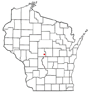
mapsize = 250px
map_caption = Location of Port Edwards, Wisconsin
mapsize1 =
map_caption1 =subdivision_type = Country
subdivision_name =United States
subdivision_type1 = State
subdivision_name1 =Wisconsin
subdivision_type2 = County
subdivision_name2 = Woodgovernment_footnotes =
government_type =
leader_title =
leader_name =
leader_title1 =
leader_name1 =
established_title =
established_date =unit_pref = Imperial
area_footnotes =area_magnitude =
area_total_km2 = 101.6
area_land_km2 = 100.0
area_water_km2 = 1.6
area_total_sq_mi = 39.2
area_land_sq_mi = 38.6
area_water_sq_mi = 0.6population_as_of = 2000
population_footnotes =
population_total = 1446
population_density_km2 = 14.5
population_density_sq_mi = 37.4timezone = Central (CST)
utc_offset = -6
timezone_DST = CDT
utc_offset_DST = -5
elevation_footnotes = GR|3
elevation_m = 297
elevation_ft = 974
latd = 44 |latm = 17 |lats = 59 |latNS = N
longd = 89 |longm = 58 |longs = 23 |longEW = Wpostal_code_type =
postal_code =
area_code =
blank_name = FIPS code
blank_info = 55-64200GR|2
blank1_name = GNIS feature ID
blank1_info = 1583955GR|3
website =
footnotes =Port Edwards is a village in Wood County,
Wisconsin ,United States . The population was 1,944 at the 2000 census. The village is located northeast and adjacent to the Town of Port Edwards.Geography
Port Edwards is located at coor dms|44|20|55|N|89|51|25|W|city (44.348788, -89.856948)GR|1.
According to the
United States Census Bureau , the village has a total area of 7.3square mile s (18.9km² ), of which, 6.0 square miles (15.6 km²) of it is land and 1.2 square miles (3.2 km²) of it (17.15%) is water.History
Originally known as "Frenchtown," this community was settled by Europeans in the 1830s, when it first formed around the nucleus of a
sawmill operated by John Edwards Jr. This business—jointly owned by this man's father, John Edwards Sr., and the senior Edwards' partner, Henry Clinton—eventually evolved into a papermaking concern.For the better part of 150 years, Port Edwards was a "dry" community, where sale of
alcoholic beverage s was prohibited by local ordinance. That was changed in the late 1990s, when a restaurant opened in the village and sought a license to sell liquor.Today, the village consists of a small cluster of 1890s to 1940s homes and the giant
Domtar Inc. papermaking complex. TheAlexander House Center for Art and History is also located here. [ [http://www.howgs.org/wood_county_history.htm HOWGS | Wood County, Wisconsin | History ] ]Demographics
As of the
census GR|2 of 2000, there were 1,944 people, 706 households, and 518 families residing in the village. Thepopulation density was 322.1 people per square mile (124.3/km²). There were 737 housing units at an average density of 122.1/sq mi (47.1/km²). The racial makeup of the village was 93.31% White, 0.57% Black or African American, 1.08% Native American, 3.86% Asian, 0.15% from other races, and 1.03% from two or more races. 0.93% of the population wereHispanic orLatino of any race.There were 706 households out of which 34.0% had children under the age of 18 living with them, 60.8% were married couples living together, 8.9% had a female householder with no husband present, and 26.5% were non-families. 23.9% of all households were made up of individuals and 12.2% had someone living alone who was 65 years of age or older. The average household size was 2.58 and the average family size was 3.04.
In the village the population was spread out with 26.7% under the age of 18, 6.1% from 18 to 24, 24.2% from 25 to 44, 21.1% from 45 to 64, and 21.9% who were 65 years of age or older. The median age was 40 years. For every 100 females there were 95.2 males. For every 100 females age 18 and over, there were 87.5 males.
The median income for a household in the village was $48,850, and the median income for a family was $54,801. Males had a median income of $46,250 versus $26,106 for females. The
per capita income for the village was $20,750. About 5.5% of families and 7.9% of the population were below thepoverty line , including 10.3% of those under age 18 and 5.1% of those age 65 or over.References
External links
* [http://www.pesd.k12.wi.us Port Edwards Public Schools]
* [http://www.portedwardswi.com Port Edwards Community Website including municipal information]
Wikimedia Foundation. 2010.