- National Register of Historic Places listings in Martinsville, Virginia
-
This list includes properties and districts listed on the National Register of Historic Places in the independent city of Martinsville, Virginia. Click the "Map of all coordinates" link to the right to view a Google map of all properties and districts with latitude and longitude coordinates in the table below.[1]
-
- This National Park Service list is complete through NPS recent listings posted November 10, 2011.[2]
[3] Landmark name [4] Image Date listed Location City or town Summary 1 Dry Bridge School February 25, 2009 1005 Jordan St.
36°41′32″N 79°50′59″W / 36.692097°N 79.849858°WMartinsville 2 East Church Street-Starling Avenue Historic District September 6, 2006 Brown St., E. Church St., Cleveland Ave., Letcher Court, Market St. E, Scuffle Hill, Starling Ave.
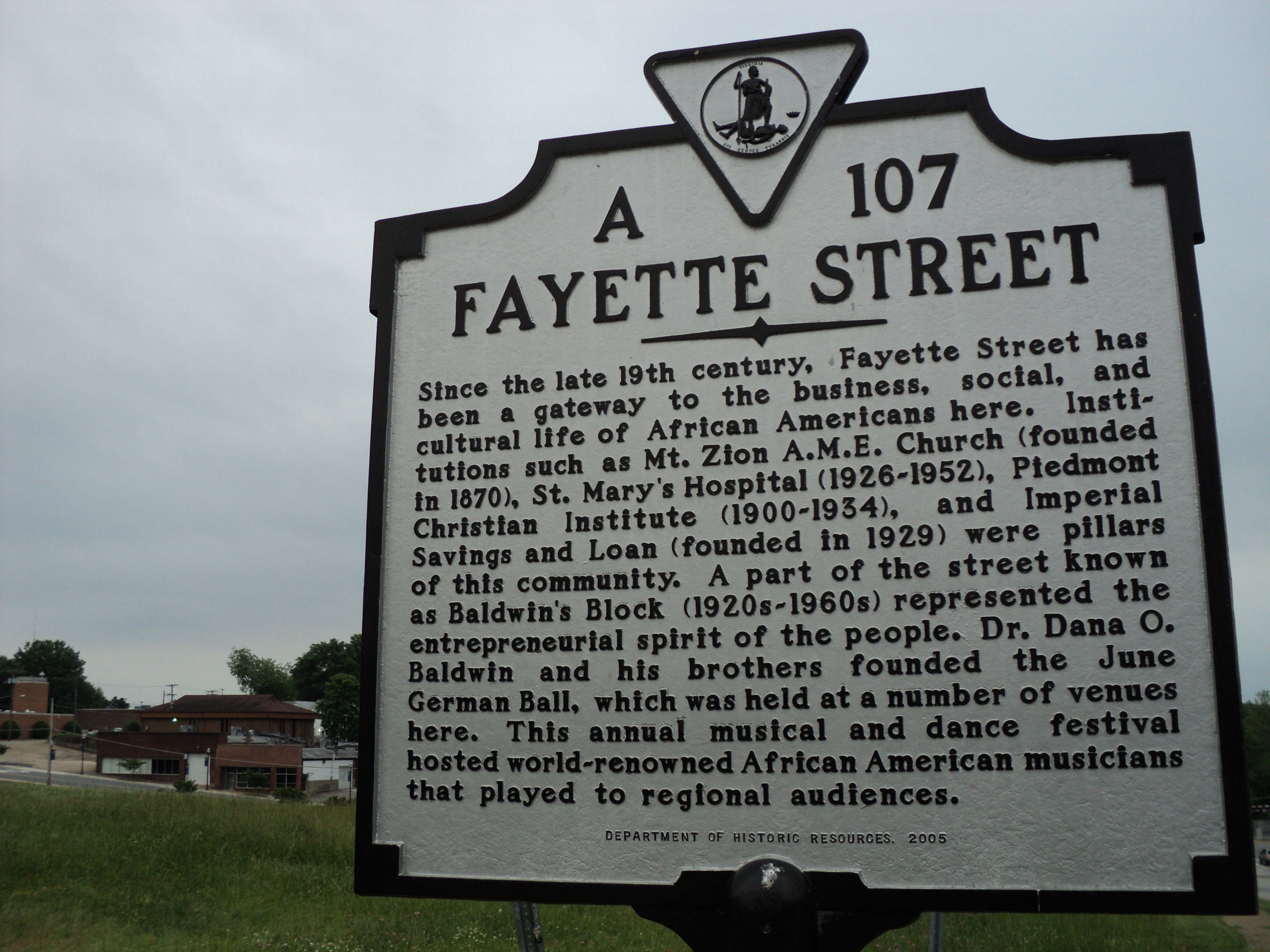
36°41′12″N 79°51′57″W / 36.686667°N 79.865833°WMartinsville 3 Fayette Street Historic District 
May 2, 2007 Fayette St. and side sts roughly bounded by Market, W. Church, Memorial and Swanson Sts.
36°41′33″N 79°52′54″W / 36.692489°N 79.881542°WMartinsville 4 Little Post Office 
February 21, 1997 207 Starling Ave.
36°41′05″N 79°51′57″W / 36.684722°N 79.865833°WMartinsville 5 Martinsville Historic District October 30, 1998 Roughly bounded by VA 457, Danville RR tracks, Clay St., and Market St.
36°41′30″N 79°52′21″W / 36.691586°N 79.872411°WMartinsville 6 Martinsville Novelty Corporation Factory May 21, 2010 900 Rives Rd.
36°40′31″N 79°51′34″W / 36.675322°N 79.85955°WMartinsville 7 Scuffle Hill 
February 21, 1997 311 E. Church St.
36°41′22″N 79°51′58″W / 36.689444°N 79.866111°WMartinsville See also
- National Register of Historic Places listings in Virginia
- List of National Historic Landmarks in Virginia
References
- ^ The latitude and longitude information provided in this table was derived originally from the National Register Information System, which has been found to be fairly accurate for about 99% of listings. For about 1% of NRIS original coordinates, experience has shown that one or both coordinates are typos or otherwise extremely far off; some corrections may have been made. A more subtle problem causes many locations to be off by up to 150 yards, depending on location in the country: most NRIS coordinates were derived from tracing out latitude and longitudes off of USGS topographical quadrant maps created under North American Datum of 1927, which differs from the current, highly accurate GPS system used by Google maps. Chicago is about right, but NRIS longitudes in Washington are higher by about 4.5 seconds, and are lower by about 2.0 seconds in Maine. Latitudes differ by about 1.0 second in Florida. Some locations in this table may have been corrected to current GPS standards.
- ^ "National Register of Historic Places: Weekly List Actions". National Park Service, United States Department of the Interior. Retrieved on November 10, 2011.
- ^ Numbers represent an ordering by significant words. Various colorings, defined here, differentiate National Historic Landmark sites and National Register of Historic Places Districts from other NRHP buildings, structures, sites or objects.
- ^ "National Register Information System". National Register of Historic Places. National Park Service. . http://nrhp.focus.nps.gov/natreg/docs/All_Data.html.
U.S. National Register of Historic Places Topics Lists by states Alabama • Alaska • Arizona • Arkansas • California • Colorado • Connecticut • Delaware • Florida • Georgia • Hawaii • Idaho • Illinois • Indiana • Iowa • Kansas • Kentucky • Louisiana • Maine • Maryland • Massachusetts • Michigan • Minnesota • Mississippi • Missouri • Montana • Nebraska • Nevada • New Hampshire • New Jersey • New Mexico • New York • North Carolina • North Dakota • Ohio • Oklahoma • Oregon • Pennsylvania • Rhode Island • South Carolina • South Dakota • Tennessee • Texas • Utah • Vermont • Virginia • Washington • West Virginia • Wisconsin • WyomingLists by territories Lists by associated states Other Template:Martinsville, Virginia
Categories:- Martinsville, Virginia
- National Register of Historic Places in Virginia
- Virginia-related lists
-


Wikimedia Foundation. 2010.