- Cloverport, Kentucky
-
Cloverport, Kentucky — City — Location of Cloverport, Kentucky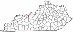
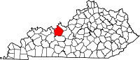
Coordinates: 37°50′3″N 86°37′55″W / 37.83417°N 86.63194°WCoordinates: 37°50′3″N 86°37′55″W / 37.83417°N 86.63194°W Country United States State Kentucky County Breckinridge Area - Total 1.7 sq mi (4.3 km2) - Land 1.6 sq mi (4.2 km2) - Water 0.0 sq mi (0.1 km2) Elevation 489 ft (149 m) Population (2000) - Total 1,256 - Density 779.1/sq mi (300.8/km2) Time zone Central (CST) (UTC-6) - Summer (DST) CDT (UTC-5) ZIP code 40111 Area code(s) 270 FIPS code 21-15904 GNIS feature ID 0489709 Cloverport is a city in Breckinridge County, Kentucky, United States, on the banks of the Ohio River. The population was 1,256 at the 2000 census. Under Kentucky state law, it is a fifth class city.
Contents
History
The town was once known as "Joesville," named after its founder, Joe Huston. Founded in 1808[1] and situated along the Ohio River, Cloverport's past has seen greater economic importance as a port city.
According to John E. Kleber "A pioneer community, Joe's Landing, was established by Joe Huston in 1798 and renamed Cloverport in 1828."[2]
In 1816, Cloverport ferryman Jacob Weatherholt piloted the family of Abraham Lincoln, then a lad of seven, along with his parents, Thomas and Nancy, across the Ohio River as the family left Kentucky to move to a newly-acquired farm in Spencer County, Indiana.
Cloverport was also the site of a button factory, which made use of mussel shells from the Ohio River.
In the nineteenth century, the Victoria Coal Mines, named in honor of Queen Victoria of the United Kingdom, produced coal oil, made from cannel coal, which was later used to light Buckingham Palace.
Former United States Supreme Court Justice Wiley Blount Rutledge was born at nearby Tar Springs on July 20, 1894. Rutledge was the son of the pastor of Cloverport Baptist Church.
Geography
According to the U.S Census Bureau, the city has a total area of 1.7 square miles (4.4 km2), of which, 1.6 square miles (4.1 km2) of it is land and 0.04 square miles (0.10 km2) of it (2.41%) is water.
Demographics
As of the census[3] of 2000, there were 1,256 people, 536 households, and 351 families residing in the city. The population density was 779.1 people per square mile (301.2/km²). There were 620 housing units at an average density of 384.6 per square mile (148.7/km²). The racial makeup of the city was 96.42% White, 2.47% African American, 0.08% Asian, 0.08% from other races, and 0.96% from two or more races. Hispanic or Latino of any race were 0.88% of the population.
There were 536 households out of which 23.9% had children under the age of 18 living with them, 47.6% were married couples living together, 14.0% had a female householder with no husband present, and 34.5% were non-families. 32.3% of all households were made up of individuals and 16.8% had someone living alone who was 65 years of age or older. The average household size was 2.27 and the average family size was 2.83.
In the city the population was spread out with 20.8% under the age of 18, 8.9% from 18 to 24, 23.6% from 25 to 44, 27.4% from 45 to 64, and 19.3% who were 65 years of age or older. The median age was 43 years. For every 100 females there were 95.9 males. For every 100 females age 18 and over, there were 89.5 males.
The median income for a household in the city was $23,750, and the median income for a family was $30,917. Males had a median income of $30,156 versus $18,750 for females. The per capita income for the city was $14,990. About 14.1% of families and 20.2% of the population were below the poverty line, including 27.9% of those under age 18 and 13.3% of those age 65 or over.
Notable natives
- Joseph Holt - Commissioner of Patents, Postmaster General and Secretary of War in President Buchanan's Administration, 1857-1861[4]
- Wiley Blount Rutledge - former United States Supreme Court justice
- Benjamin Franklin Mudge
Schools
Students in Cloverport attend Cloverport Independent Schools
See also
References
- ^ "Dictionary of Places: Cloverport". Encyclopedia of Kentucky. New York, New York: Somerset Publishers. 1987. ISBN 0403099811.
- ^ http://books.google.com/books?id=8eFSK4o--M0C&lpg=PA122&ots=2ObKE_t3TS&dq=joe%20huston%20cloverport&pg=PA122#v=onepage&q=joe%20huston%20cloverport&f=false
- ^ "American FactFinder". United States Census Bureau. http://factfinder.census.gov. Retrieved 2008-01-31.
- ^ http://www.kentuckytourism.com/things_to_do/history_heritage/joseph-holt-house-and-grave/1867/
Municipalities and communities of Breckinridge County, Kentucky Cities Cloverport | Hardinsburg | Irvington
Unincorporated
communityGarfield
Categories:- Populated places established in 1808
- Populated places in Breckinridge County, Kentucky
- Cities in Kentucky
- Kentucky populated places on the Ohio River


Wikimedia Foundation. 2010.