- Mariaville, Maine
-
Mariaville, Maine — Town — Nickname(s): The Calculagraph City Location within the state of Maine
 Mariaville, Maine
Coordinates: 44°42′53″N 68°23′34″W / 44.71472°N 68.39278°W Country United States State Maine County Hancock Area – Total 47.2 sq mi (122.2 km2) – Land 39.0 sq mi (100.9 km2) – Water 8.2 sq mi (21.3 km2) Elevation 157 ft (48 m) Population (2000) – Total 414 – Density 10.6/sq mi (4.1/km2) Time zone Eastern (EST) (UTC-5) – Summer (DST) EDT (UTC-4) ZIP code 04605 Area code(s) 207 FIPS code 23-43430 GNIS feature ID 0582580 Mariaville is a town in Hancock County, Maine, United States. The town was named for Maria Matilda, daughter of landholder William Bingham.[1] The population was 414 at the 2000 census.
Geography
According to the United States Census Bureau, the town has a total area of 47.2 square miles (122 km2), of which, 39.0 square miles (101 km2) of it is land and 8.2 square miles (21 km2) of it (17.41%) is water.
Demographics
As of the census[2] of 2000, there were 414 people, 149 households, and 105 families residing in the town. The population density was 10.6 people per square mile (4.1/km²). There were 318 housing units at an average density of 8.2 per square mile (3.2/km²). The racial makeup of the town was 99.52% White and 0.48% Asian.
There were 149 households out of which 40.3% had children under the age of 18 living with them, 60.4% were married couples living together, 4.7% had a female householder with no husband present, and 29.5% were non-families. 22.1% of all households were made up of individuals and 2.0% had someone living alone who was 65 years of age or older. The average household size was 2.78 and the average family size was 3.26.
In the town the population was spread out with 32.4% under the age of 18, 5.6% from 18 to 24, 33.6% from 25 to 44, 23.2% from 45 to 64, and 5.3% who were 65 years of age or older. The median age was 35 years. For every 100 females there were 106.0 males. For every 100 females age 18 and over, there were 98.6 males.
The median income for a household in the town was $31,250, and the median income for a family was $40,417. Males had a median income of $29,545 versus $17,500 for females. The per capita income for the town was $13,931. About 12.5% of families and 12.4% of the population were below the poverty line, including 15.1% of those under age 18 and 47.4% of those age 65 or over.
References
- ^ "Profile for Mariaville, Maine". ePodunk. http://www.epodunk.com/cgi-bin/genInfo.php?locIndex=2220. Retrieved 2010-04-18.
- ^ "American FactFinder". United States Census Bureau. http://factfinder.census.gov. Retrieved 2008-01-31.
Municipalities and communities of Hancock County, Maine City 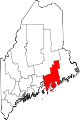
Towns Amherst | Aurora | Bar Harbor | Blue Hill | Brooklin | Brooksville | Bucksport | Castine | Cranberry Isles | Dedham | Deer Isle | Eastbrook | Franklin | Frenchboro | Gouldsboro | Great Pond | Hancock | Lamoine | Mariaville | Mount Desert | Orland | Osborn | Otis | Penobscot | Sedgwick | Sorrento | Southwest Harbor | Stonington | Sullivan | Surry | Swan's Island | Tremont | Trenton | Verona Island | Waltham | Winter Harbor
Unorganized
territoriesCDPs Other
villagesCoordinates: 44°43′14″N 68°24′56″W / 44.72056°N 68.41556°W
Categories:- Towns in Hancock County, Maine


Wikimedia Foundation. 2010.