- Northwest Hancock, Maine
-
Northwest Hancock is an unorganized territory (township) in Hancock County, Maine, United States. The population was 4 at the 2000 census. The territory is designated as Township 32 Middle Division.
Geography
According to the United States Census Bureau, the unorganized territory has a total area of 41.4 square miles (107.3 km²), 41.3 square miles (107.1 km²) of it is land and 0.1 square miles (0.2 km²) of it is water (0.22%).
Demographics
As of the census[1] of 2000.there were 4 people, 2 households, and 1 family residing in the unorganized territory. The population density was 0.1 people per square mile (0.0/km²). There were 20 housing units at an average density of 0.5/sq mi (0.2/km²). The racial makeup of the unorganized territory was 100.00% White.
There were 2 households out of which 1 was a married couples living together, and 1 was a non-family. No households were made up of individuals and none had someone living alone who was 65 years of age or older. The average household size was 2 and the average family size was 2.
All of the inhabitants were 45 to 64 years old. The median age was 50 years. For every 100 females there were 100 males. For every 100 females age 18 and over there were 100 males.
References
- ^ "American FactFinder". United States Census Bureau. http://factfinder.census.gov. Retrieved 2008-01-31.
Municipalities and communities of Hancock County, Maine City 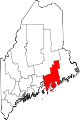
Towns Amherst | Aurora | Bar Harbor | Blue Hill | Brooklin | Brooksville | Bucksport | Castine | Cranberry Isles | Dedham | Deer Isle | Eastbrook | Franklin | Frenchboro | Gouldsboro | Great Pond | Hancock | Lamoine | Mariaville | Mount Desert | Orland | Osborn | Otis | Penobscot | Sedgwick | Sorrento | Southwest Harbor | Stonington | Sullivan | Surry | Swan's Island | Tremont | Trenton | Verona Island | Waltham | Winter Harbor
Unorganized
territoriesCentral Hancock | East Hancock | Northwest Hancock
CDPs Other
villagesCategories:- Unorganized territories in Maine
- Populated places in Hancock County, Maine

Wikimedia Foundation. 2010.