- National Register of Historic Places listings in Hancock County, Mississippi
-
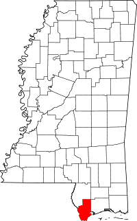 Location of Hancock County in Mississippi
This is a list of the National Register of Historic Places listings in Hancock County, Mississippi.
This is intended to be a complete list of the properties and districts on the National Register of Historic Places in Hancock County, Mississippi, United States. Latitude and longitude coordinates are provided for many National Register properties and districts; these locations may be seen together in a Google map.[1]
There are 15 properties and districts listed on the National Register in the county, including 1 National Historic Landmark.
-
- This National Park Service list is complete through NPS recent listings posted November 10, 2011.[2]
Current listings
[3] Landmark name [4] Image Date listed Location City or town Summary 1 Beach Boulevard Historic District November 25, 1980 Roughly bounded by Beach Boulevard, Necaise Ave., Seminary Dr., and 2nd and 3rd Sts.
30°18′24″N 89°20′30″W / 30.306667°N 89.341667°WBay St. Louis 2 Building at 242 St. Charles Street November 25, 1980 242 St. Charles St.
30°18′11″N 89°20′35″W / 30.303056°N 89.343056°WBay St. Louis 3 Claiborne Site (22Ha501) November 12, 1982 Address Restricted Pearlington 4 Jackson Landing Site July 27, 1973 Address Restricted Pearlington 5 Main Street Historic District 
November 25, 1980 Main St.
30°18′56″N 89°20′37″W / 30.315556°N 89.343611°WBay St. Louis 6 Nugent Site (22HA592) April 13, 1988 Address Restricted Kiln 7 Old Bay St. Louis Historic District July 8, 2010 Roughly bounded by Beach Boulevard and 3rd St. on the east, Breath Ln. and Highway 90 on the north, Seminary Dr., St. Francis St., and Old Spanish Trail on the west, and Carre Ct., Washington St., and Bookter St. on the south
30°18′32″N 89°19′48″W / 30.308889°N 89.33°WBay St. Louis 8 Rocket Propulsion Test Complex 
October 3, 1985 National Space Technology Laboratories
30°21′56″N 89°35′13″W / 30.365556°N 89.586944°WBay St. Louis 9 SJ Mound (22HA594) April 13, 1988 Address Restricted Pearlington 10 Sycamore Street Historic District November 25, 1980 Sycamore St.
30°18′31″N 89°20′39″W / 30.308611°N 89.344167°WBay St. Louis 11 Three Sisters Shell Midden (22-Ha-596) July 28, 1988 Address Restricted Pearlington 12 Up the Tree Shell Midden (22HA595) April 13, 1988 Address Restricted Pearlington 13 Washington Street Historic District November 25, 1980 Washington St.
30°18′24″N 89°20′30″W / 30.306667°N 89.341667°WBay St. Louis 14 Webb School/Gulf Coast Community Action Agency November 21, 1986 300 3rd St.
30°18′15″N 89°20′19″W / 30.304167°N 89.338611°WBay St. Louis 15 Williams Site (22-Ha-585) July 28, 1988 Address Restricted Pearlington See also
- List of National Historic Landmarks in Mississippi
- National Register of Historic Places listings in Mississippi
References
- ^ The latitude and longitude information provided in this table was derived originally from the National Register Information System, which has been found to be fairly accurate for about 99% of listings. For about 1% of NRIS original coordinates, experience has shown that one or both coordinates are typos or otherwise extremely far off; some corrections may have been made. A more subtle problem causes many locations to be off by up to 150 yards, depending on location in the country: most NRIS coordinates were derived from tracing out latitude and longitudes off of USGS topographical quadrant maps created under North American Datum of 1927, which differs from the current, highly accurate GPS system used by Google maps. Chicago is about right, but NRIS longitudes in Washington are higher by about 4.5 seconds, and are lower by about 2.0 seconds in Maine. Latitudes differ by about 1.0 second in Florida. Some locations in this table may have been corrected to current GPS standards.
- ^ "National Register of Historic Places: Weekly List Actions". National Park Service, United States Department of the Interior. Retrieved on November 10, 2011.
- ^ Numbers represent an ordering by significant words. Various colorings, defined here, differentiate National Historic Landmark sites and National Register of Historic Places Districts from other NRHP buildings, structures, sites or objects.
- ^ "National Register Information System". National Register of Historic Places. National Park Service. . http://nrhp.focus.nps.gov/natreg/docs/All_Data.html.
U.S. National Register of Historic Places Topics Lists by states Alabama • Alaska • Arizona • Arkansas • California • Colorado • Connecticut • Delaware • Florida • Georgia • Hawaii • Idaho • Illinois • Indiana • Iowa • Kansas • Kentucky • Louisiana • Maine • Maryland • Massachusetts • Michigan • Minnesota • Mississippi • Missouri • Montana • Nebraska • Nevada • New Hampshire • New Jersey • New Mexico • New York • North Carolina • North Dakota • Ohio • Oklahoma • Oregon • Pennsylvania • Rhode Island • South Carolina • South Dakota • Tennessee • Texas • Utah • Vermont • Virginia • Washington • West Virginia • Wisconsin • WyomingLists by territories Lists by associated states Other  Category:National Register of Historic Places •
  Portal:National Register of Historic Places
Municipalities and communities of Hancock County, Mississippi County seat: Bay St. Louis Cities 
CDPs Unincorporated
communitiesBayou Caddy | Clermont Harbor | Lakeshore
Categories:- Hancock County, Mississippi
- National Register of Historic Places in Mississippi by county
- Buildings and structures in Hancock County, Mississippi
-


Wikimedia Foundation. 2010.