- North Castle, New York
-
North Castle, New York — Town — Location within the state of New York
 North Castle, New York
Coordinates: 41°6′44″N 73°42′37″W / 41.11222°N 73.71028°WCoordinates: 41°6′44″N 73°42′37″W / 41.11222°N 73.71028°W Country United States State New York County Westchester Government – Supervisor William R. Weaver Area – Total 26.5 sq mi (68.6 km2) – Land 24.1 sq mi (62.4 km2) – Water 2.4 sq mi (6.2 km2) Elevation 384 ft (117 m) Population (2010) – Total 11,841 – Density 447.1/sq mi (172.6/km2) Time zone Eastern (EST) (UTC-5) – Summer (DST) EDT (UTC-4) ZIP code 10504 Area code(s) 914 FIPS code 36-51693 GNIS feature ID 0979282 Website http://www.northcastleny.com North Castle is a town in Westchester County, New York, United States. The population was 11,841 at the 2010 census.[1] It has no villages.
Contents
Geography
According to the United States Census Bureau, the town has a total area of 26.5 square miles (69 km2), of which 24.1 square miles (62 km2) is land and 2.4 square miles (6.2 km2), or 9.06%, is water.
Demographics
As of the census[2] of 2000, there were 10,849 people, 3,583 households, and 3,002 families residing in the town. The population density was 450.4 people per square mile (173.9/km²). There were 3,706 housing units at an average density of 153.9 per square mile (59.4/km²). The racial makeup of the town was 92.38% White, 1.76% African American, 0.03% Native American, 3.96% Asian, 0.05% Pacific Islander, 0.63% from other races, and 1.20% from two or more races. Hispanic or Latino of any race were 4.14% of the population.
There were 3,583 households out of which 44.2% had children under the age of 18 living with them, 74.6% were married couples living together, 6.9% had a female householder with no husband present, and 16.2% were non-families. 13.1% of all households were made up of individuals and 5.5% had someone living alone who was 65 years of age or older. The average household size was 2.99 and the average family size was 3.28.
In the town the population was spread out with 29.7% under the age of 18, 4.5% from 18 to 24, 26.8% from 25 to 44, 28.3% from 45 to 64, and 10.7% who were 65 years of age or older. The median age was 40 years. For every 100 females there were 97.1 males. For every 100 females age 18 and over, there were 94.7 males.
The median income for a household in the town was $117,815, and the median income for a family was $141,764. Males had a median income of $86,950 versus $49,500 for females. The per capita income for the town was $60,628. About 1.0% of families and 3.0% of the population were below the poverty line, including 1.7% of those under age 18 and 3.4% of those age 65 or over.
Communities in North Castle
North Castle has three distinct geographical areas, each taking the form of a hamlet.[3]
- Armonk – a hamlet[4] located in the central part of the town. It is the seat of town government[3] and the main town library.[5]
- Banksville – a hamlet,[4] also known as the "Eastern District of North Castle", located in the eastern part of the town, close to Connecticut.[3]
- North White Plains – a hamlet[4] located in the southern part of the town. It is south of the Kensico Reservoir Dam, west of the White Plains Reservoirs, and east of the Bronx River,[6] although the name generally refers to any portion of North Castle south of the Kensico Reservoir.[3]
Economy
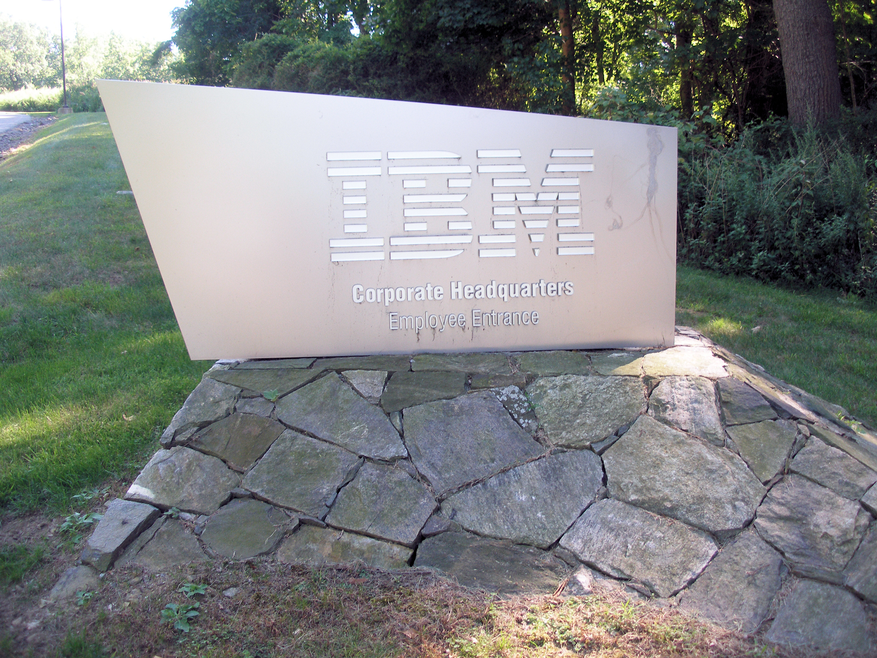
 IBM headquarters
IBM has its world headquarters in Armonk and in North Castle.[7][8][9] In addition M.E. Sharpe also has its headquarters in Armonk.[10]
Election results
Supervisor - 2009[11]
- William Weaver (Republican, Independence, Conservative) - 1,648 - 46%
- Frank Benish (Libertarian) - 990 - 27%
- Becky Kittredge (Democrat) - 965 - 27%
Councilman - 2009[11]
- John J. Cronin (Republican, Independence, Conservative) - 2,311 - 35%
- Diane Roth (Republican, Independence, Conservative) - 1,800 - 27%
- Bob Romano (Democrat) - 1,437 - 22%
- Stacey Slipe (Democrat) - 1,118 - 17%
Supervisor - 2005
- John Lombardi (Republican, Independence, Conservative) - 1,901 - 43%
- Reese Berman (Democrat, Protect North Castle) - 2,264 - 51%
- Anthony Futia, Jr. (Libertarian) - 233 - 5%
Councilman - 2005
- William Weaver (Republican, Independence, Conservative) - 2,089 - 26%
- John Stipo (Republican, Independence) - 1,398 - 18%
- Anthony Baratta (Democrat, Protect North Castle) - 1,953 - 24%
- Gerry Geist (Democrat, Conservative) - 2,548 - 32%
Supervisor - 2001
- John Lombardi (Republican) - 2,950 - 100%
Supervisor - 1999
- John Lombardi (Republican) - 1,562 - 100%
Supervisor - 1997
- John Lombardi (Republican) - 2,827 - 100%
Supervisor - 1989
- John Lombardi (Republican) - 2,126 - 74.21%
- John Stipo (Integrity) - 739 - 25.79%
Population growth (1800-2010)
- 1800 – 1,168
- 1850 – 2,189
- 1900 – 1,471
- 1950 – 3,855
- 2000 – 10,849
- 2010 – 11,841
Population growth in North Castle reflects the pattern of rural to suburban development typical of the post-World War II years. Like many other suburban communities in Westchester County and the nation, the town experienced a surge of population growth between 1940 and 1970. The overall rate of growth was moderate between 1970 and 1990 because of national economic conditions, including the rising cost of land, construction and interest, which helped to bring about a general decline in housing construction. The median price of houses sold in North Castle in 1998 was approximately $600,000.
References
- ^ "Profile of General Population and Housing Characteristics: 2010 Demographic Profile Data (DP-1): North Castle town, Westchester County, New York". U.S. Census Bureau, American Factfinder. http://factfinder2.census.gov. Retrieved November 15, 2011.
- ^ "American FactFinder". United States Census Bureau. http://factfinder.census.gov. Retrieved 2008-01-31.
- ^ a b c d "Town Life - Geography". Town of New Castle. http://www.northcastleny.com/life_geography.htm. Retrieved 2009-06-05.[dead link]
- ^ a b c "North Castle Town Website". http://www.northcastleny.com. Retrieved 2009-06-04.
- ^ http://www.northcastlelibrary.org/library_2007/HTML/hours.htm
- ^ USGS. North White Plains, NY (Map) (Acme Mapper 2.0, Service by TerraServer ed.). http://mapper.acme.com/?ll=41.05806,-73.76723&z=15&t=T&marker0=41.00241%2C-75.07207%2CSunfish%20Pond&marker1=41.42161%2C-74.04176%2CCornwall%5C%2C%20New%20York&marker2=42.70640%2C-73.76520%2CLoudonville%5C%2C%20NY&marker3=41.13907%2C-73.70022%2CNorth%20Castle%5C%2C%20New%20York. Retrieved 2009-06-05.
- ^ "Contact Us." IBM. Retrieved on October 20, 2009.
- ^ "Armonk CDP, New York." U.S. Census Bureau. Retrieved on October 20, 2009.
- ^ "North Castle town, Westchester county, New York." U.S. Census Bureau. Retrieved on October 20, 2009.
- ^ "Contacts." M. E. Sharpe. Retrieved on August 8, 2011. "80 Business Park Drive Armonk NY 10504"
- ^ a b http://www.westchestergov.com/boe99/link11.aspx Westchester County, retrieved on 11/16/09
External links
Categories:- Towns in New York
- Populated places in Westchester County, New York
- Underground Railroad locations


Wikimedia Foundation. 2010.