- Lake Mohegan, New York
-
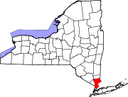
Lake Mohegan, New York — CDP — Location within the state of New York Coordinates: 41°19′7″N 73°50′53″W / 41.31861°N 73.84806°WCoordinates: 41°19′7″N 73°50′53″W / 41.31861°N 73.84806°W Country United States State New York County Westchester Area - Total 3.1 sq mi (8.0 km2) - Land 2.9 sq mi (7.5 km2) - Water 0.2 sq mi (0.5 km2) Elevation 522 ft (159 m) Population (2000) - Total 5,979 - Density 2,058.4/sq mi (794.8/km2) Time zone Eastern (EST) (UTC-5) - Summer (DST) EDT (UTC-4) ZIP code 10547 Area code(s) 914 FIPS code 36-40689 GNIS feature ID 1852903 Lake Mohegan is a census-designated place (CDP) located in the town of Yorktown in Westchester County, New York, United States. The population was 5,979 at the 2000 census. Locally, the area is known as "Mohegan Lake", and the term "Lake Mohegan" is rarely used.[1][2] However, this change dates back only to the early 1970s. Before then, local residents commonly referred to it as "Lake Mohegan".
Contents
Geography
Lake Mohegan is located at 41°19′7″N 73°50′53″W / 41.31861°N 73.84806°W (41.318568, -73.848029)[3].
According to the United States Census Bureau, the CDP has a total area of 3.1 square miles (8.0 km2), of which, 2.9 square miles (7.5 km2) of it is land and 0.2 square miles (0.52 km2) of it (5.52%) is water.
http://moheganlake.org/images/Box-PIC2_sel.jpg http://moheganlake.org/images/Box-PIC3_sel.jpg
The Cortlandt Town Center, a large shopping center, is located on Route 6 in Mohegan Lake.
Drive down to the Lake with friends.
The North County Trailway In the vicinity is the North County Trailway...one of many Bike paths in Westchester:
http://www.westchestergov.com/Parks/SideBar/Trailways.htm
Demographics
As of the census[4] of 2000, there were 5,979 people, 1,975 households, and 1,520 families residing in the CDP. The population density was 2,058.4 per square mile (796.0/km²). There were 2,052 housing units at an average density of 706.5/sq mi (273.2/km²). The racial makeup of the CDP was 84.75% White, 6.89% African American, 0.33% Native American, 2.91% Asian, 0.02% Pacific Islander, 2.78% from other races, and 2.32% from two or more races. Hispanic or Latino of any race were 9.70% of the population.
There were 1,975 households out of which 43.1% had children under the age of 18 living with them, 65.2% were married couples living together, 9.0% had a female householder with no husband present, and 23.0% were non-families. 18.9% of all households were made up of individuals and 4.7% had someone living alone who was 65 years of age or older. The average household size was 2.83 and the average family size was 3.26.
In the CDP the population was spread out with 28.8% under the age of 18, 7.6% from 18 to 24, 32.7% from 25 to 44, 22.1% from 45 to 64, and 8.8% who were 65 years of age or older. The median age was 35 years. For every 100 females there were 99.8 males. For every 100 females age 18 and over, there were 95.2 males.
The median income for a household in the CDP was $80,719, and the median income for a family was $88,903. Males had a median income of $59,219 versus $39,648 for females. The per capita income for the CDP was $29,945. About 3.5% of families and 4.1% of the population were below the poverty line, including 7.2% of those under age 18 and none of those age 65 or over.
References
- ^ Lake, David. "An Illustrated History of Mohegan Lake". Yorktown Historical Society. Retrieved May 30, 2008.
- ^ Cooper, Linda and Roker, Alice. Yorktown (NY) (Images of America). Arcadia Publishing. 2003. ISBN 0738512737.
- ^ "US Gazetteer files: 2010, 2000, and 1990". United States Census Bureau. 2011-02-12. http://www.census.gov/geo/www/gazetteer/gazette.html. Retrieved 2011-04-23.
- ^ "American FactFinder". United States Census Bureau. http://factfinder.census.gov. Retrieved 2008-01-31.
Mohegan Lake Improvement District
Below is an Excerpt of the MLID Mission Statement:
The Mohegan Lake Improvement District was established in 1975, by joint action of the Town Boards of Yorktown and Cortlandt. Located in Northern Westchester County, New York, the Lake District manages 105-acre (0.42 km2) Lake Mohegan. The lake was formed in the last great ice age, but since 1900, has experienced cultural eutrophication. The lake has become increasingly prone to algae blooms, and local residents used copper sulfate to "manage" the lake for many years. About a mile long, the lake was also used for power boating, sail boating, swimming, fishing and ice skating. Not to mention the benefits of looking at the beautiful water and enjoying the company of hundreds of species of plants and animals.
After their years of hard work, and umpteen chicken barbecues to raise funds, residents realized they needed a more lasting organization to collect money and oversee the lake. They petitioned the Towns of Yorktown and Cortlandt, which swiftly approved the creation of the Mohegan Lake Improvement District under Article 12 of the Town Law of the State of New York.
The Lake District is roughly delineated to include all properties having "lake rights" to this private lake. It's hardly "private," however - with some 1,500 households now comprising the District. Currently the District raises about $48,000 a year in taxes (roughly $30 a household) to manage the lake. The District is managed by a group of volunteers, who meet the second Wednesday each month during much of the year.
Categories:- Yorktown, New York
- Census-designated places in New York
Wikimedia Foundation. 2010.


