- Mamaroneck (town), New York
-
Mamaroneck, New York — Town — 
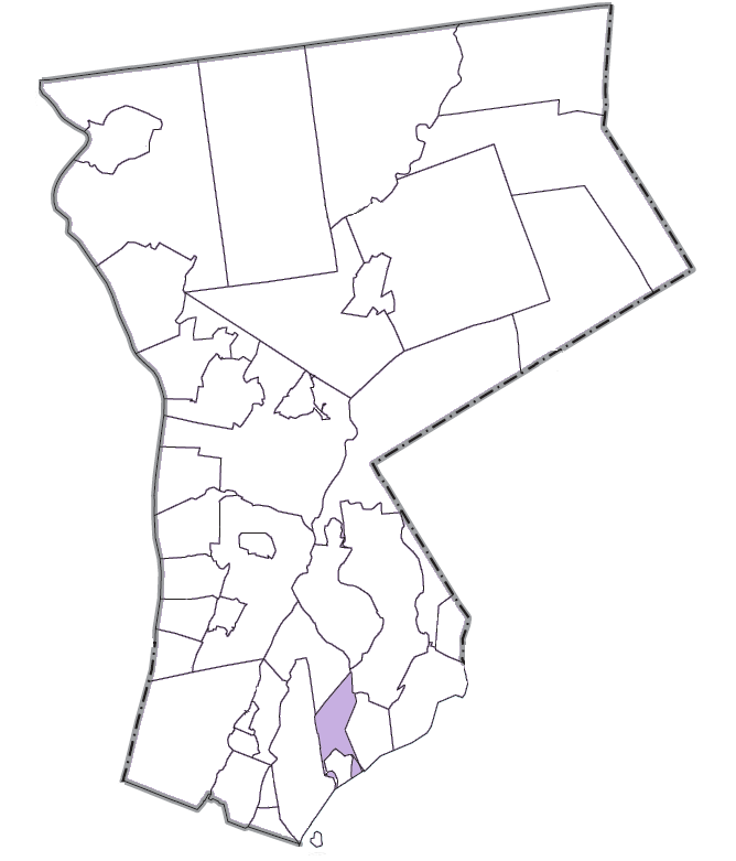
SealLocation within Westchester County Location within the state of New York
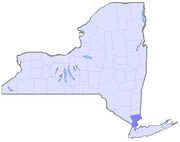
Coordinates: 40°56′57″N 73°44′1″W / 40.94917°N 73.73361°WCoordinates: 40°56′57″N 73°44′1″W / 40.94917°N 73.73361°W Country United States State New York County Westchester Government - Supervisor Valerie Moore O'Keefe Area - Total 14.0 sq mi (36.4 km2) - Land 6.6 sq mi (17.1 km2) - Water 7.4 sq mi (19.2 km2) Elevation 0 ft (0 m) Population (2010) - Total 29,156 - Density 2,074.6/sq mi (801/km2) Time zone Eastern (EST) (UTC-5) - Summer (DST) EDT (UTC-4) ZIP codes 10543, 10538, 10583 Area code(s) 914 Website http://www.townofmamaroneck.org Mamaroneck (/məˈmɑrənɛk/ mə-mar-ə-nek) is a town in Westchester County, New York, United States. The population was 29,156 at the 2010 census.[1] There are two villages contained within the town: Larchmont and the Village of Mamaroneck (part of which is located in the town of Rye). The majority of the town's land area is not within either village, constituting an unincorporated area, although a majority of the population lives within the villages. Legally, the unincorporated section and the villages constitute the town as a political and governmental subdivision of New York State. The town is led by a town board, composed of five town board members, which includes the Town Supervisor, Valerie Moore O'Keefe.
Much of the unincorporated section of the town receives its mail via the Larchmont Post Office and thereby has a Larchmont address.
Contents
Geography
According to the United States Census Bureau, the town has a total area of 14.0 square miles (36 km2), of which 6.6 square miles (17 km2) is land and 7.4 square miles (19 km2), or 52.85%, is water. The unincorporated area of the town measures 5.17 square miles (13.4 km2).
History
The area that is now the town of Mamaroneck was purchased from Native American Chief Wappaquewam and his brother Manhatahan by an Englishman named John Richbell in 1661. During the American Revolutionary War in 1776, the British loyalist William Lounsbury was attacked and killed by a group of revolutionaries led by John Flood. Several other skirmishes occurred that year between loyalists and revolutionaries.
The New York Legislature created Mamaroneck as a town on March 7, 1788. The Town of Mamaroneck is divided into three parts: the Village of Larchmont, an unincorporated area, and the Village of Mamaroneck, the rest of that village being in the town of Rye. This three-part division occurred in the 1890s to meet the growing demand for municipal services that the town could not provide. By definition at the time, a town could only provide basic government functions such as organizing and supervising elections, administering judicial functions, and constructing and maintaining highways.
During the 1890s, parts of the town of Mamaroneck that were situated closest to the water thrived. Larchmont Manor, with its beaches along Long Island Sound, had become well-known as a summer resort for families from New York City, and people were beginning to live there year-round. A large part of the town's population lived northeast of the Manor near Mamaroneck Harbor, the commercial center of town, where fishing, shipping, and manufacturing could be found. As the population of these two areas expanded, the residents soon found the need for adequate water supply, sewage disposal, garbage collection, sidewalks, and improved street lighting, police and fire protection.
In 1891, residents of Larchmont Manor obtained a charter from the Legislature under which they incorporated their section of town into a village. Four years later, residents of the most developed and populated sections of the towns of Mamaroneck and Rye voted to incorporate as the Village of Mamaroneck. The Mamaroneck River serves as the boundary separating the towns of Mamaroneck and Rye. While residents of the two villages were now able to receive municipal services, not enough people resided in the unincorporated remainder of the town of Mamaroneck to be included in either village. After World War I, the unincorporated section of the town grew sufficiently that the State Legislature granted the town government the local powers to provide local services it had previously granted to the villages by charter.
In 1910, the course at Winged Foot Golf Club was constructed. The golf club has been host to a number of professional tournaments, including the 1997 PGA Championship and the 1929, 1959, 1974, 1984 and 2006 U.S. Open.
The town of Mamaroneck introduced New York's first vegetable-oil-powered garbage truck in 2008. [1]
Demographics
As of the census[2] of 2000, there were 28,967 people, 10,929 households, and 7,748 families residing in the town. The population density was 4,377.5 people per square mile (1,689.5/km²). There were 11,255 housing units at an average density of 1,700.8 per square mile (656.4/km²). The racial makeup of the town was 88.93% White, 2.80% Black or African American, 0.12% Native American, 3.12% Asian, 0.05% Pacific Islander, 2.91% from other races, and 2.06% from two or more races. Hispanic of any race were 10.92% of the population.
There were 10,929 households out of which 35.6% had children under the age of 18 living with them, 60.0% were married couples living together, 8.0% had a female householder with no husband present, and 29.1% were non-families. 25.4% of all households were made up of individuals and 10.5% had someone living alone who was 65 years of age or older. The average household size was 2.62 and the average family size was 3.15.
In the town the population was spread out with 26.1% under the age of 18, 5.1% from 18 to 24, 29.7% from 25 to 44, 24.3% from 45 to 64, and 14.8% who were 65 years of age or older. The median age was 39 years. For every 100 females there were 91.3 males. For every 100 females aged 18 and over, there were 87.2 males.
The median income for a household in the town was $84,213, and the median income for a family was $118,774 (these figures had risen to $108,702 and $144,834 respectively as of a 2007 estimate[3]). Males had a median income of $81,249 versus $42,703 for females. The per capita income for the town was $57,822. About 2.9% of families and 4.5% of the population were below the poverty line, including 3.7% of those under age 18 and 7.1% of those age 65 or over.
Economy
Archie Comics was headquartered in the village of Mamaroneck and the town of Mamaroneck. It has since moved to Norwalk, Connecticut.[4][5]
Notable residents
- Edward Franklin Albee III, playwright, grew up in Larchmont
- Gerald B. Appel, celebrity physician, grew up in Mamaroneck[6]
- Richard K. Bernstein, renowned figure in diabetes treatment [7]
- Elizabeth Berridge, award-winning theatre actor
- James Fenimore Cooper, novelist[8]
- Kevin Dillon, actor[9]
- Matt Dillon, actor[10]
- Lou Gehrig, hall of fame baseball player, resided in a North Chatsworth Avenue apartment while playing for the Yankees
- Timothy Geithner, United States Secretary of the Treasury[11]
- D. W. Griffith, silent film director, lived in Mamaroneck for a few years in the 1920s
- Norman Rockwell, painter
- Albert Shanker, president of United Federation of Teachers
References
- ^ "Profile of General Population and Housing Characteristics: 2010 Demographic Profile Data (DP-1): Mamaroneck town, Westchester County, New York". U.S. Census Bureau, American Factfinder. http://factfinder2.census.gov. Retrieved November 15, 2011.
- ^ "American FactFinder". United States Census Bureau. http://factfinder.census.gov. Retrieved 2008-01-31.
- ^ http://factfinder.census.gov/servlet/ADPTable?_bm=y&-context=adp&-qr_name=ACS_2007_3YR_G00_DP3YR3&-ds_name=ACS_2007_3YR_G00_&-tree_id=3307&-redoLog=true&-_caller=geoselect&-geo_id=06000US3611944842&-format=&-_lang=en
- ^ "Mamaroneck town, Westchester county, New York." U.S. Census Bureau. Retrieved on August 29, 2009.
- ^ "Management." Archie Comics. Retrieved on August 29, 2009.
- ^ Richardson, Lynda. Public Lives, New York Times December 4, 2003
- ^ http://www.diabetes-book.com/index.shtml
- ^ James Fenimore Cooper Biography and Literary Works
- ^ www.filmreference.com/film/7/Kevin-Dillon.html
- ^ www.larchmontgazette.com/2005/articles/20051208dillon.html
- ^ Berger, Joseph (January 2 2009). "Suddenly, There’s a Celebrity Next Door". The New York Times. http://www.nytimes.com/2009/01/04/nyregion/westchester/04colwe.html. Retrieved June 1 2011.
External links
Categories:- Towns in New York
- United States places with Orthodox Jewish communities
- Populated places in Westchester County, New York
- Populated coastal places in New York


Wikimedia Foundation. 2010.