- Rosendale Village, New York
Infobox Settlement
official_name = Rosendale Village, New York
settlement_type = CDP
nickname =
motto =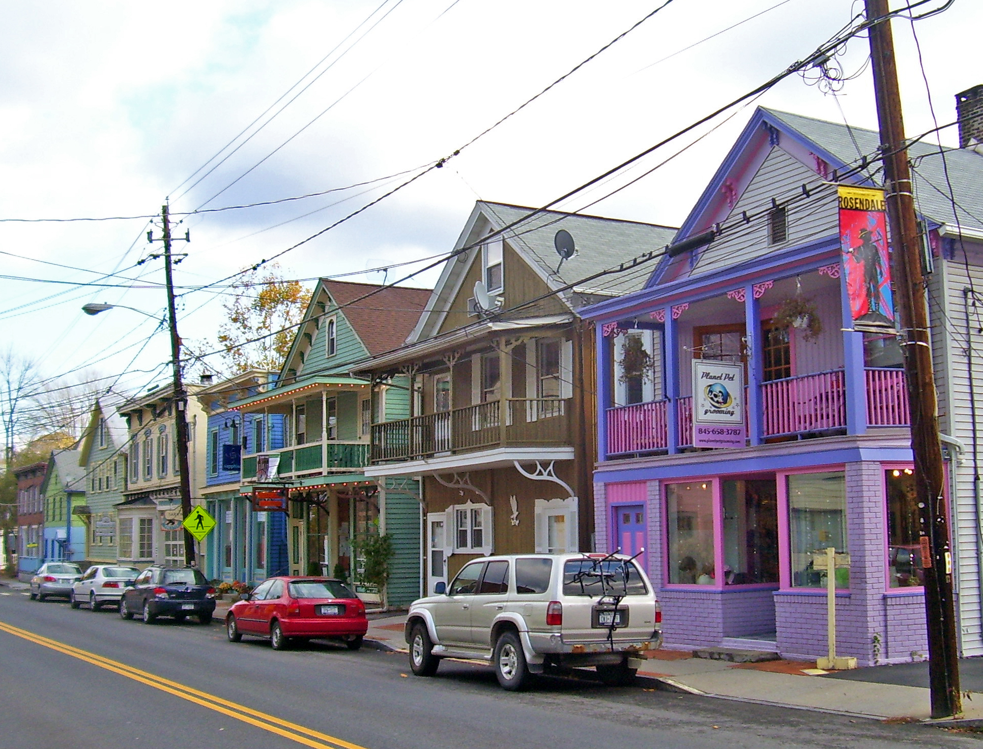
imagesize = 300px
image_caption = Restored historic buildings along Main Street (NY 213)
image_|pushpin_
pushpin_label_position =
pushpin_map_caption =Location within the state of New York
pushpin_mapsize =
mapsize =
map_caption =
mapsize1 =
map_caption1 =subdivision_type = Country
subdivision_name =United States
subdivision_type1 = State
subdivision_name1 =New York
subdivision_type2 = County
subdivision_name2 = Ulster
government_footnotes =
government_type =
leader_title =
leader_name =
leader_title1 =
leader_name1 =
established_title =
established_date =area_footnotes =
area_magnitude =
area_total_km2 = 5.1
area_land_km2 = 4.9
area_water_km2 = 0.2
area_total_sq_mi = 2.0
area_land_sq_mi = 1.9
area_water_sq_mi = 0.1population_as_of = 2000
population_footnotes =
population_total = 1374
population_density_km2 = 280.1
population_density_sq_mi = 725.5timezone = Eastern (EST)
utc_offset = -5
timezone_DST = EDT
utc_offset_DST = -4
elevation_footnotes =
elevation_m =
elevation_ft =
latd = 41 |latm = 50 |lats = 53 |latNS = N
longd = 74 |longm = 4 |longs = 34 |longEW = Wpostal_code_type =
postal_code =
area_code =
blank_name = FIPS code
blank_info = 36-63742
blank1_name =
blank1_info =
website =
footnotes =Rosendale (Rosendale Village) is a hamlet (and
census-designated place ) in Ulster County,New York ,United States . The population was 1,374 at the 2000 census.Rosendale is situated within the southwest part of the Town of Rosendale.
History
The community was an incorporated village until it was dissolved by voter referendum in
1978 . It is now an unincorporated hamlet, featuring a downtown business district and Post Office (ZIP code 12472).Geography
Rosendale Village is located at coor dms|41|50|53|N|74|4|34|W|city (41.847986, -74.076124)GR|1.
According to the
United States Census Bureau , the CDP has a total area of 2.0square mile s (5.1km² ), of which, 1.9 square miles (4.9 km²) of it is land and 0.1 square miles (0.2 km²) of it (3.57%) is water.The community is located on the north bank of the
Rondout Creek and is west of theNew York State Thruway .Demographics
As of the
census GR|2 of 2000, there were 1,374 people, 602 households, and 329 families residing in the CDP. Thepopulation density was 725.5 per square mile (280.7/km²). There were 666 housing units at an average density of 351.7/sq mi (136.1/km²). The racial makeup of the CDP was 94.91% White, 2.33% African American, 0.51% Asian, 1.16% from other races, and 1.09% from two or more races. Hispanic or Latino of any race were 4.00% of the population.There were 602 households out of which 25.4% had children under the age of 18 living with them, 40.7% were married couples living together, 9.0% had a female householder with no husband present, and 45.2% were non-families. 34.7% of all households were made up of individuals and 12.6% had someone living alone who was 65 years of age or older. The average household size was 2.27 and the average family size was 2.97.
In the CDP the population was spread out with 21.0% under the age of 18, 8.2% from 18 to 24, 32.5% from 25 to 44, 25.8% from 45 to 64, and 12.4% who were 65 years of age or older. The median age was 39 years. For every 100 females there were 93.2 males. For every 100 females age 18 and over, there were 90.7 males.
The median income for a household in the CDP was $34,712, and the median income for a family was $50,789. Males had a median income of $35,259 versus $25,764 for females. The
per capita income for the CDP was $20,700. About 5.2% of families and 8.2% of the population were below thepoverty line , including 8.6% of those under age 18 and 3.6% of those age 65 or over.References
External links
* [http://www.townofrosendale.com Official Home Page of the Town of Rosendale]
* [http://www.centuryhouse.org Local Historical Society]
* [http://RosendaleStreetFestival.com Annual Rosendale Street Festival]
* [http://www.picklefest.com International Pickle Festival]
* [http://www.rosendalelibrary.org/ Rosendale Library]

Wikimedia Foundation. 2010.