- New York State Route 213
-
NYS Route 213
Route information Maintained by NYSDOT, Ulster County and the city of Kingston Length: 27.00 mi[2] (43.45 km) Existed: 1930[1] – present Major junctions West end:  NY 28A in Olive
 US 209 in Marbletown
East end:  NY 32 in Kingston
Location Counties: Ulster Highway system Numbered highways in New York
Interstate • U.S. • N.Y. (former) • Reference • County←  NY 212
NY 214  →
→New York State Route 213 (NY 213) is a state highway located entirely in Ulster County. It runs from the eastern Catskills to downtown Kingston.
While it is signed as an east–west route, most of its course consists of two segments running in a more north–south direction, giving it a V-shape on the map. The only section of the highway to truly run east–west is a middle segment between its two concurrencies, in the vicinity of High Falls.
Contents
Route description
Olivebridge to Stone Ridge
Route 213 begins in the east at a junction with NY 28A along the south side of Ashokan Reservoir, not far from the now-closed spillway road. It shortly winds its way down through Olivebridge, across the Blue Line and out of the Catskill Park, following a more southeasterly tack. When approaching from the east, a spectacular view of Ashokan High Point is available from this section.
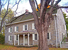 The Wynkoop House in Stone Ridge
Much of this section feels more like the county roads it overlaps, winding through narrow, wooded stretches and rounding some 90-degree angled corners, situations not normally found on state highways. Only just before downtown Stone Ridge does the road begin to open up and straighten out.
Stone Ridge to High Falls
In Stone Ridge 213 joins US 209 for a mile or so, along the hamlet's historic Main Street. A half-mile south of the hamlet, it leaves to the east at a traffic light. After that, it heads more directly to the east, crossing Rondout Creek just above the falls that give High Falls its name.
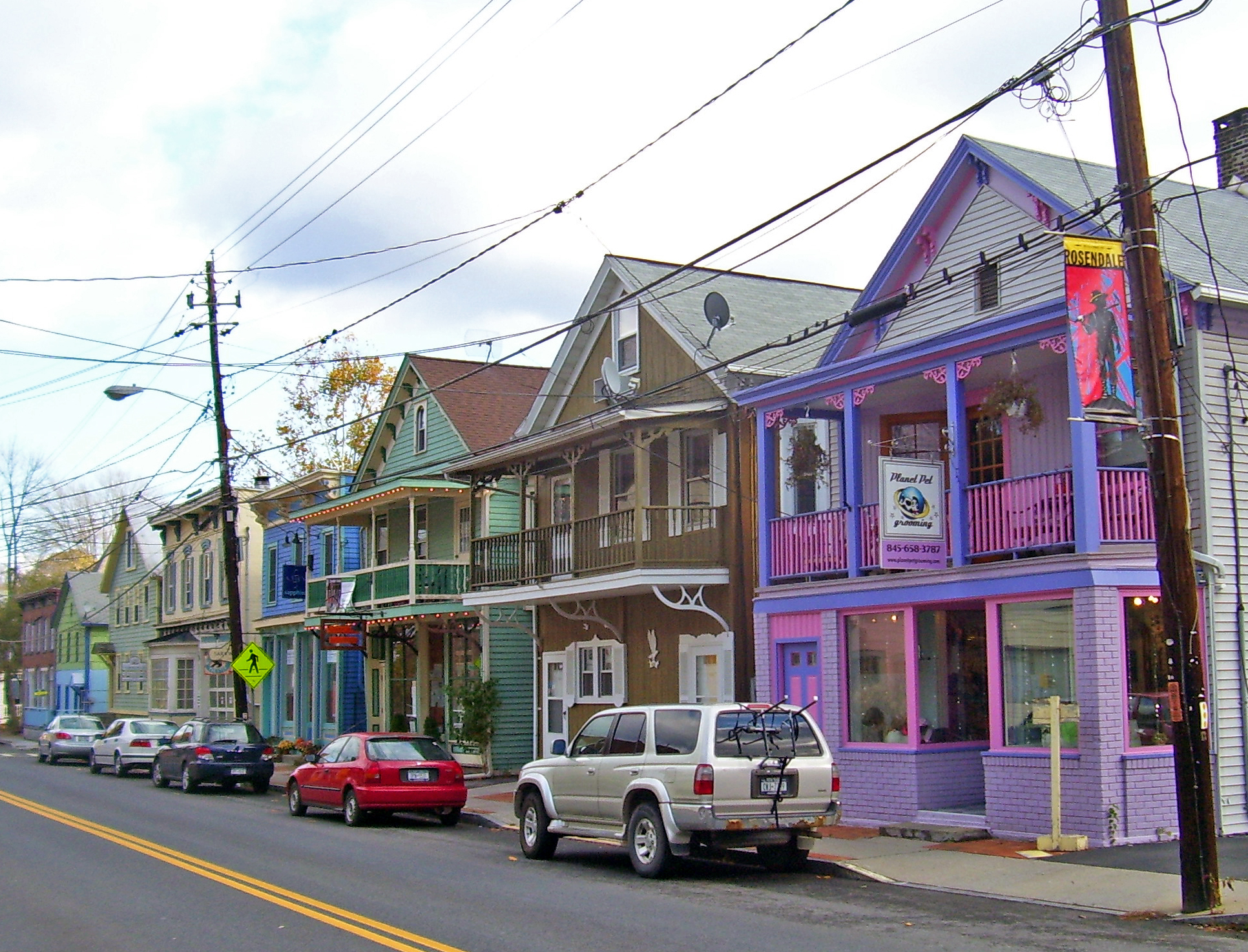
 Historic buildings in downtown Rosendale
It passes through downtown High Falls with its shops, trendy restaurants and remnants of the Delaware and Hudson Canal, then heads east into the Town of Marbletown. It follows the creek again and begins to curve northward.
Rosendale to Kingston
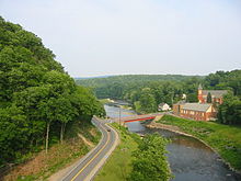 NY 213, as viewed from the Rosendale trestle
In Rosendale 213 meets NY 32 and crosses the creek with it. The concurrency ends at the next major water crossing, the Wallkill River, just past Tillson. After that bridge, it turns to the northeast again and follows the river under the New York State Thruway past the parklike areas around Sturgeon Pool in Rifton, formed by the Wallkill's impoundment near its mouth.
After the pond ends, 213 runs parallel to the Rondout (although some distance away), along a straighter course toward another crossing at New Salem, just outside of the city limits of Kingston. Once in Kingston, it follows Abeel Street, turning left at Wilbur Avenue. After a lengthy winding route, it turns right on Greenkill Avenue for one block, then left on Clinton Avenue. Two blocks later, it meets NY 32 at Henry Street, turning right and overlapping it for four blocks until it reaches Broadway. NY 32 continues left, and NY 213 ends.
History
NY 213 was assigned as part of the 1930 renumbering of state highways in New York. Originally, NY 213 began at NY 28 at the west end of the Ashokan Reservoir in Boiceville and followed what is now NY 28A southeastward around the reservoir to Olivebridge. Here, it turned onto its modern alignment and proceeded eastward to Rosendale, initially the junction of NY 213 and NY 376, a north–south connector between Rosendale and Dashville. The route continued northeast from Rosendale on modern NY 32 to Kingston, where it ended in the western portion of the city. At the time, the segment of modern NY 213 between Dashville and Kingston was part of NY 32.[1] Ca. 1933, NY 213 was truncated to its current western terminus in Olivebridge and rerouted east of Rosendale to follow NY 376 and NY 32 to Kingston. The former alignment of NY 213 north of Rosendale became part of a realigned NY 32.[3][4]
Major intersections
The entire route is in Ulster County.
Location Mile[2] Destinations Notes Olive 0.00 NY 28AHamlet of Olivebridge Marbletown 8.63 US 209 northHamlet of Stone Ridge; northern terminus of US 209 / NY 213 overlap 9.47 US 209 southSouthern terminus of US 209 / NY 213 overlap Rosendale 14.71 NY 32 northHamlet of Rosendale; northern terminus of NY 32 / NY 213 overlap 17.26 NY 32 southHamlet of Tillson; southern terminus of NY 32 / NY 213 overlap City of Kingston 26.68 NY 32 south (Henry Street)Western terminus of NY 32 / NY 213 overlap 27.00 NY 32 north (Broadway)Eastern terminus of NY 32 / NY 213 overlap 1.000 mi = 1.609 km; 1.000 km = 0.621 mi References
- ^ a b Standard Oil Company of New York (1930). Road Map of New York (Map). Cartography by General Drafting.
- ^ a b "2008 Traffic Volume Report for New York State" (PDF). New York State Department of Transportation. June 16, 2009. pp. 188–189. https://www.nysdot.gov/divisions/engineering/technical-services/hds-respository/NYSDOT%20TVR%202008%20by%20Route.pdf. Retrieved February 1, 2010.
- ^ Texas Oil Company (1932). Texaco Road Map – New York (Map). Cartography by Rand McNally and Company.
- ^ Texas Oil Company (1933). Texaco Road Map – New York (Map). Cartography by Rand McNally and Company.
External links
Categories:- State highways in New York
- Wallkill River
- Transportation in Ulster County, New York


Wikimedia Foundation. 2010.