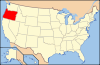
- National Register of Historic Places listings in Clatsop County, Oregon
-
This is a list of properties and districts in Clatsop County, Oregon that are listed on the National Register of Historic Places.
Current listings
Landmark name Image Date listed Location City or Town Summary 1 Astor Building September 7, 1984 1203 Commercial St.
46°11′20″N 123°49′43″W / 46.18889°N 123.82861°WAstoria 2 John Jacob Astor Hotel November 16, 1979 1401 Commercial St.
46°11′21″N 123°49′38″W / 46.18917°N 123.82722°WAstoria 3 Astoria City Hall September 7, 1984 1618 Exchange St.
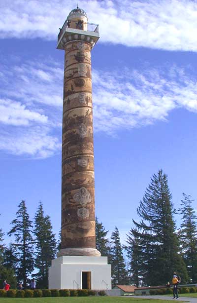
46°11′18″N 123°50′14″W / 46.18833°N 123.83722°WAstoria 4 Astoria Column 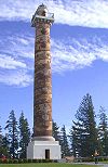
May 2, 1974 Coxcomb Hill
46°10′54″N 123°48′59″W / 46.18167°N 123.81639°WAstoria 5 Astoria Downtown Historic District June 22, 1998 Boundary roughly from the Columbia R. to Exchange St and from Seventh St. to Seventeenth St.
46°11′22″N 123°49′44″W / 46.18944°N 123.82889°WAstoria 6 Astoria Elks Building June 1, 1990 453 Eleventh St.
46°11′17″N 123°49′51″W / 46.18806°N 123.83083°WAstoria 7 Astoria Fire House No. 2 September 7, 1984 2968 Marine Dr.
46°11′28″N 123°48′33″W / 46.19111°N 123.80917°WAstoria 8 Astoria Victory Monument November 15, 1984 Columbia St., Bond and W. Marine Dr.
46°11′24″N 123°50′47″W / 46.19°N 123.84639°WAstoria 9 Astoria Wharf and Warehouse Company June 14, 1984 Water St. between 3rd & 4th Sts.
46°11′31″N 123°50′17″W / 46.19194°N 123.83806°WAstoria 10 Bald Point Site (35CLT23) September 10, 1997 Address Restricted Cannon Beach 11 Robert Rensselaer Bartlett House June 5, 1986 1215 Fifteenth St.
46°10′59″N 123°49′32″W / 46.18306°N 123.82556°WAstoria 12 Peter L. Cherry House September 7, 1984 836 15th St.
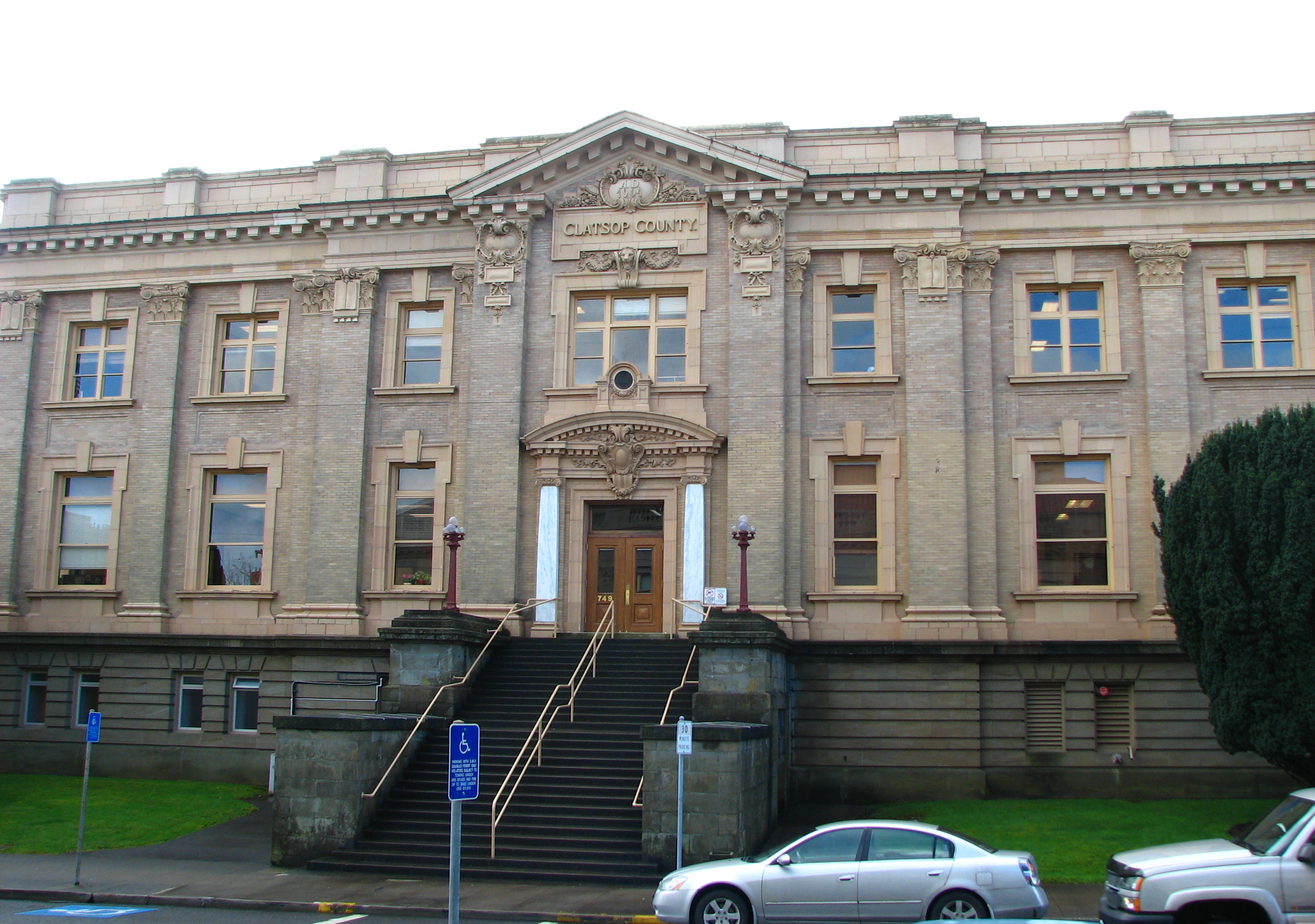
46°11′12″N 123°50′18″W / 46.18667°N 123.83833°WAstoria 13 Clatsop County Courthouse 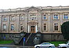
April 5, 1984 749 Commercial St.
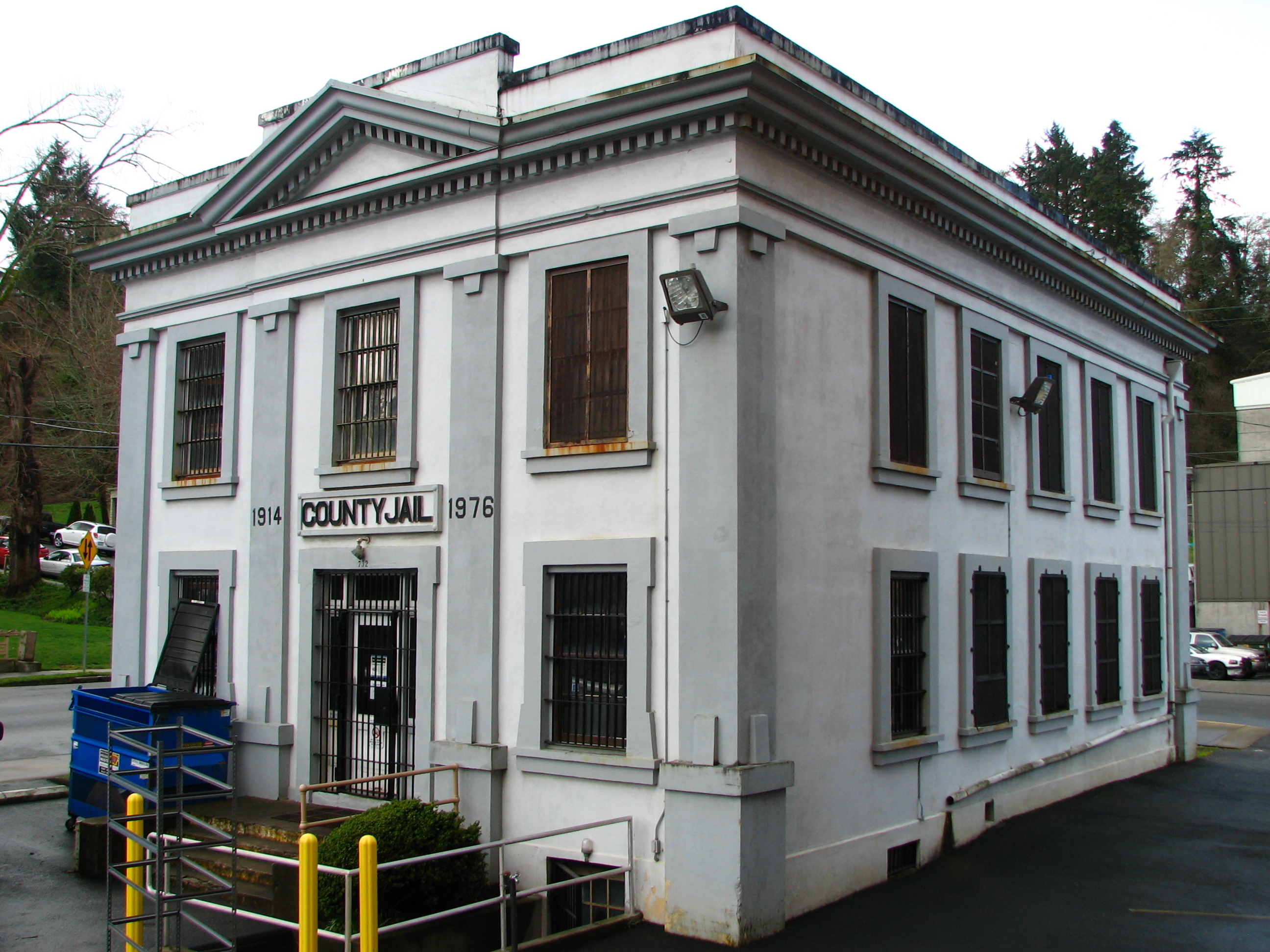
46°11′17″N 123°49′52″W / 46.18806°N 123.83111°WAstoria 14 Clatsop County Jail (Old) 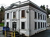
May 19, 1983 732 Duane St.
46°11′20″N 123°50′3″W / 46.18889°N 123.83417°WAstoria 15 Ecola Point Site (35CLT21)[1][2] September 10, 1997 Address Restricted Cannon Beach 16 Erickson-Larsen Ensemble February 20, 1991 3025-3027 Marine Dr.
46°11′29″N 123°48′29″W / 46.19139°N 123.80806°WAstoria 17 Albert W. Ferguson House September 7, 1984 1661 Grand Ave.
46°11′10″N 123°49′24″W / 46.18611°N 123.82333°WAstoria 18 Ferdinand Fisher House May 6, 1987 687 Twelfth St.
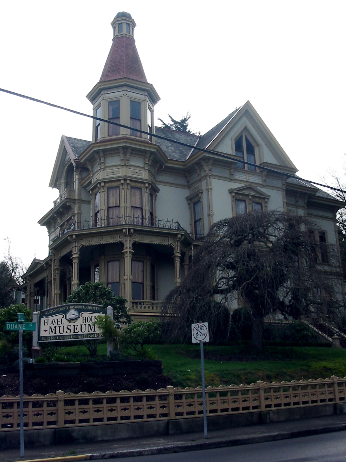
46°32′47″N 123°50′5″W / 46.54639°N 123.83472°WAstoria 19 Capt. George Flavel House and Carriage House 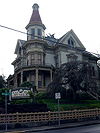
November 28, 1980 441 8th St.
46°11′28″N 123°50′3″W / 46.19111°N 123.83417°WAstoria Queen Anne style house, built in 1885, now a house museum. Featured in Goonies. 20 Captain George Conrad Flavel House June 5, 1986 627 Fifteenth St.
46°11′13″N 123°49′33″W / 46.18694°N 123.82583°WAstoria House built in 1901. 21 George C. and Winona Flavel House February 19, 1991 818 Grand Ave.
46°11′9″N 123°50′0″W / 46.18583°N 123.833333°WAstoria House built in 1893. 22 Martin Foard House June 5, 1986 690 Seventeenth St.
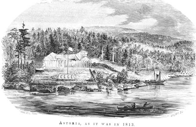
46°11′11″N 123°49′22″W / 46.18639°N 123.82278°WAstoria 23 Fort Astoria 
October 15, 1966 15th and Exchange Sts.
46°11′17″N 123°49′34″W / 46.18806°N 123.82611°WAstoria 24 Fort Clatsop National Memorial 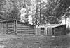
October 15, 1966 4.5 mi. S of Astoria
46°8′2″N 123°52′40″W / 46.13389°N 123.87778°WAstoria 25 Fort Stevens 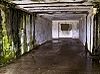
September 22, 1971 Fort Stevens State Park
46°12′3″N 123°57′48″W / 46.20083°N 123.96333°WHammond 26 William and Nellie Fullam House October 25, 1991 781 S. Prom
45°59′21″N 123°55′46″W / 45.98917°N 123.92944°WSeaside 27 Rev. William S. Gilbert House June 3, 1993 725 Eleventh St.
46°11′11″N 123°49′51″W / 46.18639°N 123.83083°WAstoria 28 Goodwin-Wilkinson Farmhouse March 9, 1992 US 26/101 W of Cullaby Lake
46°5′13″N 123°54′55″W / 46.08694°N 123.91528°WWarrenton 29 Grace Episcopal Church and Rectory September 7, 1984 1545 Franklin Ave.
46°11′13″N 123°49′31″W / 46.18694°N 123.82528°WAstoria 30 Capt. J. H. D. Gray House September 7, 1984 1687 Grand Ave.
46°11′10″N 123°49′24″W / 46.18611°N 123.82333°WAstoria 31 John N. Griffin House October 25, 1984 1643 Grand Ave.
46°11′10″N 123°49′31″W / 46.18611°N 123.82528°WAstoria 32 Haller-Black House October 25, 1991 841 South Prom
45°59′20″N 123°55′47″W / 45.98889°N 123.92972°WSeaside 33 Hlilusqahih Site (35CLT37) April 26, 1984 Address Restricted Knappa 34 John Hobson House February 17, 1978 469 Bond St.
46°11′24″N 123°50′11″W / 46.19°N 123.83639°WAstoria 35 Gustavus Holmes House October 25, 1984 682 34th St.
46°11′27″N 123°48′16″W / 46.19083°N 123.80444°WAstoria 36 Indian Creek Village Site (35CLT12) September 10, 1997 Address Restricted Cannon Beach 37 Indian Point Site (35 CLT 34) May 9, 1984 Address Restricted Svensen 38 Astoria 39 Peter and Maria Larson House March 9, 1990 611 31st St.
46°11′27″N 123°48′31″W / 46.19083°N 123.80861°WAstoria 40 Charles Latourette David House March 22, 1984 683 D St.
46°1′16″N 123°55′4″W / 46.02111°N 123.91778°WGearhart 41 Christian Leinenweber House May 20, 1999 3480 Franklin Ave.
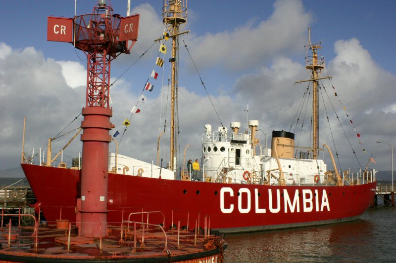
46°11′31″N 123°48′12″W / 46.19194°N 123.80333°WAstoria 42 Lightship WAL-604, COLUMBIA 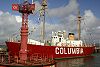
December 20, 1989 1792 Maritime Dr.
46°11′25″N 123°49′23″W / 46.19028°N 123.82306°WAstoria 43 Noonan-Norblad House March 31, 1988 1625 Grand Ave.
46°11′10″N 123°49′26″W / 46.18611°N 123.82389°WAstoria 44 Old Grace Episcopal Church Rectory March 9, 1990 637 16th St.
46°11′13″N 123°49′29″W / 46.18694°N 123.82472°WAstoria 45 Judge C. H. Page House June 6, 1985 1393 Franklin Ave.
46°11′13″N 123°49′40″W / 46.18694°N 123.82778°WAstoria 46 Charles Preston House October 25, 1991 141 Ave. I
45°59′19″N 123°55′42″W / 45.98861°N 123.92833°WSeaside 47 Sea Lyft November 14, 2001 702 "D" St.
46°1′18″N 123°55′2″W / 46.02167°N 123.91722°WGearhart 48 Shively-McClure Historic District August 4, 2005 From Franklin Ave. to Lexington Ave., and from 9th St. to 18th St.
46°11′9″N 123°49′37″W / 46.18583°N 123.82694°WAstoria 49 Norris Staples House October 25, 1984 1031 14th St.
46°11′2″N 123°49′37″W / 46.18389°N 123.82694°WAstoria 50 Charles Stevens House June 6, 1985 1388 Franklin Ave.
46°11′14″N 123°49′39″W / 46.18722°N 123.8275°WAstoria 51 Svenson Blacksmith Shop 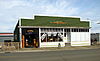
November 6, 1986 1769 Exchange St.
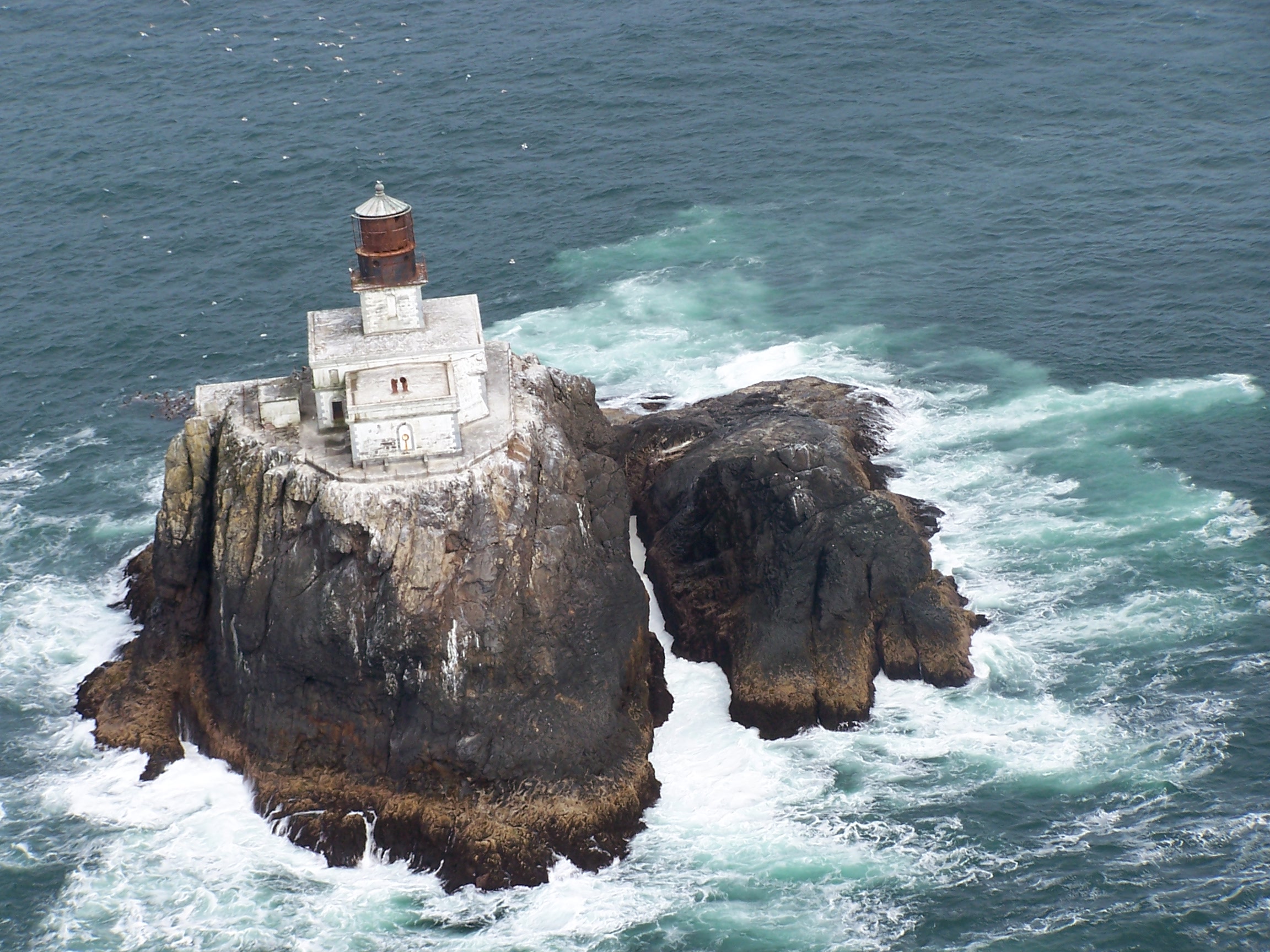
46°11′21″N 123°49′19″W / 46.18917°N 123.82194°WAstoria 52 Tillamook Rock Lighthouse 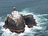
December 9, 1981 SW of Seaside
45°56′14″N 124°1′9″W / 45.93722°N 124.01917°WSeaside 53 Union Fishermen's Cooperative Packing Company Alderbrook Station February 20, 1991 4900 Ash St.
46°11′50″N 123°46′52″W / 46.19722°N 123.78111°WAstoria 54 Uniontown-Alameda Historic District August 25, 1988 Marine Dr. and Alameda Ave., between Hume and Hull Aves.
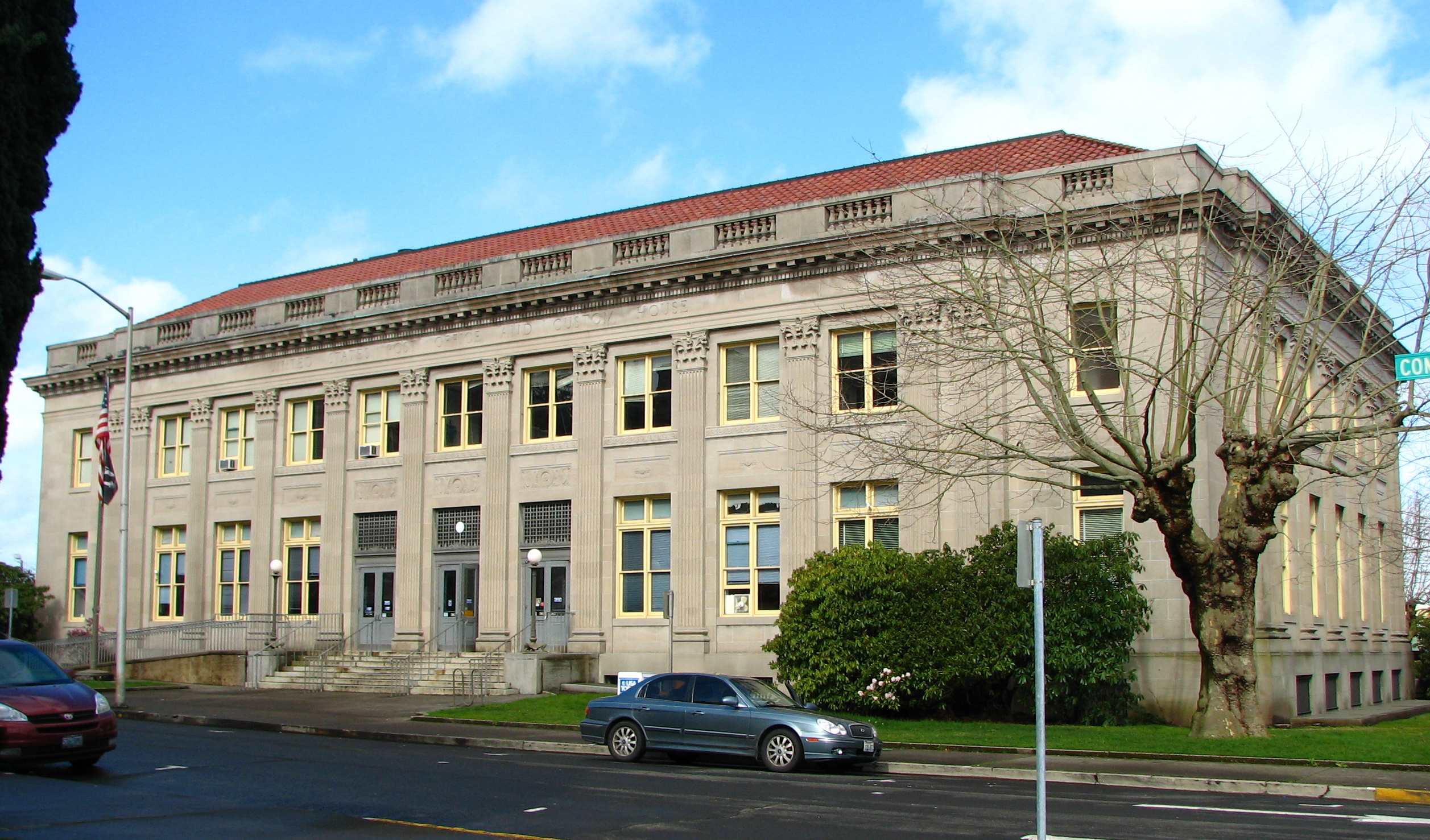
46°11′22″N 123°50′58″W / 46.18944°N 123.84944°WAstoria 55 US Post Office and Custom House 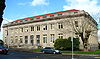
March 4, 1985 750 Commercial St.
46°11′19″N 123°49′53″W / 46.18861°N 123.83139°WAstoria 56 Warren Investment Company Housing Group June 5, 1986 656, 674, and 690 Eleventh St.
46°11′12″N 123°49′49″W / 46.18667°N 123.83028°WAstoria 57 Daniel Knight Warren House September 8, 1988 107 Skipanon Rd.
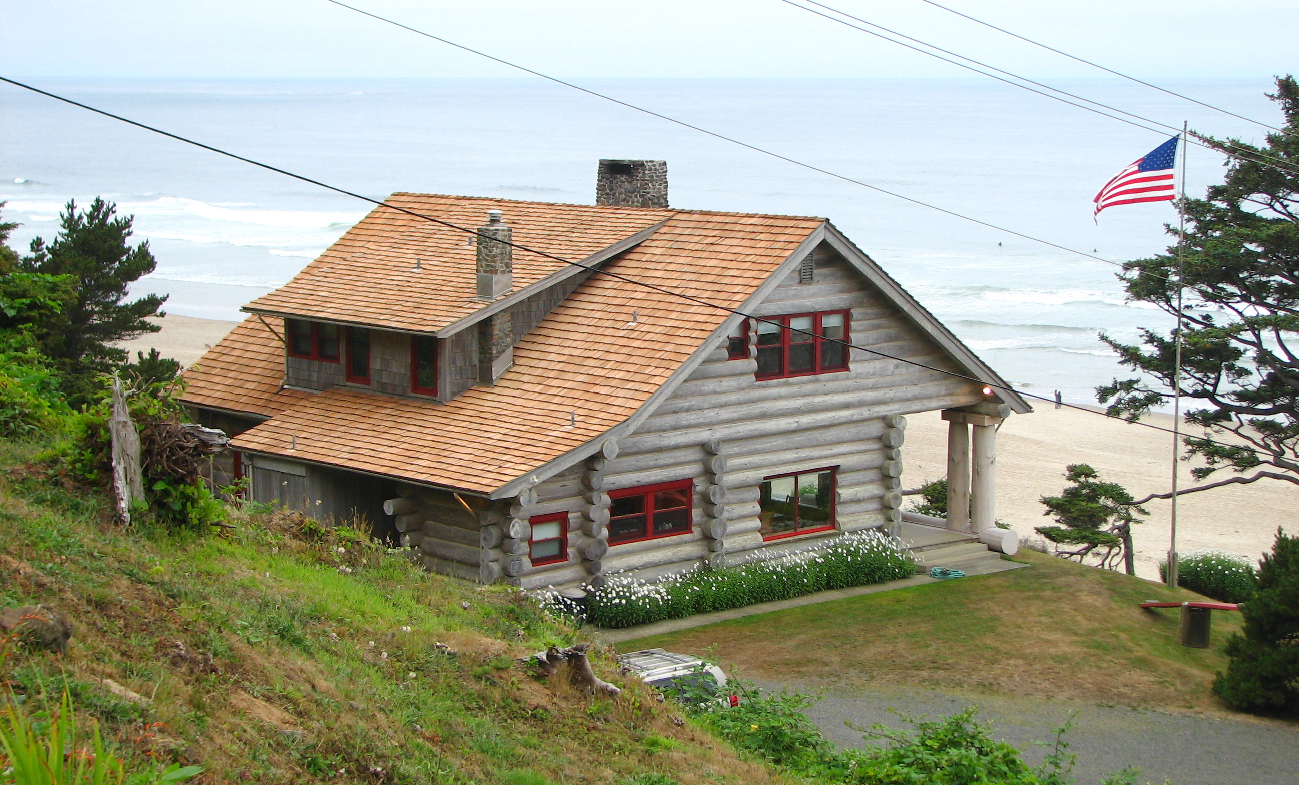
46°10′8″N 123°55′15″W / 46.16889°N 123.92083°WWarrenton 58 Oswald West Coastal Retreat 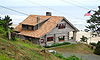
February 26, 1992 1981 Pacific Ave.
45°52′56″N 123°57′41″W / 45.88222°N 123.96139°WCannon Beach 59 Andrew Young House June 26, 1986 3720 Duane Ave.
46°11′34″N 123°47′59″W / 46.19278°N 123.79972°WAstoria 60 Benjamin Young House and Carriage House March 7, 1979 3652 Duane St.
46°11′33″N 123°48′4″W / 46.1925°N 123.80111°WAstoria References
- ^ Name appears as "Bcola" in NRIS and in mirror sites like www.nationalregisterofhistoricplaces.com; correct name of "Ecola" is shown in Oregon state's list and in the U.S. Federal Register, published here.
- ^ "Oregon National Register List". Oregon Parks and Recreation Department. January 5, 2009. http://www.oregon.gov/OPRD/HCD/NATREG/docs/oregon_nr_list.pdf. Retrieved March 16, 2009.
U.S. National Register of Historic Places in Oregon Lists by county Baker • Benton • Clackamas • Clatsop • Columbia • Coos • Crook • Curry • Deschutes • Douglas • Gilliam • Grant • Harney • Hood River • Jackson • Jefferson • Josephine • Klamath • Lake • Lane • Lincoln • Linn • Malheur • Marion • Morrow • Multnomah: Portland North • Multnomah: Portland Northeast • Multnomah: Portland Northwest • Multnomah: Portland Southeast • Multnomah: Portland Southwest • Multnomah: Other • Polk • Sherman • Tillamook • Umatilla • Union • Wallowa • Wasco • Washington • Wheeler • Yamhill
Other lists Categories:- National Register of Historic Places in Clatsop County, Oregon
- Clatsop County, Oregon


Wikimedia Foundation. 2010.