- Mount Hood Railroad
-
Not to be confused with Mount Hood Railway and Power Company.
Mount Hood Railroad 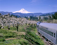

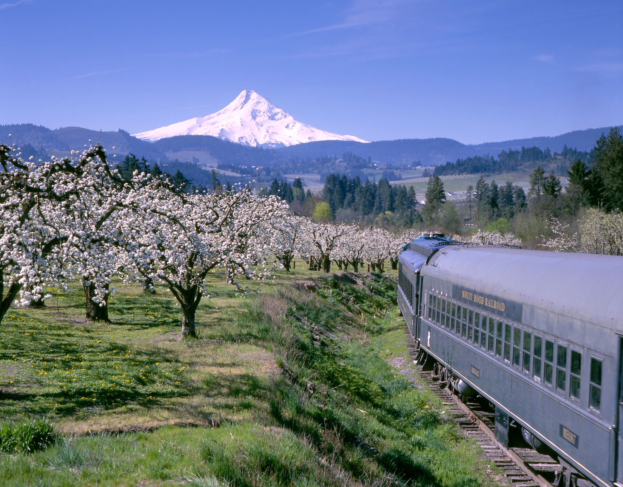
The Mount Hood Railroad in spring, with Mount Hood in the background. Terminus Hood River, Oregon
- ParkdaleCommercial operations Original gauge 4 ft 8 1⁄2 in (1,435 mm) Preserved operations Preserved gauge 4 ft 8 1⁄2 in (1,435 mm) Commercial history Opened 1906 / 1909 Closed 1987 Preservation history 1987 Bought by private investors 2008 Sold to Permian Basin Railways Website http://www.mthoodrr.com/ Mount Hood Railroad The Mount Hood Railroad (reporting mark MH) is a heritage and shortline freight railroad located in Hood River, Oregon, 60 miles (97 km) east of Portland, Oregon, United States.
The majority of the railroad's revenue is generated from passenger excursions although a few small freight shippers remain that generate several carloads of traffic per week.
Contents
MHRR trackage
The northern terminus of the Mount Hood Railroad is at Hood River, Oregon, where the line interchanges with the Union Pacific Railroad. The line starts out parallel to the Hood River for the first three 3 miles (4.8 km) until it reaches a switchback. Switchbacks used to be common, but this is now only one of five remaining railroad switchbacks in use in the United States. After the trains reverse direction at the switchback, the line continues south through the communities of Pine Grove, Odell, and Dee before reaching the southern end of the line at Parkdale. The total length of the line is just over 21 miles (34 km).
Locomotives and equipment
The Mount Hood Railroad currently has three locomotives on its roster:
- MHRR 02 - EMD GP38-2 (ex-CR/PC 7796, ex-PCN 16)
- MHRR 88 - EMD GP9 (ex-SP 3885)
- MHRR 89 - EMD GP9 (built 9/59, ex-MILW 306, ex-MNVA 306)
The MHRR roster also includes one excursion passenger train which consists of two closed coaches, one snack car, one open air coach, and a caboose. There is also a dinner train, which consists of four cars configured in dining seating arrangements. The railroad's new owners added a full-length dome lounge car in 2008. This is a former Atchison, Topeka & Santa Fe car originally built by the Budd Company in 1954.
History
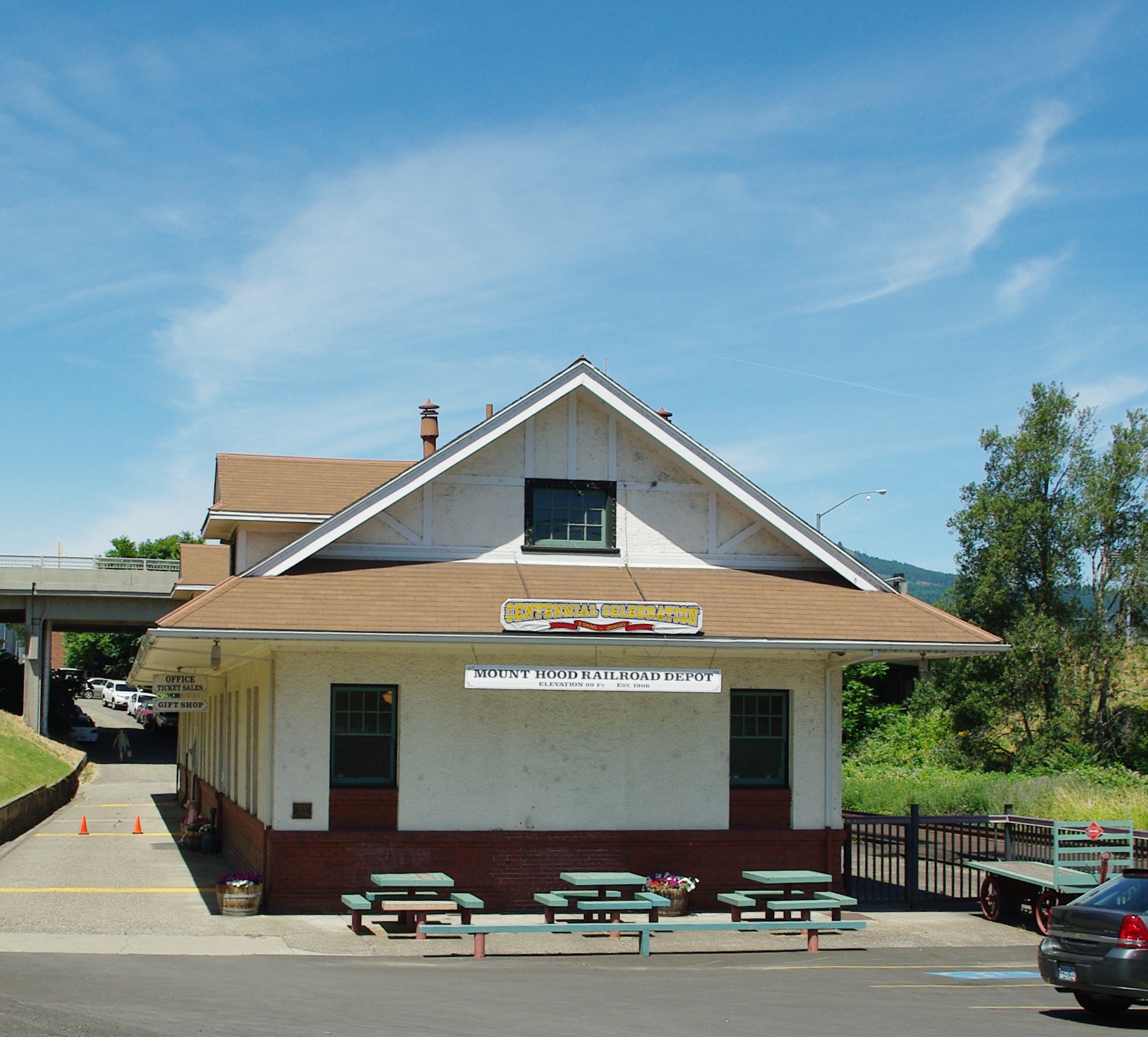
 Railroad depot in Hood River
The line south out of Hood River was first built in 1906, extending as far as Dee. In 1909 the line was extended to the present-day end of track at Parkdale. The Union Pacific acquired the line in 1968 and operated it with the primary customers being fruit shippers and the lumber operation at Dee. As local industries switched to truck-based transportation for their goods, carloads on the line dwindled and the Union Pacific proposed abandoning the line. In 1987 a group of local investors purchased the railroad from Union Pacific and began to offer passenger excursions to augment the freight business. The line was sold again in 2008 to Permian Basin Railways,[1] a subsidiary of Chicago-based Iowa Pacific Holdings.
Today the railroad offers four-hour scenic tours through the Hood River Valley and narrated historic excursion train tours, as well as special events. There are views of Mount Hood and Mount Adams along with the surrounding orchards and farmland of the Hood River Valley.
See also
References
- ^ Brinckman, Jonathan (2008-04-09). "Sale of Mount Hood Railway completed". The Oregonian. http://blog.oregonlive.com/business/2008/04/sale_of_mount_hood_railway_com.html. Retrieved 2008-07-07.
External links
- Mount Hood Railroad
- Information, maps and pictures related to Mount Hood Railway and Power Company from PDX History
- Information on the Mount Hood Railroad from Union Pacific
- Information on an extant piece of Mount Hood Railway and Power Company equipment from trainweb.org
Railroads of Oregon Common carriers 
Passenger carriers AMTK • LPN • OPE • SV • TMTC (MAX Light Rail) • PS • TMTC (Westside Express) • WST • WURR (Eagle Cap)
Former carriers See also: List of United States railroads by political division Categories:- Oregon railroads
- Heritage railroads in Oregon
- Spin-offs of the Union Pacific Railroad
- Companies operating former Union Pacific Railroad lines
- Hood River, Oregon
- Transportation in Hood River County, Oregon
- Visitor attractions in Hood River County, Oregon

Wikimedia Foundation. 2010.