- Hood River (Oregon)
-
Hood River Country United States State Oregon County Hood River Source Mount Hood - location Cascade Range - coordinates 45°36′18″N 121°37′58″W / 45.605°N 121.63278°W [1] Mouth Columbia River - elevation 79 ft (24 m) [1] - coordinates 45°42′55″N 121°30′40″W / 45.71528°N 121.51111°W [1] Length 25 mi (40 km) [2] Basin 279 sq mi (723 km2) [3] Discharge for river mile 6.1, near Hood River, OR - average 975 cu ft/s (28 m3/s) [3][4] - max 33,200 cu ft/s (940 m3/s) - min 136 cu ft/s (4 m3/s) 
 Location of the mouth of the Hood River in Oregon
The Hood River, formerly known as Dog River, is a tributary of the Columbia River in northwestern Oregon in the United States. Approximately 25 miles (40 km) long from its mouth to its farthest headwaters on the East Fork, the river descends from wilderness areas in the Cascade Range on Mount Hood and flows through the agricultural Hood River Valley to join the Columbia River in the Columbia River Gorge.
It rises in three separate forks on the north side of Mount Hood, within the Mount Hood Wilderness in Hood River County which is approximately 50 miles (80 km) east of Portland.
Contents
West Fork
The West Fork, approximately 15 miles (24 km) long, rises on northwestern Mount Hood from Ladd Glacier. It flows generally east-northeast and joins the East Fork from the west near Dee.
Middle Fork
The Middle Fork, approximately 10 miles (16 km) long, rises in several short branches on the north slopes of Mount Hood, from Coe Glacier and Eliot Glacier. It flows north through the upper Hood River Valley.
East Fork
The East Fork, approximately 15 miles (24 km) long, rises on the eastern side of the mountain in the Mount Hood National Forest fed by Newton-Clark Glacier, and flows northward into the Upper Hood River Valley, where it is joined by the Dog River and then by the Middle Fork.
Main stem
The combined main stem river, approximately 10 miles (16 km) long, flows northeast through the Hood River Valley. It joins the Columbia at Hood River, a popular destination for windsurfing and kiteboarding in the Columbia Gorge.
History
The maps of the Lewis and Clark Expedition show the Hood River under the name Labeasche River after Francis Labiche, one of the expedition's members. In the mid-19th century pioneer era a party of starving travelers resorting to eating dog meat. As a result the Hood River became known as the Dog River. This name was unpopular. A pioneer resident of the area, Mrs. Nathaniel Coe, was able to change local usage to Hood River, after Mount Hood. The name Hood River appeared on maps as early as 1856. The older Dog River name became attached to a lesser tributary of the East Fork Hood River.[5]
Maps
-
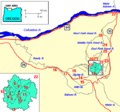
Hood River and surroundings
-

Hood River watershed
See also
- List of Oregon rivers
References
- ^ a b c U.S. Geological Survey Geographic Names Information System: Hood River
- ^ Approximate length from mouth to headwaters of the East Fork Hood River; the length from the confluence of the East and West Forks to the mouth is approximately 10 miles (16 km).
- ^ a b "National Water Information System". USGS. http://waterdata.usgs.gov/or/nwis/uv/?site_no=14120000&PARAmeter_cd=00065,00060. Retrieved 2007-02-15.
- ^ "Water Resources Data for Oregon, Water Year 2005; Hood River and Mosier Creek Basins". United States Geological Survey. http://pubs.usgs.gov/wdr/2005/wdr-or-05/pdf/hood.pdf. Retrieved 29 September 2009.
- ^ McArthur, Lewis A.; Lewis L. McArthur (1992) [1928]. Lewis Ankeny. ed. Oregon Geographic Names (6th ed.). Portland, Oregon: Oregon Historical Society Press. pp. 420–421. ISBN 0-87595-236-4.
Categories:- Rivers of Oregon
- Columbia River Gorge
- Landforms of Hood River County, Oregon
- Tributaries of the Columbia River
-


Wikimedia Foundation. 2010.