- Danner, Oregon
-
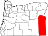
Danner is an unincorporated community located in Malheur County, Oregon, United States, near Jordan Valley.
Contents
History
The old Idaho-Oregon-Nevada highway ran through Danner, following the route of the Skinner Toll Road which opened the area for settlement in 1863.
Danner is the location of the grave of Jean Baptiste Charbonneau, the youngest member of the Lewis and Clark Expedition as the infant son of Sacagawea. He died here in 1866 at the age of 61 after developing pneumonia while passing through the area. His gravesite was located, marked and fenced off through the efforts of Danner residents Kirt and Johanna Skinner, and was entered into the National Register of Historic Places on March 14, 1973. Charbonneau's grave lies among five other graves near the "Inskip Station", a fortified stone ranch house that operated as a stage station in the 1860s.[1] Inskip's property was later known as the Ruby Ranch. A plaque marks the remains of Inskip Station within sight of the resting place of Charbonneau.
A town had been platted and promoted as Ruby Townsite by Harley J. Hooker, who sold land for $1.25 per acre when the Jordan Valley Irrigation District began constructing an irrigation dam and canal system near Danner about 1910.[2] The proposed agricultural town never grew as anticipated, however, since the high desert's harsh climate did not allow farmers to produce a wide enough range of crops. Hooker built a single story lava rock office building in Danner about 1915. After his death in 1919 it was used as the Danner community hall for a number of years. It became unsafe and was demolished a few years ago.
The name of the community comes from John H. Danner, an early area postmaster. The Postal Service denied an application to call the post office Ruby for the nearby Ruby Ranch, but in 1920 the post office name Danner was approved.[3]
By the 1930s Danner boasted a general store run by Jesse Anderson, a Danish immigrant. The building he constructed is still standing today, a half mile south of the site of Inskip Station.
Current status
Today's main highway (US-95) bypasses Danner by 3 miles. Although Danner no longer has its own post office, store or school, it is still a recognized community inhabited by numerous families, most of whom operate cattle ranches. Schools and other services are provided by Jordan Valley 17 miles to the northeast.
See also
References
External links
Coordinates: 42°56′40″N 117°20′21″W / 42.94444°N 117.33917°W
Municipalities and communities of Malheur County, Oregon Cities Adrian | Jordan Valley | Nyssa | Ontario | Vale
Unincorporated
communitiesCategories:- Ghost towns in Oregon
- Unincorporated communities in Malheur County, Oregon
- Oregon geography stubs

Wikimedia Foundation. 2010.