- Jordan Valley, Oregon
Infobox Settlement
official_name = Jordan Valley, Oregon
settlement_type =City
nickname = Heart of the Owyhees
motto =
imagesize =
image_caption =
image_
imagesize =
image_caption =
image_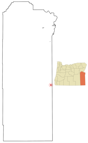
mapsize = 250x200px
map_caption = Location inOregon
mapsize1 =
map_caption1 =
subdivision_type = Country
subdivision_name =United States
subdivision_type1 = State
subdivision_name1 =Oregon
subdivision_type2 = County
subdivision_name2 = Malheur
government_type =
leader_title =Mayor
leader_name = Jake Roe
established_title = Incorporated
established_date = 1911
area_magnitude =
area_total_sq_mi = 2.1
area_total_km2 = 5.4
area_land_sq_mi = 2.1
area_land_km2 = 5.4
area_water_sq_mi = 0
area_water_km2 = 0
area_urban_sq_mi =
area_urban_km2 =
area_metro_sq_mi =
area_metro_km2 =
population_as_of = 2000
population_note =
population_total = 239
population_metro =
population_urban =
population_density_km2 = 44.4
population_density_sq_mi = 114.6
timezone = Mountain
utc_offset = -7
timezone_DST = Mountain
utc_offset_DST = -6
latd = 42 |latm = 58 |lats = 35 |latNS = N
longd = 117 |longm = 3 |longs = 19 |longEW = W
elevation_m = 1336.6
elevation_ft = 4385
website = [http://www.cityofjordanvalley.com www.cityofjordanvalley.com]
postal_code_type =ZIP code
postal_code = 97910
area_code = 541
blank_name = FIPS code
blank_info = 41-37850GR|2
blank1_name = GNIS feature ID
blank1_info = 1122534GR|3
footnotes =Jordan Valley is a city in Malheur County,
Oregon ,United States . It is part of the Ontario, OR–ID Micropolitan Statistical Area. The city was named after Jordan Creek,Fact|date=September 2008 a tributary ofOwyhee River , which runs through the city; the creek is named for a 19th century prospector, Michael M. Jordan.Fact|date=September 2008 The population was 239 at the 2000 census.History
Jordan Valley was incorporated as a city in 1911.
In the center of town stands a "pelota fronton", built in 1915 by Basque settlers, many of whom had been recruited from
Spain to herdsheep . Their descendants are a noticeable presence today in Malheur County.Geography
According to the
United States Census Bureau , the city has a total area of 2.1square mile s (5.4km² ), all of it land.Jordan Valley's most prominent landmark is the blunt
plateau adjacent to town, named Pharmacy Hill.Jordan Valley's main occupations are cattle
ranching andsheep herding. People in those occupations typically live far from town on homesteads, but still use Jordan Valley as their cultural and economic center. People within Jordan Valley primarily provide a number of services to tourists passing through onU.S. Highway 95 , which is the primary road fromBoise, Idaho toReno, Nevada .Jordan Valley is known for its excellent hunting and fishing as well as its proximity to
Jordan Craters , an extinct volcanic field. Other popular areas nearby includeLeslie Gulch ,Cow Lakes ,Antelope Reservoir , and theThree Forks Reservoir to the south.Demographics
As of the
census GR|2 of 2000, there were 239 people, 109 households, and 66 families residing in the city. Thepopulation density was 114.6 people per square mile (44.4/km²). There were 140 housing units at an average density of 67.2/sq mi (26.0/km²). The racial makeup of the city was 93.72% White, 0.42% Asian, 0.42% Pacific Islander, 1.67% from other races, and 3.77% from two or more races. Hispanic or Latino of any race were 2.09% of the population.There were 109 households out of which 20.2% had children under the age of 18 living with them, 50.5% were married couples living together, 6.4% had a female householder with no husband present, and 39.4% were non-families. 36.7% of all households were made up of individuals and 16.5% had someone living alone who was 65 years of age or older. The average household size was 2.17 and the average family size was 2.85.
In the city the population was spread out with 22.6% under the age of 18, 5.4% from 18 to 24, 20.9% from 25 to 44, 30.5% from 45 to 64, and 20.5% who were 65 years of age or older. The median age was 45 years. For every 100 females there were 88.2 males. For every 100 females age 18 and over, there were 86.9 males.
The median income for a household in the city was $25,313, and the median income for a family was $37,500. Males had a median income of $32,917 versus $16,750 for females. The
per capita income for the city was $14,501. About 13.5% of families and 20.5% of the population were below thepoverty line , including 22.0% of those under the age of eighteen and 8.9% of those sixty five or over.References
External links
* [http://www.cityofjordanvalley.com City of Jordan Valley] (official website)
* [http://www.jordanvalley.k12.or.us/ Jordan Valley School District]
Wikimedia Foundation. 2010.