- McDermitt, Nevada-Oregon
-
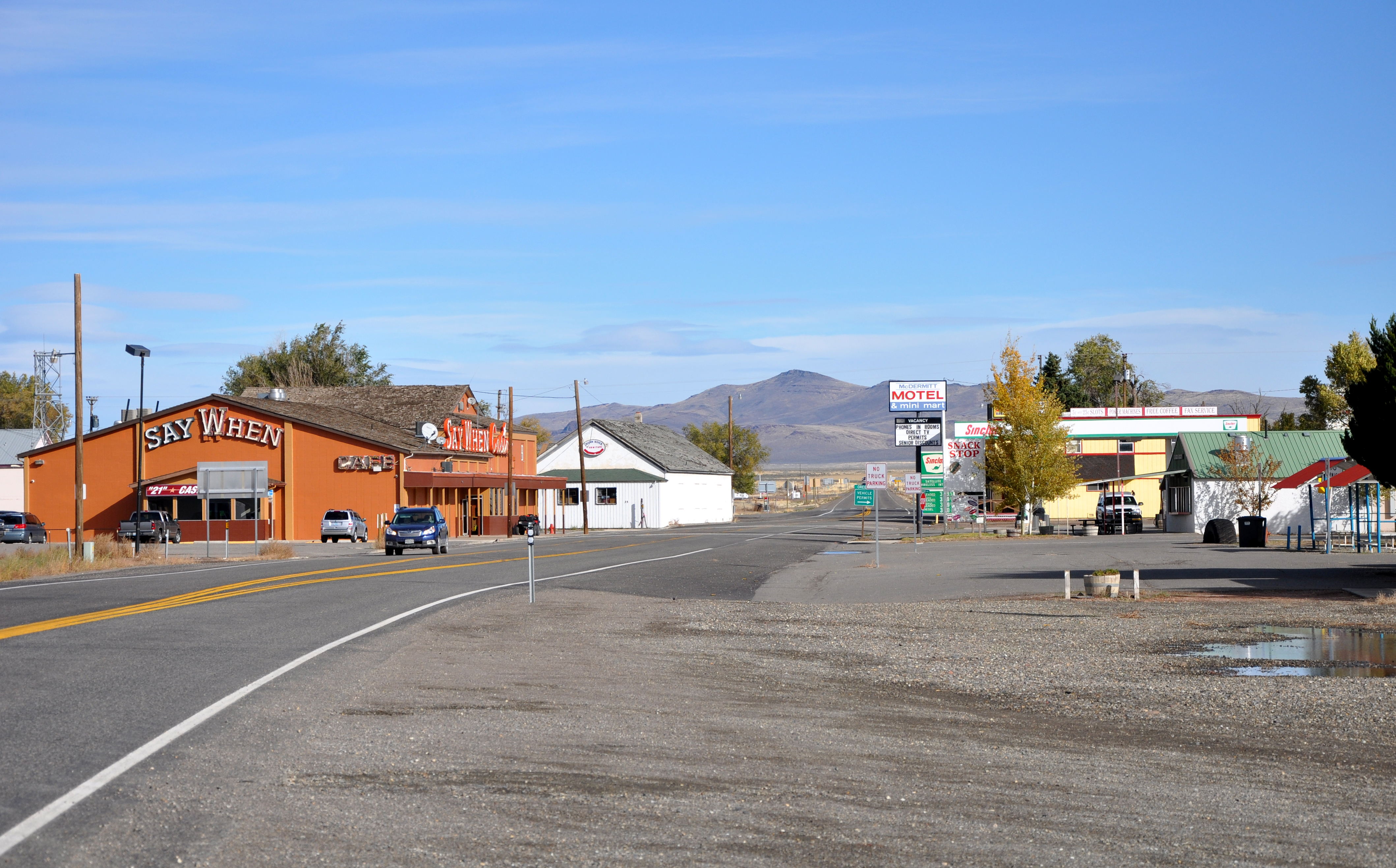
McDermitt, Nevada–Oregon — Unincorporated community — McDermitt skyline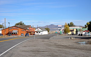 Location of McDermitt in Nevada
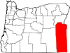
Coordinates: 41°59′51″N 117°43′06″W / 41.9975°N 117.71833°WCoordinates: 41°59′51″N 117°43′06″W / 41.9975°N 117.71833°W Country United States State Nevada and Oregon County Humboldt County, Nevada and Malheur County, Oregon Named for Lt. Col. Charles McDermit, 2nd Cavalry, California Volunteers Elevation 4,432 ft (1,351 m) Population (2010) – Total 513 Time zone PST (UTC-8) – Summer (DST) PDT (UTC-7) ZIP codes 89421 (NV) and 89425 (OR) Area code(s) Area code 775 (NV), 458 and 541 (OR) Coordinates and elevation from United States Geological Survey[1] McDermitt is an unincorporated community straddling the Nevada–Oregon border, in Humboldt County, Nevada, and Malheur County, Oregon in the United States. For statistical purposes, the census bureau has allocated McDermitt two census-designated places (CDP), McDermitt NV and Fort McDermitt NV. The Oregon portion of McDermitt is not part of the McDermitt CDP, but is included in the Ontario, OR–ID Micropolitan Statistical Area.
As of the 2010 census, the combined population was 513.[2]
Contents
History
The community, originally called Dugout, was named after Fort McDermit, which in turn was named after Lt. Col. Charles McDermit,[3][4] commander of the Military District of Nevada, who was killed in a skirmish in the area in 1865. It is not known why there is a discrepancy in the spelling.[3] Fort McDermit, which was five miles (8 km) outside the current township, was originally established to protect the stagecoach route from Virginia City through Winnemucca to Silver City, Idaho Territory. The stage road was the military's most important transportation route in southeast Oregon[5]. The township of Dugout was established as support for Fort McDermit.
Geography and climate
The community is on U.S. Highway 95, 73 miles (117 km) north of Winnemucca. The elevation of McDermitt is 4,432 feet (1,351 m) above sea level.[1]
McDermitt is in the Oregon High Desert with a semi-arid climate (Köppen climate classification BSk), averaging 9.3 inches (236 mm) of rain annually with hot, dry summers and cold winters. Most precipitation (51%) occurs from March through June. About 21% occurs from September through November and 21% from December through February, most of this falling as snow.[6]
Demographics
As of the census of 2000, there were 269 people, 90 households, and 60 families residing in the CDP. The population density was 20.4 people per square mile (7.9/km²). There were 107 housing units at an average density of 8.1 per square mile (3.1/km²). 262 (97.4%) of the population is Native American; seven people (2.6%) are White. Two people (0.74%) are Hispanic or Latino of any race.[7] a precipitous decline from the 373 people enumerated in the census a decade earlier.[citation needed]
There were 90 households out of which 24.4% had children under the age of 18 living with them, 34.4% were married couples living together, 25.6% had a female householder with no husband present, and 33.3% were non-families. 30% of all households were made up of individuals and 5.6% had someone living alone who was 65 years of age or older. The average household size was 2.99 and the average family size was 3.85.[7]
In the CDP the population was spread out with 29.7% under the age of 18, 10.0% from 18 to 24, 23.8% from 25 to 44, 25.3% from 45 to 64, and 11.2% who were 65 years of age or older. The median age was 32 years. For every 100 females there were 108.5 males. For every 100 females age 18 and over, there were 96.9 males.[7]
The median income for a household in the CDP was $16,563, and the median income for a family was $17,396. Males had a median income of $25,625 versus $24,375 for females. The per capita income for the CDP was $6,399. About 37.7% of families and 33.0% of the population were below the poverty line, including 23.9% of those under the age of eighteen and 35.0% of those sixty five or over.[7]
Economy
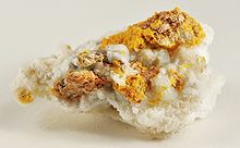
McDermitt’s economy has historically been based on mining, ranching and farming. In the period 1917 to 1989 it was home to four mercury mines in the McDermitt Caldera, Bretz, Opalite, Cordero and McDermitt, which from 1933 to 1989 were the largest producers in North America.[8] A significant gold mine was the Buckskin National, producing 24,000 ounces of gold and 300,000 ounces of silver over the period 1906-1941, in the nearby Santa Rosa Mountains.[9] The closure of mercury mining in 1991 has resulted in a significant decline in population.[2]
Current development activities that may result in renewed mining are at Cordero (gold-silver),[8] Cordero (gallium),[10] Buckskin-National (gold-silver),[11] Aurora (uranium)[12] and Disaster Peak (gold).[13] The largest employers in McDermitt are the Say When casino (pictured) and the high school.
Points of interest
The state line goes through the White Horse Inn, a historical landmark now being restored, which was a saloon, hotel, and (reportedly) brothel.[14] When it was open, food could be ordered and paid for in Oregon, avoiding the Nevada state sales tax.[15]
Education
Humboldt County School District operates the McDermitt Combined School, a kindergarten-twelfth grade (K-12) school, in the community.
Transportation
References
- ^ a b "McDermitt". Geographic Names Information System, U.S. Geological Survey. December 12, 1980. http://geonames.usgs.gov/pls/gnispublic/f?p=gnispq:3:::NO::P3_FID:845557. Retrieved November 12, 2010.
- ^ a b "2010 Census Data". U.S. Census Bureau. http://2010.census.gov/2010census/data/index.php. Retrieved 2011-08-24.
- ^ a b McArthur, Lewis A.; McArthur, Lewis L. (2003) [First published 1928]. Oregon Geographic Names (7th ed.). Portland, Oregon: Oregon Historical Society Press. p. 624. ISBN 9780875952772. OCLC 53075956.
- ^ "McDermit, Charles" (pdf). Carson City Consolidated Municipality. http://www.carson-city.nv.us/Modules/ShowDocument.aspx?documentid=11839. Retrieved 2011-08-25.
- ^ "Winnemucca to Silver City Wagon Road". Bureau of Land Management. http://www.blm.gov/or/resources/heritage/culwinnemucca.php. Retrieved 2011-08-26.
- ^ Taylor, Jerry L. (2002). "Louse Canyon Geographic Management Area Standards Of Rangeland Health Evaluation" (pdf). Bureau of Land Management. http://www.blm.gov/or/districts/vale/plans/files/Louse%20Canyon%20GMA%20Evaluation.pdf. Retrieved 2011-11-06.
- ^ a b c d "American FactFinder: McDermitt CDP, Nevada". U.S. Census Bureau. http://factfinder.census.gov/servlet/SAFFFacts?_event=Search&geo_id=&_geoContext=&_street=&_county=mcdermitt&_cityTown=mcdermitt&_state=&_zip=&_lang=en&_sse=on&pctxt=fph&pgsl=010&show_2003_tab=&redirect=Y. Retrieved November 12, 2010.
- ^ a b "Cordero Property". Nevgold Resource Corp. http://www.nevgoldcorp.com/s/Cordero.asp. Retrieved 2011-08-24.
- ^ "Buckskin National and McCormick Group Mine/Millsites: Humboldt Toiyabe National Forest" (pdf). US Forest Service. http://www.fs.fed.us/r4/resources/minerals/mine_cleanup/completed_projects/buckskin.pdf. Retrieved 2011-08-26.
- ^ "Cordero Gallium Project". Gold Canyon Resources Inc. http://www.goldcanyon.ca/s/Cordero_Gallium.asp?ReportID=363062. Retrieved 2011-08-24.
- ^ "National District" (pdf). Nevada Bureau of Mines and Geology. http://www.nbmg.unr.edu/scans/3350/33500011.pdf. Retrieved 2011-08-24.
- ^ "Oregon Energy". Energy Ventures Limited. http://www.energyventures.com.au/projects/projectsoregon.html. Retrieved 2011-08-24.
- ^ "Albisu - Nevada, USA". Concordia Resource Corporation. http://concordiaresourcecorp.com/projects/albisu/. Retrieved 2011-08-24.
- ^ http://www.baberfamilytree.org/Notes/4.htm#138
- ^ http://www.scs.unr.edu/~sjbarnes/mcdermit.html
External links
- Historic images of McDermitt from Salem Public Library

Wikimedia Commons has media related to: Municipalities and communities of Humboldt County, Nevada City 
CDP McDermitt
Unincorporated
communitiesDenio | Golconda | Orovada | Paradise Valley | Stone House | Valmy
Indian reservation Winnemucca Indian Colony of Nevada
Municipalities and communities of Malheur County, Oregon Cities Adrian | Jordan Valley | Nyssa | Ontario | Vale
Unincorporated
communitiesCategories:- Populated places in Humboldt County, Nevada
- Census-designated places in Nevada
- Populated places in Nevada with Native American majority populations
- Populated places in Oregon with Native American majority populations
- Ontario micropolitan area
- Unincorporated communities in Malheur County, Oregon


Wikimedia Foundation. 2010.