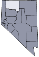
- Humboldt County, Nevada
US County infobox
county = Humboldt County
state = Nevada
map size =
founded = 1856
seat = Winnemucca | area_total_sq_mi =9658
area_water_sq_mi =10
area percentage = 0.10%
census yr = 2007
pop = 18052| density_km2 =1
web = www.hcnv.us
|Humboldt County is a
county located in theU.S. state ofNevada . As of 2007, the population was estimated to be 18,052 [ [http://www.nsbdc.org/what/data_statistics/demographer/pubs/pop_increase/ 2006 Estimates by County ] ] . Itscounty seat is WinnemuccaGR|6.The county was the site of an arrest in 2000 that led to the U.S. Supreme Court decision "
Hiibel v. Sixth Judicial District Court of Nevada " in 2004.History
Humboldt County is Nevada's oldest county, created by the Utah Territorial Legislature in 1856. It was also one of Nevada's original nine counties created in 1861. Named for the
Humboldt River whichJohn C. Fremont named afterBaron Friedrich Heinrich Alexander von Humboldt , a German naturalist, traveler and statesman. Humboldt never saw the places that bear his name. Unionville was the first county seat in 1861 until the mining boom died there and it was moved to Winnemucca on the transcontinental railroad line in 1873.Geography
According to the U.S. Census Bureau, the county has a total area of 9,658
square mile s (25,014km² ), of which, 9,648 square miles (24,988 km²) of it is land and 10 square miles (26 km²) of it is water. The total area is 0.10% water.The
Santa Rosa Range runs through eastern Humboldt County.Adjacent counties
*
Elko County, Nevada - east
*Lander County, Nevada - southeast
*Pershing County, Nevada - south
*Washoe County, Nevada - west
*Harney County, Oregon - north
*Malheur County, Oregon - north
*Owyhee County, Idaho - northeastDemographics
As of the
census GR|2 of 2000, there are 16,106 people in the county, organized into 5733 households, and 4133 families. Thepopulation density is 2 people per square mile (1/km²). There are 6,954 housing units at an average density of 1 per square mile (0/km²). The racial makeup of the county is 83.21% White, 4.02% Native American, 0.57% Asian, 0.51% Black or African American, 0.07% Pacific Islander, 8.54% from other races, and 3.09% from two or more races. 18.87% of the population are Hispanic or Latino of any race.There are 5,733 households out of which 40.9% have children under the age of 18 living with them, 59.6% are married couples living together, 7.6% have a female householder with no husband present, and 27.9% are non-families. 22.8% of all households are made up of individuals and 6.3% have someone living alone who is 65 years of age or older. The average household size is 2.77 and the average family size is 3.28.
In the county the population is spread out with 31.40% under the age of 18, 7.50% from 18 to 24, 31.20% from 25 to 44, 22.30% from 45 to 64, and 7.50% who are 65 years of age or older. The median age is 33 years. For every 100 females there are 110.30 males. For every 100 females age 18 and over, there are 110.20 males.
The median income for a household in the county is $47,147, and the median income for a family is $52,156. Males have a median income of $44,694 versus $25,917 for females. The
per capita income for the county is $19,539. 9.70% of the population and 7.70% of families are below thepoverty line . Out of the total population, 10.40% of those under the age of 18 and 10.80% of those 65 and older are living below the poverty line.Communities
Winnemucca is the sole incorporated city in the county. McDermitt is the sole
census-designated place in the county.Other unincorporated areas include:
*Denio
*Golconda
*Orovada
*Paradise Valley
*Stone House
*ValmyEducation
Humboldt County School District serves Humboldt County.References
Wikimedia Foundation. 2010.