- Canyonville, Oregon
-
Canyonville, Oregon — City — 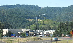 Location in Oregon
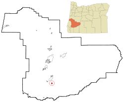
Coordinates: 42°55′51″N 123°16′39″W / 42.93083°N 123.2775°W Country United States State Oregon County Douglas Incorporated 1901 Government – Mayor Bob Deaton Area – Total 0.9 sq mi (2.4 km2) – Land 0.9 sq mi (2.4 km2) – Water 0 sq mi (0 km2) Elevation 750 ft (228.60 m) Population (2007) – Total 1,640 – Density 1,411.6/sq mi (542.6/km2) Time zone Pacific (UTC-8) – Summer (DST) Pacific (UTC-7) ZIP code 97417 Area code(s) 541 FIPS code 41-11000[1] GNIS feature ID 1118589[2] Website www.cityofcanyonville.com Canyonville is a city in Douglas County, Oregon, United States. The population was 1,293 at the 2000 census, while the 2007 estimate is 1,640 residents.[3] The Seven Feathers Casino Resort is located in Canyonville.
Contents
Geography
According to the United States Census Bureau, the city has a total area of 0.9 square miles (2.3 km2), all of it land.[4]
Demographics
As of the census of 2000, there were 1,293 people, 534 households, and 341 families residing in the city.[1] The population density was 1,411.6 people per square mile. There were 580 housing units at an average density of 633.2 per square mile. The racial makeup of the city was 91.88% White, 0.15% African American, 3.40% Native American, 0.85% Asian, 0.23% Pacific Islander, 0.54% from other races, and 2.94% from two or more races. Hispanic or Latino of any race were 3.17% of the population.
There were 534 households out of which 25.3% had children under the age of 18 living with them, 49.6% were married couples living together, 10.1% had a female householder with no husband present, and 36.0% were non-families. 30.0% of all households were made up of individuals and 15.7% had someone living alone who was 65 years of age or older. The average household size was 2.41 and the average family size was 2.97.
In the city the population was spread out with 24.1% under the age of 18, 7.8% from 18 to 24, 22.3% from 25 to 44, 25.7% from 45 to 64, and 20.2% who were 65 years of age or older. The median age was 42 years. For every 100 females there were 92.7 males. For every 100 females age 18 and over, there were 89.6 males.
The median income for a household in the city was $27,674, and the median income for a family was $31,500. Males had a median income of $30,240 versus $17,417 for females. The per capita income for the city was $14,017. About 15.8% of families and 17.0% of the population were below the poverty line, including 15.4% of those under age 18 and 19.0% of those age 65 or over.
References
- ^ a b "American FactFinder". United States Census Bureau. http://factfinder.census.gov. Retrieved 2008-01-31.
- ^ "US Board on Geographic Names". United States Geological Survey. 2007-10-25. http://geonames.usgs.gov. Retrieved 2008-01-31.
- ^ PSU:Population Research Center
- ^ "US Gazetteer files: 2010, 2000, and 1990". United States Census Bureau. 2011-02-12. http://www.census.gov/geo/www/gazetteer/gazette.html. Retrieved 2011-04-23.
External links
- City of Canyonville (official website)
- Canyonville listing in the Oregon Blue Book
Coordinates: 42°55′51″N 123°16′39″W / 42.930801°N 123.277436°W
Municipalities and communities of Douglas County, Oregon Cities 
CDPs Glide | Green | Roseburg North | Tri-City | Winchester Bay
Unincorporated
communitiesAnlauf | Ash | Azalea | Brockway | Camas Valley | Curtin | Days Creek | Dillard | Drew | Elkhead | Gardiner | Idleyld Park | Leona | Lookingglass | Melrose | Millwood | Milo | Nonpareil | Peel | Rice Hill | Round Prairie | Scottsburg | Shady | Steamboat | Tenmile | Tiller | Umpqua | Wilbur | Winchester
Categories:- Cities in Oregon
- Populated places in Douglas County, Oregon


Wikimedia Foundation. 2010.