- Reedsport, Oregon
Infobox Settlement
official_name = Reedsport, Oregon
settlement_type =City
nickname = Gateway to the Dunes
motto =
imagesize =
image_caption =
image_
imagesize =
image_caption =
image_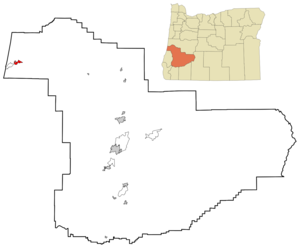
mapsize = 250px
map_caption = Location inOregon
mapsize1 =
map_caption1 =
subdivision_type = Country
subdivision_name =United States
subdivision_type1 = State
subdivision_name1 =Oregon
subdivision_type2 = County
subdivision_name2 = Douglas
government_type =
leader_title =Mayor
leader_name = Keith Tymchuk
established_title = Incorporated
established_date = 1919
area_magnitude =
area_total_sq_mi = 2.3
area_total_km2 = 5.9
area_land_sq_mi = 2.1
area_land_km2 = 5.3
area_water_sq_mi = 0.2
area_water_km2 = 0.6
area_urban_sq_mi =
area_urban_km2 =
area_metro_sq_mi =
area_metro_km2 =
population_as_of = 2000
population_note =
population_total = 4378
population_metro =
population_urban =
population_density_km2 = 820.6
population_density_sq_mi = 2126.6
timezone = Pacific
utc_offset = -8
timezone_DST = Pacific
utc_offset_DST = -7
latd = 43 |latm = 41 |lats = 56 |latNS = N
longd = 124 |longm = 6 |longs = 44 |longEW = W
elevation_m = 3.1
elevation_ft = 10
website = http://www.reedsport.or.us
postal_code_type =ZIP code
postal_code = 97467
area_code = 541
blank_name = FIPS code
blank_info = 41-61300GR|2
blank1_name = GNIS feature ID
blank1_info = 1148362GR|3
footnotes =Reedsport is a city in Douglas County,
Oregon ,United States . It was named for a local settler, Alfred W. Reed, who founded the city in 1912. As of the 2000 census, the population was 4,378.History
According to the "
Oregon Blue Book ", Reedsport was established on the estuary of theUmpqua River onJanuary 7 1852 . The post office was establishedJuly 17 1912 .The building of Southern Pacific Railroad lines extending south to Coos Bay lead to the development of Reedsport. Before the post office was established in 1912, Reedsport was a camp for railroad construction workers.
Built on marshy ground, for much of its history Reedsport has struggled with frequent flooding; most of its early buildings were elevated three to eight feet above ground. Following a devastating flood in 1964, a dike was constructed to protect the lower town. During this flood, the waters reached the fish hatchery and overflowed the fish troughs allowing hundreds of thousands of small-mouth bass to be introduced into the Umpqua River. [ [http://www.loonlakerv.com/umpqua-river.html Loon Lake Lodge & RV Resort] ] According to fishing reports small-mouth bass became the most abundant fish in the Umpqua River. Every few years, flooding will occur enough that city employees will close these dikes to prevent low-lying areas of the town from flooding.
In the last quarter of the 20th century, Reedsport has struggled with the collapse of the Oregon
timber industry. In the last two decades, Reedsport has seen an increase of tourism. Part of this is due to its close proximity to the fishing of the Umpqua River. Another part of the recent surge in tourism is due to the sand dunes that are near Reedsport.Although the U.S. Forest Service maintains a local office in the town, Reedsport's historic connection with the timber industry ended in 1999 with the closing of the
International Paper plant in nearby Gardiner.Recently, Reedsport has seen a rise in tourism due to recreation at the nearby
Oregon Dunes National Recreation Area . A number of businesses catering toall-terrain vehicle s have opened in Reedsport to serve the needs of this growing activity. The Reedsport Chamber of Commerce hosts an annual Dunefest in neighboring Winchester Bay, which is a festival centered around all-terrain vehicle racing and socializing, includingbeer garden s, concerts, and vendor booths. [ [http://www.dunefest.com Dune Fest] ]Geography
Reedsport is located at coor dms|43|41|56|N|124|6|44|W|city (43.698789, -124.112140)GR|1. Reedsport, where
Oregon Route 38 meets U.S. Route 101, is convert|54|mi|km|0 northwest of Roseburg.According to the
United States Census Bureau , the city has a total area of 2.3square mile s (5.9km² ), of which, 2.1 square miles (5.3 km²) of it is land and 0.2 square miles (0.6 km²) of it (10.48%) is water.Demographics
As of the
census GR|2 of 2000, there were 4,378 people, 1,978 households, and 1,265 families residing in the city. Thepopulation density was 2,126.6 people per square mile (820.6/km²). There were 2,178 housing units at an average density of 1,057.9/sq mi (408.2/km²). The racial makeup of the city was 93.92% White, 0.02% African American, 1.23% Native American, 0.43% Asian, 0.02% Pacific Islander, 2.15% from other races, and 2.22% from two or more races. Hispanic or Latino of any race were 4.68% of the population.There were 1,978 households out of which 23.5% had children under the age of 18 living with them, 52.5% were married couples living together, 7.7% had a female householder with no husband present, and 36.0% were non-families. 32.0% of all households were made up of individuals and 17.9% had someone living alone who was 65 years of age or older. The average household size was 2.19 and the average family size was 2.71.
In the city the population was spread out with 20.6% under the age of 18, 6.3% from 18 to 24, 19.9% from 25 to 44, 27.0% from 45 to 64, and 26.2% who were 65 years of age or older. The median age was 47 years. For every 100 females there were 93.3 males. For every 100 females age 18 and over, there were 89.6 males.
The median income for a household in the city was $26,054, and the median income for a family was $33,689. Males had a median income of $33,214 versus $20,734 for females. The
per capita income for the city was $16,093. About 11.7% of families and 16.0% of the population were below thepoverty line , including 21.5% of those under age 18 and 10.9% of those age 65 or over.Education
Elementary school
Highland Elementary (K-6)
Middle and high school
Reedsport Jr/Sr High School (7-12)
Points of interest
*The
Dean Creek Elk Viewing Area is located three miles (5 km) east of Reedsport onOregon Route 38 . This convert|1000|acre|km2|0|sing=on preserve jointly managed by theBureau of Land Management and theOregon Department of Fish and Wildlife provides an opportunity to view 60-100Roosevelt elk in their natural habitat year round.*The Oregon Dunes National Recreation Area interpretive center is located at the intersection of Oregon Route 38 and U.S. Route 101. It features interpretive panels, short films, and information about the local area and attractions.
*
Umpqua River Light house, two miles (3 km) south in Winchester Bay.*
Umpqua Discovery Center , in downtown Reedsport, features local history information provided through interactive media and displays.Mass media
Radio
*KDUN (1030 AM)
*KJMX (99.5 FM)Newspaper
"
The Umpqua Post "Notable residents
*Delilah Rene Luke, radio personality
*Vicki Walker , politicianReferences
ee also
History
*
Steamboats of the Oregon Coast External links
* [http://www.reedsport.or.us City of Reedsport]
Wikimedia Foundation. 2010.