- Sutherlin, Oregon
Infobox Settlement
official_name = Sutherlin, Oregon
settlement_type =City
nickname =
motto =
imagesize =
image_caption =
image_
imagesize =
image_caption =
image_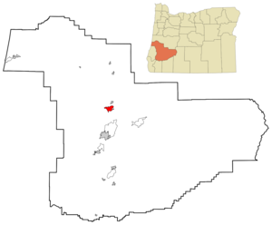
mapsize = 250px
map_caption = Location inOregon
mapsize1 =
map_caption1 =
subdivision_type = Country
subdivision_name =United States
subdivision_type1 = State
subdivision_name1 =Oregon
subdivision_type2 = County
subdivision_name2 = Douglas
government_type =
leader_title =Mayor
leader_name = Lee Sparks
established_title = Incorporated
established_date = 1911
area_magnitude =
area_total_sq_mi = 5.3
area_total_km2 = 13.7
area_land_sq_mi = 5.2
area_land_km2 = 13.5
area_water_sq_mi = 0.1
area_water_km2 = 0.2
area_urban_sq_mi =
area_urban_km2 =
area_metro_sq_mi =
area_metro_km2 =
population_as_of = 2000
population_note =
population_total = 6669
population_metro =
population_urban =
population_density_km2 = 495.2
population_density_sq_mi = 1283.2
timezone = Pacific
utc_offset = -8
timezone_DST = Pacific
utc_offset_DST = -7
latd = 43 |latm = 23 |lats = 18 |latNS = N
longd = 123 |longm = 18 |longs = 58 |longEW = W
elevation_m = 158.50
elevation_ft = 520
website = http://www.ci.sutherlin.or.us
postal_code_type =ZIP code
postal_code = 97479
area_code = 541
blank_name = FIPS code
blank_info = 41-71650GR|2
blank1_name = GNIS feature ID
blank1_info = 1127772GR|3
footnotes =Sutherlin is a city in Douglas County,
Oregon ,United States . The population was 6,669 at the 2000 census. Nearby features include Cooper Creek Reservoir, theUmpqua River , and numerous vineyards.Geography
Sutherlin is located at coor dms|43|23|18|N|123|18|58|W|city (43.388435, -123.316175)GR|1.
According to the
United States Census Bureau , the city has a total area of 5.3square mile s (13.7km² ), of which, 5.2 square miles (13.5 km²) of it is land and 0.1 square miles (0.2 km²) of it (1.70%) is water.Demographics
As of the
census GR|2 of 2000, there were 6,669 people, 2,713 households, and 1,909 families residing in the city. Thepopulation density was 1,283.2 people per square mile (495.2/km²). There were 2,975 housing units at an average density of 572.4/sq mi (220.9/km²). The racial makeup of the city was 93.79% White, 0.13% African American, 1.72% Native American, 0.51% Asian, 0.06% Pacific Islander, 1.09% from other races, and 2.68% from two or more races. Hispanic or Latino of any race were 3.97% of the population.There were 2,713 households out of which 30.0% had children under the age of 18 living with them, 56.7% were married couples living together, 9.8% had a female householder with no husband present, and 29.6% were non-families. 24.5% of all households were made up of individuals and 14.5% had someone living alone who was 65 years of age or older. The average household size was 2.46 and the average family size was 2.88.
In the city the population was spread out with 25.0% under the age of 18, 6.7% from 18 to 24, 24.9% from 25 to 44, 22.0% from 45 to 64, and 21.3% who were 65 years of age or older. The median age was 40 years. For every 100 females there were 91.5 males. For every 100 females age 18 and over, there were 86.9 males.
The median income for a household in the city was $29,068, and the median income for a family was $34,414. Males had a median income of $32,047 versus $20,911 for females. The
per capita income for the city was $13,439. About 12.4% of families and 14.9% of the population were below thepoverty line , including 16.5% of those under age 18 and 9.1% of those age 65 or over.References
External links
* [http://www.ci.sutherlin.or.us/ City of Sutherlin homepage]
Wikimedia Foundation. 2010.