- Arlington, Washington
Infobox Settlement
official_name = Arlington, Washington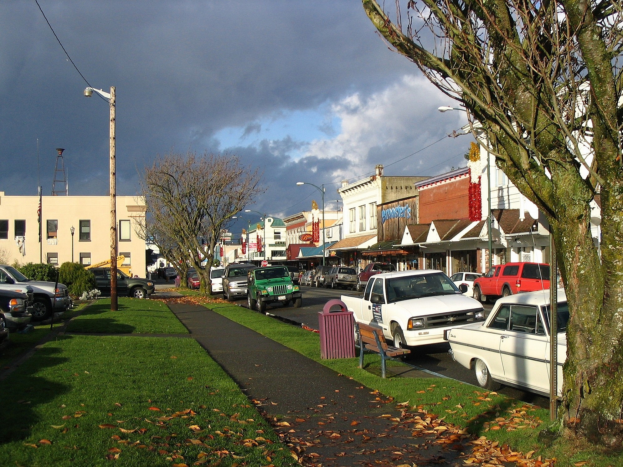
settlement_type =City
nickname =
imagesize =
image_caption =
image_
image_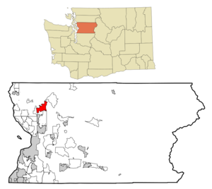
mapsize = 250px
map_caption = Location of Arlington within Snohomish County
mapsize1 =
map_caption1 =
subdivision_type = Country
subdivision_name =United States
subdivision_type1 = State
subdivision_name1 =Washington
subdivision_type2 = County
subdivision_name2 = Snohomish
government_type =
leader_title =Mayor
leader_name =Margaret Larson
established_date =
area_magnitude = 1 E9
area_total_km2 = 19.6
area_land_km2 = 19.6
area_water_km2 = 0.0
population_as_of = 2004
population_note =
population_total = 14,491
population_density_km2 = 597.8
timezone = PST
utc_offset = -8
timezone_DST = PDT
utc_offset_DST = -7
area_total_sq_mi = 7.6
area_land_sq_mi = 7.6
area_water_sq_mi = 0.0
elevation_m = 35
elevation_ft = 115
latd = 48 |latm = 10 |lats = 52 |latNS = N
longd = 122 |longm = 8 |longs = 20 |longEW = W
website = http://www.ci.arlington.wa.us/
postal_code_type =ZIP code
postal_code = 98223
area_code = 360
blank_name = FIPS code
blank_info = 53-02585GR|2
blank1_name = GNIS feature ID
blank1_info = 1515947GR|3
footnotes =Arlington is a city located in northern
Snohomish County, Washington , USA, bordered by the city of Marysville to the south. As of the 2004 census, the city had a total population of 14,491. The city owns the Arlington Municipal Airport, located three miles (5 km) southwest of Arlington, which is home to the annual Northwest EAA Fly-In. The city is also home to theStillaguamish Valley Pioneer Museum . Its few industrial and manufacturing businesses are dispersed throughout portions of the city.History
Arlington was platted in 1890, and was named after Lord Henry Arlington, a member of Charles II of England's cabinet. Arlington was incorporated as a city in 1903.
Geography
Arlington is located at 48°10'52" North, 122°8'20" West (48.181101, -122.138955).GR|1 Arlington is situated in the Stillaguamish Valley, at the junction of the North and South Forks of the
Stillaguamish River , at the base of theCascade Range . Arlington is accessible viaInterstate 5 ,Washington State Route 530 from Darrington, andWashington State Route 9 .Government and Politics
Mayors of Arlington:
*1903: J.M. Smith
*1905: Neil Brown
*1906: Will H. Verd
*1908: Peter Larsen
*1910: George Kunze
*1912: W.H. Ford
*1914: George Kunze
*1916: H.W. Sessoms
*1918: J.H. Persun
*1920: Chas J. Warren
*1922: O.G. Kesling
*1924: Will H. Verd
*1926: R.W. Shaw
*1928: Harold M. Murphy
*1930: M. Hiram Amsberry
*1934: Henry Backstrom
*1938: H. Hiram Amsberry
*1942: Ernest Meier
*1948: Walter Bracy
*1949: Robert Murphy
*1956: J. Boyd Ellis
*1960: Woodrow Willey
*1962: H. James Cann
*1972: H.A. Christensen
*1980: John Larson
*1990: Robert Kraski
*2004: Margaret LarsonDemographics
As of the 2004 census, there were 14,491 people, 4,281 households, and 3,095 families residing in the city. The
population density was 1,548.4 people per square mile (598.2/km²). There were 4,516 housing units at an average density of 597.0/sq mi (230.6/km²). The racial makeup of the city was 90.01% White, 2.20% African American, 1.13% Native American, 1.04% Asian, 0.32% Pacific Islander, 2.47% from other races, and 2.83% from two or more races. 5.83% of the population were Hispanic or Latino of any race.There were 4,281 households out of which 42.6% had children under the age of 18 living with them, 56.7% were married couples living together, 11.5% had a female householder with no husband present, and 27.7% were non-families. 22.7% of all households were made up of individuals and 9.3% had someone living alone who was 65 years of age or older. The average household size was 2.72 and the average family size was 3.19.
The median age of city resident's is 32 years:
*31.5% are under the age of 18,
*8.0% are from 18 to 24,
*32.6% are from 25 to 44,
*18.4% are from 45 to 64, and
*9.6% who are 65 years of age or older. For every 100 females there are 93.3 males. For every 100 females age 18 and over, there were 91.2 males.The median income for a household in the city was $46,302, and the median income for a family was $51,941. Males had a median income of $41,517 versus $26,912 for females. The
per capita income for the city was $19,146. 7.2% of the population and 5.8% of families were below thepoverty line . 9.2% of those under the age of 18 and 10.4% of those 65 and older were living below the poverty line.Economy
Timber
From its founding, Arlington was dependent on
timber harvesting and timber products. It was once dubbed the "Shingle Capital of the World" owing to theshingle mills, sawmills, and logging camps in the vicinity.Railroad
*Seattle, Lake Shore and Eastern Railroad
*Northern Pacific
*Burlington Northern Santa FeFarming
*Arlington Cooperative Association
*Pioneer Creamery, 1901
*Arlington Condensery, 1920
*Snohomish County Dairy Association
*DarigoldAviation
*Arlington Municipal Airport
*Boeing
*Everette Airport AcademyMedical
*Cascade Valley Hospital
*Providence Everett Medical Center
*Skagit Valley HospitalDistricts and Neighborhoods
mokey Point
Smokey Point is a bustling residential, commercial, and industrial community. The northeast portion of this community was annexed by Arlington in 1999.
Gleneagle
The largest planned development in Arlington,
Gleneagle is a 1,037-unit neighborhood and HOA built in and around theGleneagle Golf Course . Consisting of single-family homes and townhouses, Gleneagle was primarily built up from 1987 through 2002 and houses approximately 30% of Arlington's population.High Clover Park
High Clover Park is a planned neighborhood and development, consisting of 162 single family homes. It is situated northwest of the Arlington Municipal Airport.Arlington Heights
Arlington Heights is a residential area situated east of Arlington on the triangular raised plateau bordered on the east by the
Cascade Mountains , on the northwest by the North Fork of theStillaguamish River , and on the southwest by the South Fork of the Stillaguamish River. In the Cascade foothills east of Arlington Heights is theJim Creek Naval Radio Station , avery low frequency radio array for communication with submarines. It is largely decommissioned but still in use as a recreation facility by Navy personnel and families. Arlington Heights is outside the municipal boundaries of Arlington, but its residents have Arlington postal addresses and their children attend Arlington schools. Some areas in Arlington Heights have excellent views of Whitehorse and Three Fingers Mountains.External links
* [http://arlingtontimes.com/ The Arlington Times - Local newspaper]
* [http://www.ci.arlington.wa.us/ Arlington's Official Website]
* [http://www.stillymuseum.org/ Stillaguamish Valley Pioneer Museum]
* Nearby hiking trails on [http://www.hikipedia.com/search/near/Arlington/WA Hikipedia]References
"Arlington Centennial 1903-2003: A Pictorial History of Arlington, Washington"
Wikimedia Foundation. 2010.