- Jefferson County, Washington
-
Jefferson County, Washington 
Location in the state of Washington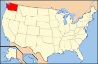
Washington's location in the U.S.Founded December 22, 1852 Seat Port Townsend Area
- Total
- Land
- Water
2,184 sq mi (5,657 km²)
1,814 sq mi (4,698 km²)
369 sq mi (956 km²), 16.91%Population
- (2010)
- Density
29,872
16/sq mi (6.3/km²)Website www.co.jefferson.wa.us Jefferson County is a county located in the U.S. state of Washington, named after Thomas Jefferson. As of 2010, the population was 29,872. The county seat is at Port Townsend, which is also the county's only incorporated city.
Jefferson County was formed out of Thurston County on December 22, 1852, by the legislature of Oregon Territory,[1] and included the northern 4,854 square miles (12,571.8 km2) portion of the Olympic Peninsula. On April 26, 1854, the legislature of Washington Territory created Clallam County from the northwestern 2,670 square miles (6,915.3 km2) portion of this original area.
The Hood Canal Bridge connects Jefferson County to Kitsap County, Washington. The Keystone-Port Townsend route of the Washington State Ferries connects the county to Whidbey Island in Island County, Washington.
Contents
Geography
According to the U.S. Census Bureau, the county has a total area of 2,184 square miles (5,656.5 km2), of which 1,814 square miles (4,698.2 km2) is land and 369 square miles (955.7 km2) (16.91%) is water.
The county is split in three parts by its landforms:
- Eastern Jefferson County along the Strait of Juan de Fuca, Admiralty Inlet, and Puget Sound
- Central Jefferson County, which is uninhabited and lies in the Olympic Mountains within Olympic National Park and Olympic National Forest
- Western Jefferson County, along the Pacific Ocean.
Because of the mountainous barrier, there is no road lying entirely within Jefferson County that connects the eastern and western parts. The most direct land route between the two ends of the county involves a drive of approximately 100 miles (160 km) along U.S. Route 101 through neighbouring Clallam County. The mountains also block the damp Chinook winds, which make the climate very much more wet in the West than the so-called Eastern "banana belt" in the rain shadow.
Geographic features
 Port Townsend from ferry.
- Admiralty Inlet
- Destruction Island
- Discovery Bay
- Hood Canal
- Mount Olympus, Washington, the highest point in Jefferson county
- Olympic Mountains
- Olympic Peninsula
- Pacific Ocean
- Point Wilson
- Port Townsend Bay
- Protection Island
- Puget Sound
- Queets River
- Quimper Peninsula
- Strait of Juan de Fuca
Major highways
Adjacent counties
- Island County, Washington - northeast
- Kitsap County, Washington - southeast
- Mason County, Washington - south/southeast
- Grays Harbor County, Washington - south/southwest
- Clallam County, Washington - northwest
- San Juan County, Washington - northeast (water boundary only, in Strait of Juan de Fuca).
National protected areas
- Olympic National Forest (part)
- Olympic National Park (part)
- Protection Island National Wildlife Refuge
- Quillayute Needles National Wildlife Refuge (part)
- Pacific Northwest National Scenic Trail (part)
Demographics
Historical populations Census Pop. %± 1860 531 — 1870 1,268 138.8% 1880 1,712 35.0% 1890 8,368 388.8% 1900 5,712 −31.7% 1910 8,337 46.0% 1920 6,557 −21.4% 1930 8,346 27.3% 1940 8,918 6.9% 1950 11,618 30.3% 1960 9,639 −17.0% 1970 10,661 10.6% 1980 15,965 49.8% 1990 20,146 26.2% 2000 25,953 28.8% 2010 29,872 15.1% As of the census[2] of 2000, there were 25,953 people, 11,645 households, and 7,580 families residing in the county. The population density was 14 people per square mile (6/km²). There were 14,144 housing units at an average density of 8 per square mile (3/km²). The racial makeup of the county was 92.17% White, 0.42% Black or African American, 2.31% Native American, 1.19% Asian, 0.13% Pacific Islander, 0.76% from other races, and 3.02% from two or more races. 2.06% of the population were Hispanic or Latino of any race. 17.4% were of German, 14.8% English, 9.9% Irish and 7.5% Norwegian ancestry according to Census 2000. 97.1% spoke English and 1.0% Spanish as their first language.
There were 11,645 households out of which 23.20% had children under the age of 18 living with them, 53.60% were married couples living together, 8.20% had a female householder with no husband present, and 34.90% were non-families. 28.50% of all households were made up of individuals and 11.70% had someone living alone who was 65 years of age or older. The average household size was 2.21 and the average family size was 2.67.
In the county, the population was spread out with 19.80% under the age of 18, 5.00% from 18 to 24, 21.60% from 25 to 44, 32.50% from 45 to 64, and 21.10% who were 65 years of age or older. The median age was 47 years. For every 100 females there were 95.80 males. For every 100 females age 18 and over, there were 94.40 males.
The median income for a household in the county was $37,869, and the median income for a family was $45,415. Males had a median income of $37,210 versus $25,831 for females. The per capita income for the county was $22,211. About 7.20% of families and 11.30% of the population were below the poverty line, including 16.60% of those under age 18 and 6.00% of those age 65 or over.
Politics
Jefferson County is a staunchly Democratic area, with even rural areas giving significant margins to John Kerry against George W. Bush in the 2004 U.S. presidential election.
The communities in the Eastern and Western halves of Jefferson County tend to not mingle much, because of the barrier dividing the county. The communities also differ in amount and sources of family income, and population size and density, with the West being more dependent on logging, somewhat less prosperous, and having fewer people for roughly the same area. Port Townsend, located in the relatively populous East is gradually developing into a retirement community. Areas of East Jefferson County located south of Port Townsend remain largely rural and can be divided into two parts, those communities located on the Hood Canal and those on the Admiralty Inlet. Because of persistent differences in local self-interest, the two sides of the county regularly experience political friction. Perennial discussions and attempts to separate the West half from the East gained little support during the twentieth century because of the perception that less prosperous West is subsidised by the East from which it would secede, leaving it worse rather than better-off, and giving adjoining counties little reason to wish to annex the West.
County seat Port Townsend casts a significant number of votes, and voted for John Kerry by a margin of over 3-to-1. Areas outside of Port Townsend (such as Cape George) gave Kerry 2-to-1 victory margins. Democrats also do well in the small towns of northern Jefferson County, with strong Democratic leans in Coyle, Discovery Bay, Gardiner, and Nordland, as well as in the towns just southeast of Port Townsend (Chimacum, Irondale, Kala Point, and Port Hadlock). Democrats also perform strongly in the sparsely-populated western part of the county, where much of the population is Native American.
Republicans tend to win small victories in several parts of the county, such as the sparsely-populated area around Crocker Lake. Although it has trended Democratic in recent years, Port Ludlow — an affluent area that casts a notable number of votes — still has a Republican lean (although the north part of Port Ludlow has become a marginally Democratic area).
Census-recognized communities
Other communities
- Adelma Beach
- Beckett Point
- Cape George
- Center
- Chimacum
- Clearwater
- Coyle
- Crocker Lake
- Dabob
- Discovery Bay
- East Quilcene
- Fort Flagler
- Fort Worden
- Gardiner
- Glen Cove
- Indian Island
- Kala Point
- Kalaloch
- Leland
- Mats Mats
- Mount Walker
- Oak Bay
- Queets
- Shine
See also
References
- ^ Reinartz, Kay. "History of King County Government 1853–2002". p. 2. http://www.metrokc.gov/kc150/historical%20overview.pdf. Retrieved 2007-12-28.
- ^ "American FactFinder". United States Census Bureau. http://factfinder.census.gov. Retrieved 2008-01-31.
External links
- Official Jefferson County Parks and Recreation Department Website The official government website for Jefferson County Parks and Recreation, a Division of Jefferson County Public Works Department.
- University of Washington Libraries Digital Collections – The Pacific Northwest Olympic Peninsula Community Museum A web-based museum showcasing aspects of the rich history and culture of Washington State's Olympic Peninsula communities. Features cultural exhibits, curriculum packets and a searchable archive of over 12,000 items that includes historical photographs, audio recordings, videos, maps, diaries, reports and other documents.
- Jefferson County Official Website
- Jefferson County Historical Society Research Center A searchable, online collection of 49,000 records maintained by the Jefferson County museum and research center, whose mission is to actively discover, collect, preserve, and promote the heritage of Jefferson County in the State of Washington.
- PortLudowToday-Digital Village A non profit organization providing a virtual collection of activities and current events surrounding this master planned community.

Clallam County Island County and Strait of Juan de Fuca Pacific Ocean 
 Jefferson County, Washington

Grays Harbor County Mason County Kitsap County Municipalities and communities of Jefferson County, Washington City 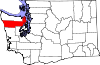
CDP Unincorporated
communitiesBeckett Point | Cape George | Center | Chimacum | Clearwater | Discovery Bay | Gardiner | Indian Island | Kalaloch | Queets
Indian reservation Quinault Indian Reservation‡
Footnotes ‡This populated place also has portions in an adjacent county or counties
Categories:- Washington (state) counties
- Jefferson County, Washington
- 1852 establishments in the United States


Wikimedia Foundation. 2010.