- Queets River
Geobox|River
name = Queets River
native_name =
other_name =
category = River
etymology =
nickname =
image_size = 300
image_caption =
country = United States
country_
state = Washington
region =
district =
municipality =
tributary_left =Sams River
tributary_left1 = Salmon River
tributary_right = Clearwater River
city =
source = Olympic Mountains
source_location = | source_region = | source_country =
source_elevation_imperial = 4230
source_elevation_note = Source elevation derived fromGoogle Earth search using GNIS source coordinates.]
source_lat_d = 47
source_lat_m = 47
source_lat_s = 21
source_lat_NS = N
source_long_d = 123
source_long_m = 36
source_long_s = 28
source_long_EW = W
source_coordinates_note = GNIS|1531493|Queets River]
mouth = Pacific Ocean
mouth_location = | mouth_region = | mouth_country =
mouth_elevation_imperial = 0
mouth_lat_d = 47
mouth_lat_m = 32
mouth_lat_s = 40
mouth_lat_NS = N
mouth_long_d = 124
mouth_long_m = 21
mouth_long_s = 22
mouth_long_EW = W
mouth_coordinates_note=
length_imperial = 60
length_note = [http://www.bartleby.com/69/47/Q00447.html Queets River] , Columbia Gazetteer of North America]
length_orientation =
width_imperial = | width_orientation =
depth_imperial =
volume_imperial =
watershed_imperial =
discharge_imperial = 4353
discharge_note = [http://pubs.usgs.gov/wdr/2005/wdr-wa-05-1/pdf/wa00103ADR2005_Figure12.pdf Quinault, Queets, Hoh, and Quillayute River Basins] , Water Resources Data - Washington Water Year 2005, USGS]
discharge_max_imperial = 91100
discharge_min_imperial = 281
map_size = 300
map_caption =
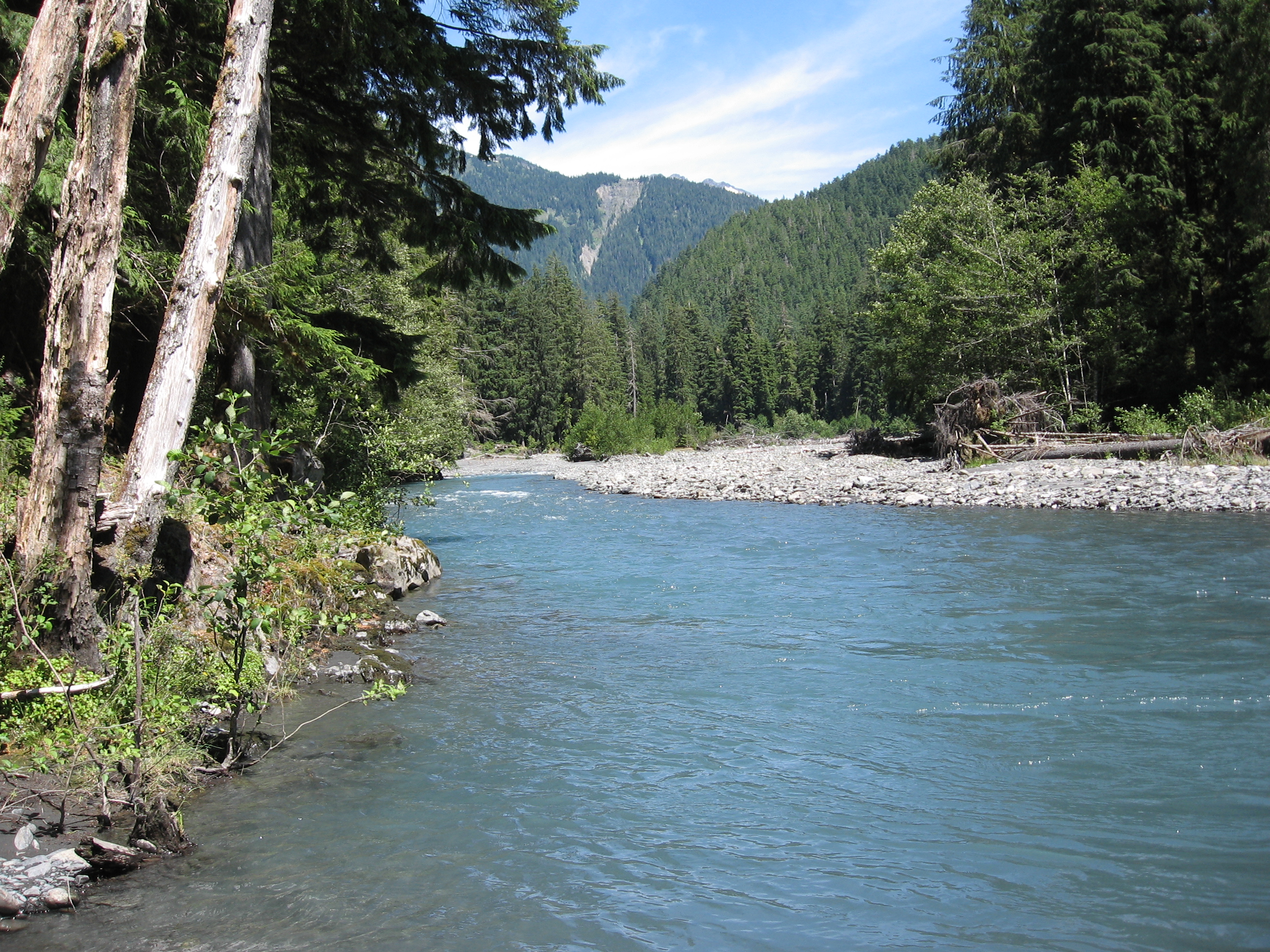
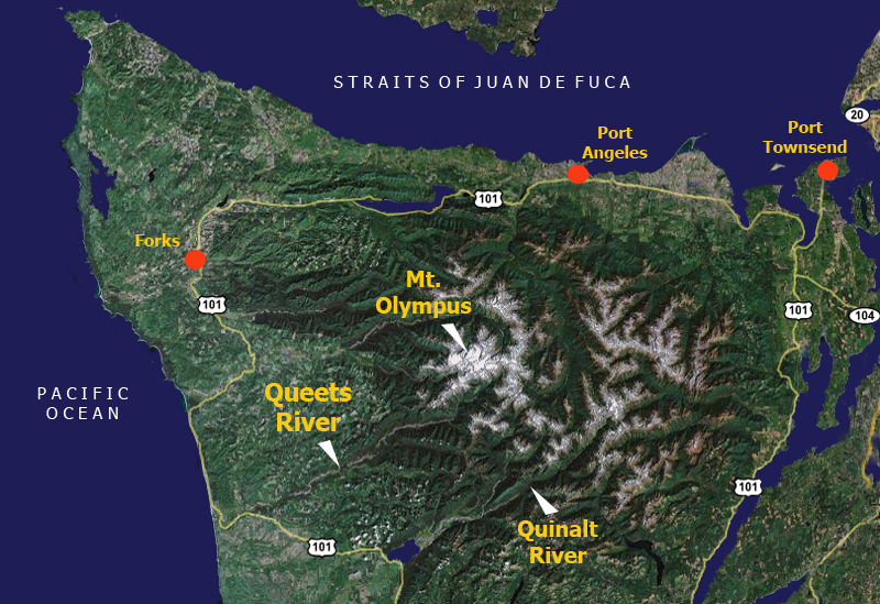
commons =The Queets River is ariver in theU.S. state ofWashington . It is located on theOlympic Peninsula , mostly within theOlympic National Park and empties into thePacific Ocean . The name Queets is derived from the Quaitso Indians, who lived along the river and were closely related to the Quinault to the south. [cite book |last= Phillips |first= James W. |title= Washington State Place Names |year= 1971 |publisher= University of Washington Press |isbn= 0-295-95158-3 |pages= p. 114]Course
The Queets River originates at the foot of the
Queets Glacier onMount Queets in the Olympic Mountains. It flows generally southeast, collecting numerous tributaries including the Clearwater River, Salmon River, and Sams River before emptying into the Pacific Ocean near the community of Queets.Nearly all of the river is within Olympic National Park. The last convert|4|mi|km are outside the park, within the Quinault Indian reservation. A short portion of the river near its mouth is within Grays Harbor County while the rest is in Jefferson County.
Natural history
The Queets River is unusual in being a large river flowing through a relatively low-gradient, heavily forested alluvial valley. The forests on the western side of the Olympic Mountains have one of the highest rates of
biomass production per unit area in North America. Discharge rates in the winter can be very high, sometimes with surges to nearly 100,000 cubic feet per second. This combination results in frequent log jams and new channels. The river is not kept clear of woody debris, making it one of the few North American rivers of its size in which large log jams are common.cite journal |last= Abbe |first= Tim B. |coauthors= David R. Montgomery |title= Patterns and processes of wood debris accumulation in the Queets river basin, Washington |journal= Geomorphology |volume= 51 |pages= 81-107 |year=2003 |url= http://duff.ess.washington.edu/grg/publications/pdfs/Abbe_Mont_2003.pdf |accessdate= 2008-10-04]Recreation
There is a primitive
National Park Service campground at the end of the Queets River Road. The Queets River Trail begins on the north bank of the river, across from the campground, and follows the river about convert|16|mi|km upstream. Access to the trailhead requires fording the Queets River, which can be treacherous.There are primitive campsites along the trail at the Lower Crossing Way Trail junction and Spruce Bottom.The river is runnable by kayak or canoe from the campground to the Highway 101 bridge (roughly convert|19|mi|km), but is replete with hazards, mainly in the form of log jams.
ee also
*
List of Washington rivers References
External links
* [http://www.nps.gov/olym/parknews/upper-queets-valley-reopens-via-alternative-route.htm Upper Queets Valley Reopens Via Alternative Route] , Olympic National Park, National Park Service

Wikimedia Foundation. 2010.