- Elwha River
Geobox River
name = Elwha River
native_name =
other_name =
other_name1 =

image_size = 300
image_caption = Elwha River
country = United States
country1 =
state = Washington
state1 =
region_type = Counties
region = Clallam
region1 = Jefferson
district =
district1 =
city = Port Angeles
city1 =
length_imperial = 45
length_note =
watershed_imperial = 318
watershed_note = [http://pubs.usgs.gov/wdr/2005/wdr-wa-05-1/pdf/wa00103ADR2005_Figure14.pdf Hoko, Elwha, and Dungeness River Basins] , Water Resource Data, Washington, 2005, USGS.]
discharge_location = McDonald Bridge,River mile 8.6
discharge_imperial = 1507
discharge_max_imperial = 41600
discharge_min_imperial = 10
discharge_note =
discharge1_location =
discharge1_imperial =
source_name = Olympic Range
source_location =
source_district =
source_region =
source_state =
source_country =
source_lat_d = 47
source_lat_m = 46
source_lat_s = 8
source_lat_NS = N
source_long_d = 123
source_long_m = 34
source_long_s = 43
source_long_EW = W
source_coordinates_note = gnis|1531449]
source_elevation_imperial = 3655
source_elevation_note =Google Earth elevation for GNIS coordinates.]
source_length_imperial =
mouth_name = Strait of Juan de Fuca
mouth_location =
mouth_district =
mouth_region =
mouth_state =
mouth_country =
mouth_lat_d = 48
mouth_lat_m = 9
mouth_lat_s = 2
mouth_lat_NS = N
mouth_long_d = 123
mouth_long_m = 33
mouth_long_s = 35
mouth_long_EW = W
mouth_coordinates_note =
mouth_elevation_imperial = 0
mouth_elevation_note =
tributary_left =Goldie River
tributary_left1 =
tributary_right =Hayes River
tributary_right1 =Lost River
tributary_right2 =Lillian River
tributary_right3 =Little River
free_name =
free_value =
map_size = 300
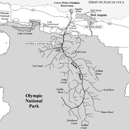
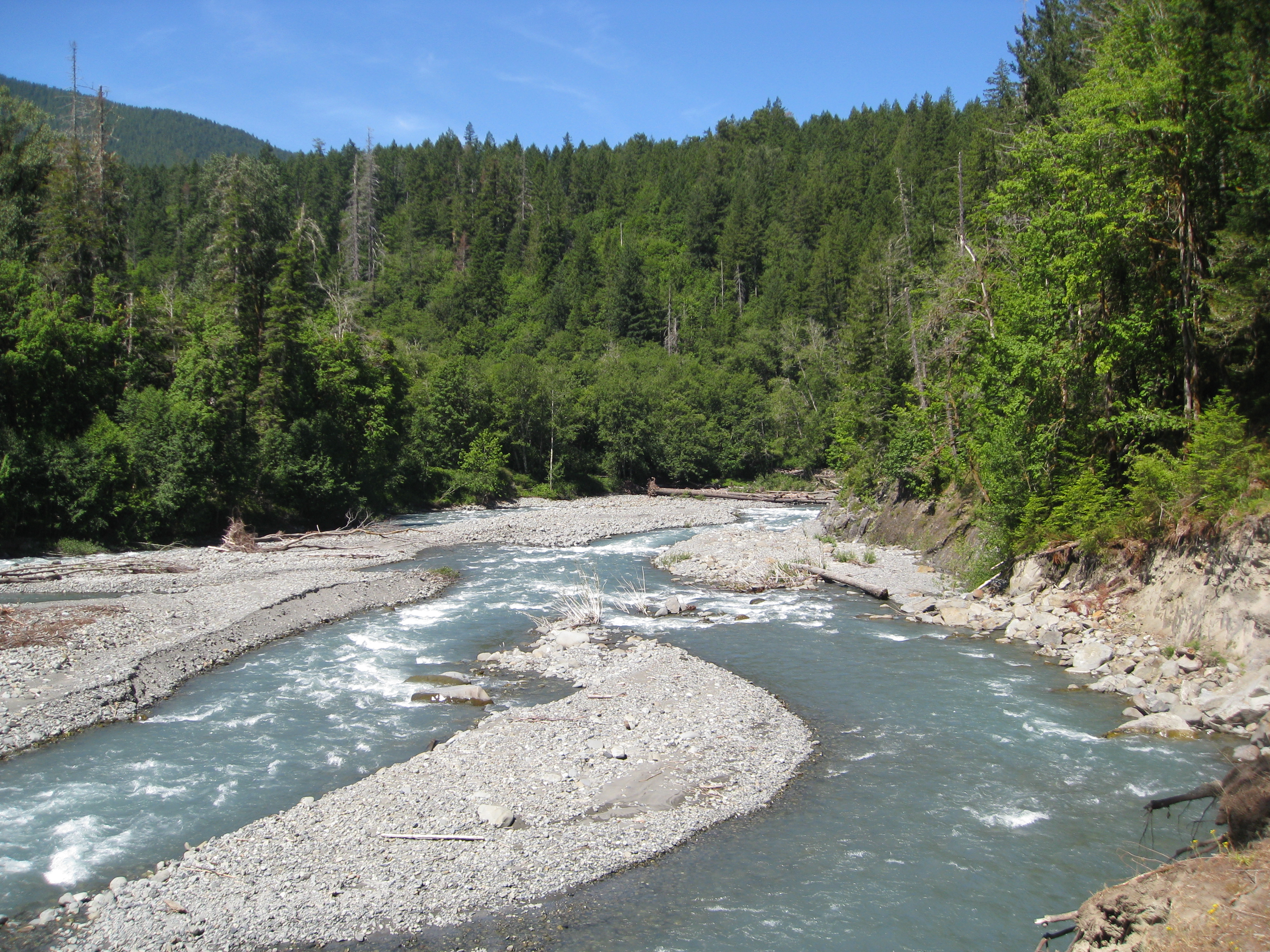
map_caption = Map of the Elwha River The Elwha River is a 45-mile-longriver located on theOlympic Peninsula in theU.S. state ofWashington . From its source atElwha snowfinger in theOlympic Range ofOlympic National Park it flows generally north to theStrait of Juan de Fuca . Most of the river is contained within Olympic National Park. There are two dams on the river's lower course, both of which are scheduled to be removed.The river is one of the only in the Pacific Northwest to contain all 5 species of
Pacific Salmon and also contained four other anadromoustrout species. Prior to the construction of the dams, approximately 400,000 adult salmon returned to the river each year to spawn in over 70 miles of river habitat. Today, less than 4,000 salmon return each year in only 4.9 miles of available habitat below the first dam.The species of
anadromous fish in the river include;Chinook Salmon ,Coho Salmon ,Chum Salmon ,Sockeye Salmon , andPink Salmon , as well as,Steelhead ,Coastal cutthroat trout ,Bull trout , andDolly Varden char .Course
The Elwha River begins at the
Elwha snowfinger near Mount Barnes andMount Queets in the Olympic Range within Olympic National Park, inJefferson County, Washington . The river flows southeast, then curves northward for the rest of its course. Major peaks near the Elwha's source include Mount Christie,Mount Carrie Mount Meany, and Mount Seattle.After receiving the tributaries Delabarre Creek and Godkin Creek the Elwha River flows northward. The Hayes River joins in Press Valley, where the Hayes River Ranger Station is located. Lost River joins near the northern end of Press Valley, after which the Elwha crosses into
Clallam County, Washington .Just after the countyline, the Elwha River passes the Elkhorn Ranger Station and enters the
Grand Canyon of the Elwha . The river leaves the Grand Canyon as it passes underDodger point bridge and pastHumes Ranch Cabin along theGeyser Valley trail . After passingKrause Bottom , the river enters Rica Canyon atGoblin's Gate . After Rica Canyon, the river fans out into a delta at the head ofLake Mills , the reservoir behindGlines Canyon Dam . Below the dam the Elwha is paralleled by Olympic Hot Springs Road. After flowing by a couple campgrounds and the Elwha Ranger Station the river exitsOlympic National Park and entersLake Aldwell , the reservoir behindElwha Dam .Below Elwha River, the Elwha River flows several miles north, through the
Lower Elwha Indian Reservation , to enter theStrait of Juan de Fuca at Angeles Point, just west of the city ofPort Angeles, Washington . [Course info mainly from: cite book | title = Washington Road & Recreation Atlas | year = 2000 | publisher =Benchmark Maps ]Dams
The river is the site for the largest
dam removal project in history. TheElwha Ecosystem Restoration project is also the second largest ecosystem restoration project theNational Park Service has ever attempted, after theEverglades . The Elwha River Ecosystem and Fisheries Restoration Act of 1992 authorized the Secretary of the Interior to acquire and remove two dams on the river and restore the ecosystem and native anadromous fisheries. The 108-foot-tallElwha Dam and the 210-foot-tallGlines Canyon Dam will be dismantled in stages starting in 2012. Currently, water treatment facilities are being built downstream to protect the water supply for the City ofPort Angeles and the fish hatcheries from silt and sediment that will wash downstream once the dams are removed. Upon completion of those facilities, dam removal can begin. In order to protect fish stocks below the dams, the actual removal will take approximately 2 1/2 years, to assure there is no silt in the river while salmon are spawning downstream.Once
dam removal is complete, salmon will be able to naturally recolonize the 70+ miles of available habitat withinOlympic National Park . In addition, the area once under the reservoirs will be revegetated to prevent erosion and speed up ecological restoration of the area. It is hoped that within 15-20 years, salmon runs will again number more than 300,000 adult returns each year.Geobox River
name = Elwha River
native_name =
other_name =
other_name1 =
image_size = 300
image_caption = Elwha Riveree also
*
List of Washington rivers References
Further reading
*"Watershed: The Undamming of America" by Elizabeth Grossman (2002, ISBN 1-58243-108-6)
External links
* [http://www.nps.gov/olym/elwha/home.htm Elwha River Restoration]
* [http://archives.seattletimes.nwsource.com/cgi-bin/texis.cgi/web/vortex/display?slug=elwha06m&date=20040806 Elwha dam removal gets final go-ahead] , from "The Seattle Times "
* [http://www.nps.gov/archive/olym/elwha/docs/restoreact.htm Elwha River Ecosystem and Fisheries Restoration Act PL 102-495]
* [http://www.unconquering.org "Unconquering the Last Frontier"] , a film by [http://www.linkedin.com/in/robertlundahl [Robert Lundahl]
* [http://www.robertlundahl.com "Over the Elwha"] Aerial Photography of the Elwha River Ecosystem by [http://www.linkedin.com/in/robertlundahl [Robert Lundahl]
* [http://www.elwharivereducation.org/ Elwha River Education] site, including large image repository
* [http://www.elwha.org/ The Lower Elwha Klallam Tribe]
* [http://www.interactive-earth.com/visualizations/glines_removal.htm Glines Canyon Dam Removal Animation]
* [http://www.interactive-earth.com/visualizations/elwha_removal.htm Elwha Dam Removal Animation]
Wikimedia Foundation. 2010.