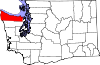
- National Register of Historic Places listings in Clallam County, Washington
-
List of National Registered Historic Places in Clallam County, Washington
- See also List of Registered Historic Places in Washington
-
- This National Park Service list is complete through NPS recent listings posted November 10, 2011.[1]
[2] Landmark name [3] Image Date listed Location City or town Summary 1 Aircraft Warning Service Observation Tower April 29, 1993 216 Spring Rd.
48°06′13″N 123°14′59″W / 48.103611°N 123.249722°WAgnew 2 Altair Campground Community Kitchen July 13, 2007 Approx. 4 mi. S of US 101
48°00′42″N 123°35′30″W / 48.011667°N 123.591667°WPort Angeles 3 Beaver School November 19, 1992 US 101 N, W side
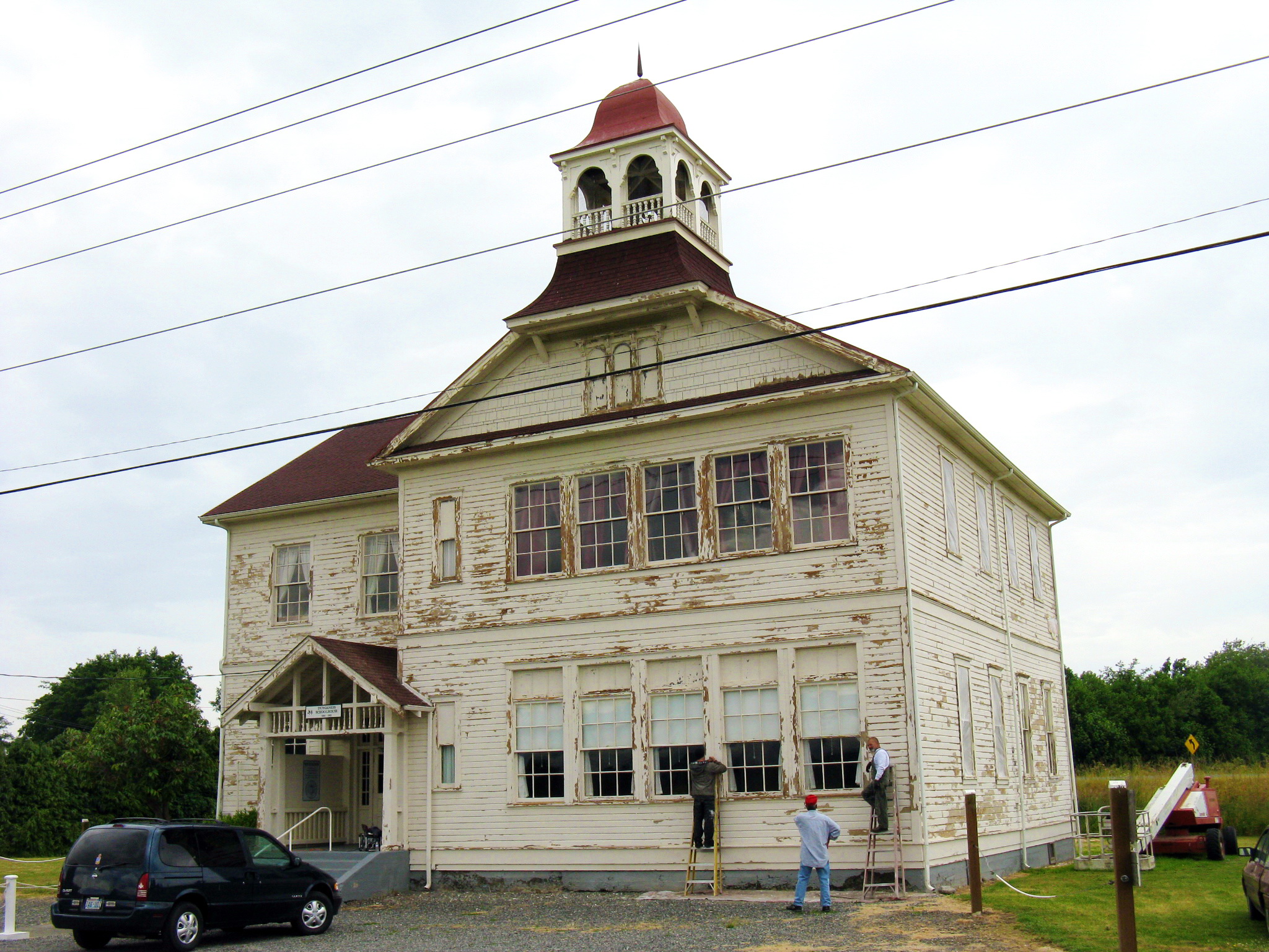
48°03′50″N 124°18′38″W / 48.063889°N 124.310556°WBeaver Rural Public Schools of Washington State MPS 4 Blue Mountain School November 5, 1987 Blue Mountain Rd.
48°03′02″N 123°16′21″W / 48.050556°N 123.2725°WPort Angeles Rural Public Schools of Washington State MPS 5 Canyon Creek Shelter 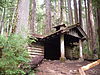
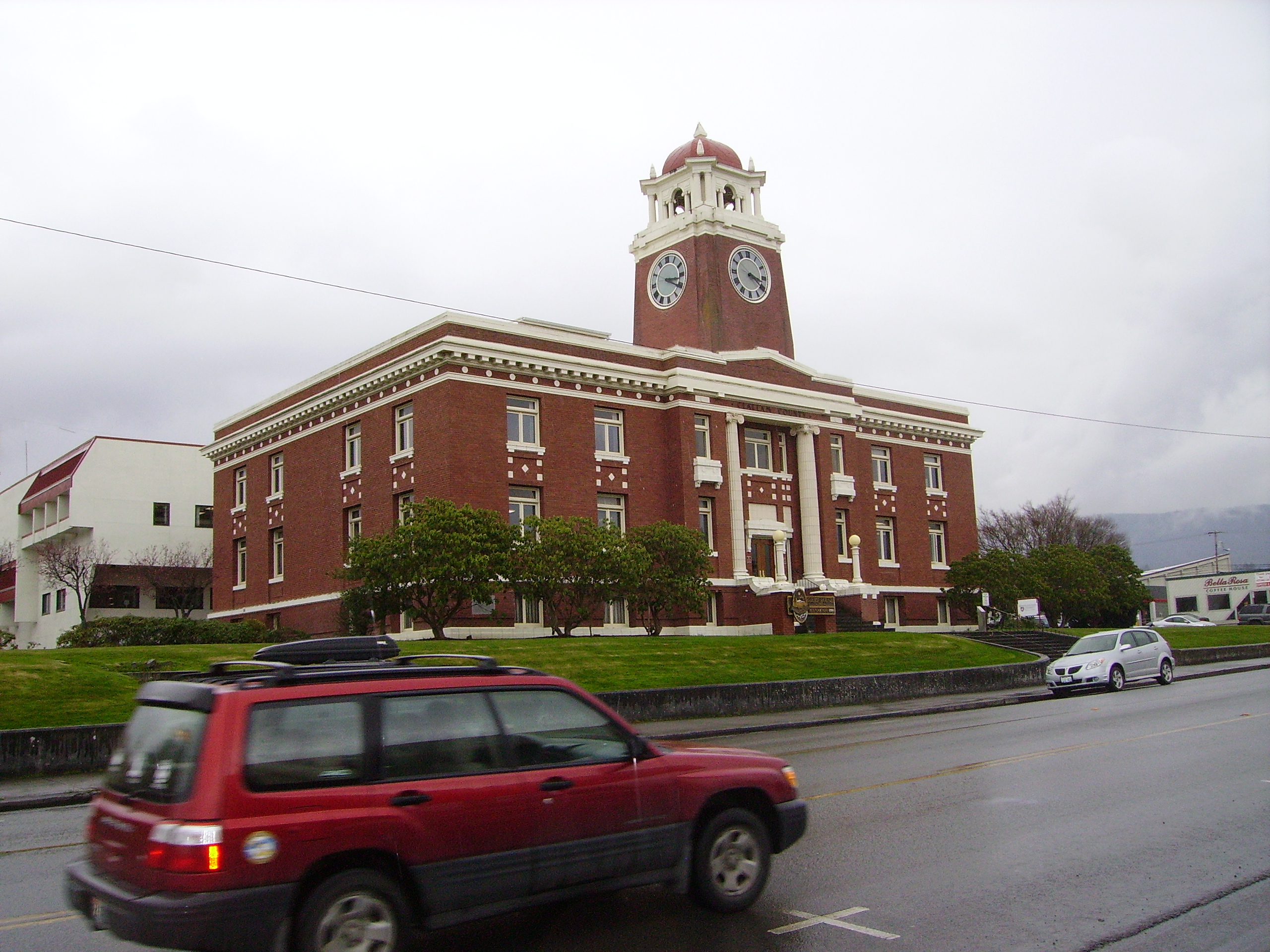
July 13, 2007 Approximately .9 miles north of the Upper Sol Duc River Trailhead Port Angeles 6 Clallam County Courthouse 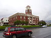
September 2, 1987 319 Lincoln St.
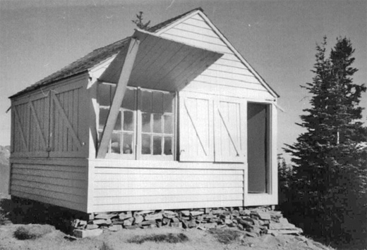
48°06′57″N 123°25′55″W / 48.115833°N 123.431944°WPort Angeles 7 Dodger Point Fire Lookout 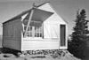
July 13, 2007 Approx. 13 mi. along Dodger Point Trail starting at the Whiskey Bend Trail
47°52′29″N 123°30′29″W / 47.874722°N 123.508056°WPort Angeles 8 Dungeness River Bridge July 16, 1982 Spans Dungeness River
48°05′08″N 123°08′46″W / 48.085556°N 123.146111°WSequim Historic Bridges and Tunnels in Washington TR 9 Dungeness School 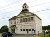
May 19, 1988 657 Towne Rd.
48°08′34″N 123°07′38″W / 48.142778°N 123.127222°WDungeness Rural Public Schools of Washington State MPS 10 Eagle Ranger Station July 13, 2007 Approximately 11.6 miles south of WA 101 on Upper Sol Duc Rd.
47°58′19″N 123°51′52″W / 47.971944°N 123.864444°WPort Angeles 11 Elkhorn Guard Station July 13, 2007 Approximately 11.5 miles along Elwha River Trail from the Whiskey Bend Trailhead Port Angeles 12 Elwha Campground Community Kitchen July 13, 2007 3 miles south of U.S. Route 101 in Washington
48°01′39″N 123°35′13″W / 48.0275°N 123.586944°WPort Angeles 13 Elwha Ranger Station 
July 13, 2007 Approximately 3 miles southeast of WA 101 on the Olympic Hot Springs Rd.
48°01′00″N 123°35′27″W / 48.016667°N 123.590833°WPort Angeles 14 Elwha River Bridge July 16, 1982 Old Hwy. 112
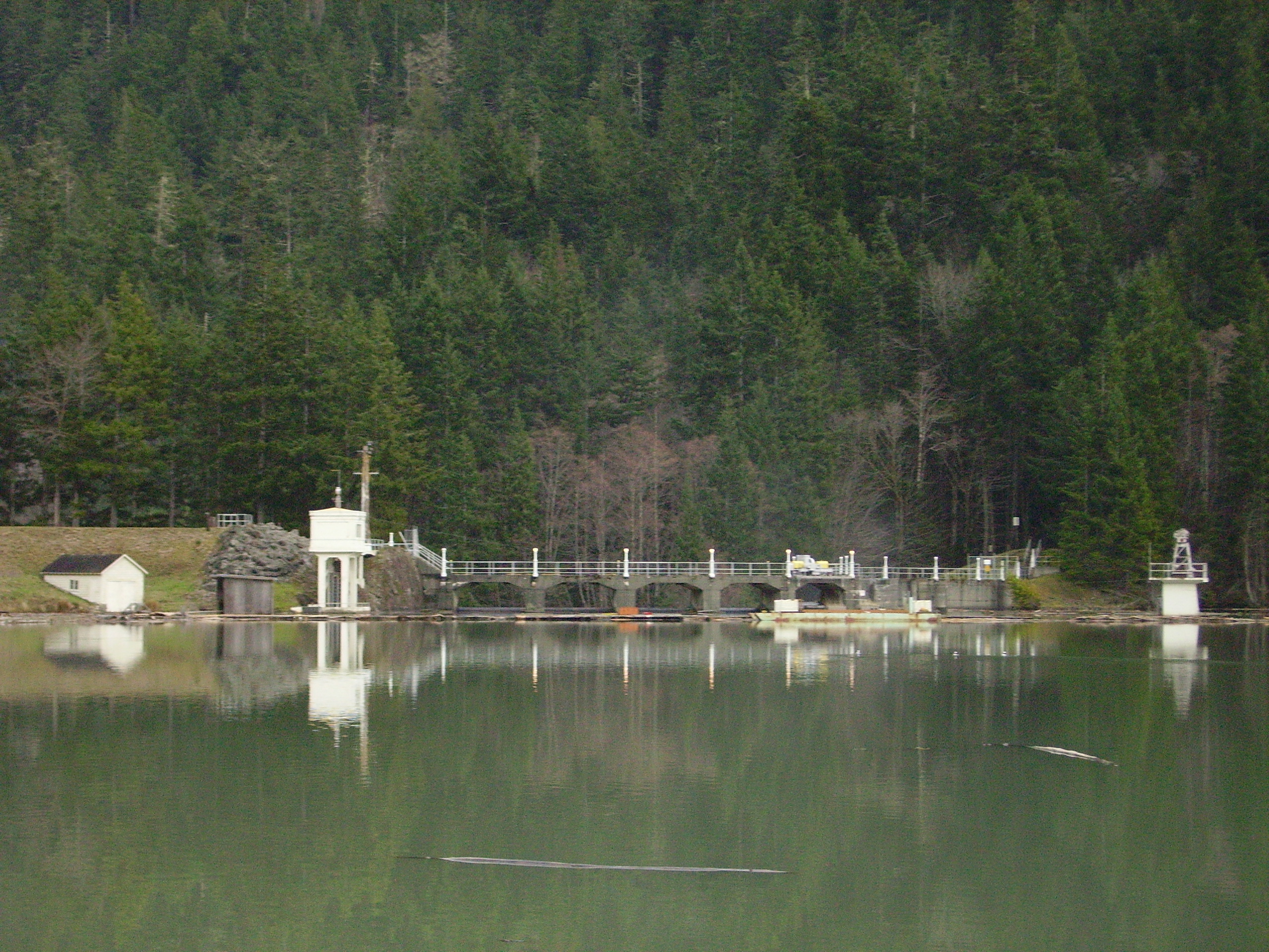
48°06′04″N 123°33′23″W / 48.101111°N 123.556389°WElwha Historic Bridges and Tunnels in Washington TR 15 Elwha River Hydroelectric Power Plant 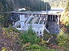
December 15, 1988 N end of Lake Aldwell
48°05′42″N 123°33′18″W / 48.095°N 123.555°WPort Angeles 16 Emery Farmstead December 16, 1988 Emery Rd.
48°04′12″N 123°15′41″W / 48.07°N 123.261389°WPort Angeles 17 Fifteen Mile Shelter July 13, 2007 Approx. 12.4 mi. from park boundary on N Fork Bogachiel R Trail
47°54′10″N 124°01′14″W / 47.902778°N 124.020556°WPort Angeles 18 Glines Canyon Hydroelectric Power Plant 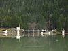
December 15, 1988 N end of Lake Mills at Elwha River
48°00′11″N 123°35′54″W / 48.003056°N 123.598333°WPort Angeles 19 Hoko River Archeological Site 
March 21, 1978 Address Restricted Pysht 20 Hoko River Rockshelter Archeological Site March 27, 1980 Address Restricted Sekiu 21 Humes Ranch Cabin 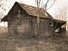
September 14, 1977 S of Port Angeles on Elwha River
47°56′53″N 123°32′39″W / 47.948056°N 123.544167°WPort Angeles 22 Hyak Shelter July 13, 2007 Approx. 15.4 mi. from park boundary on N Fork Bogachiel River Trail
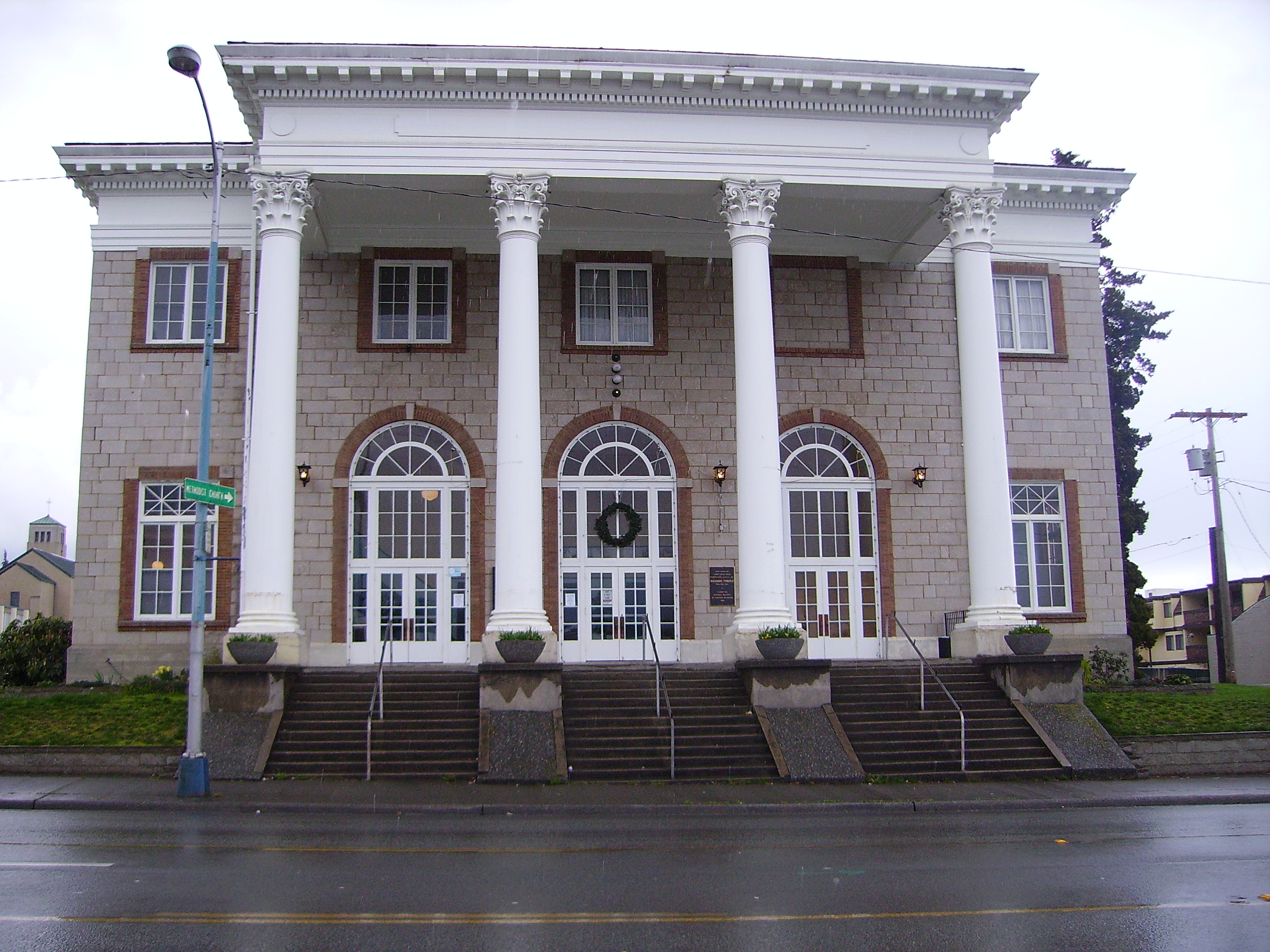
47°55′27″N 123°58′14″W / 47.924167°N 123.970556°WPort Angeles 23 John A. Hyer Farm July 29, 1994 Address Restricted Sequim 24 Manis Mastodon Site March 21, 1978 Address Restricted Sequim 25 Masonic Temple 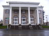
May 11, 1989 622 S. Lincoln St.
48°06′48″N 123°26′08″W / 48.113333°N 123.435556°WPort Angeles 26 McAlmond House August 9, 1976 N of Sequim on Dungeness Bay
48°09′03″N 123°08′05″W / 48.150833°N 123.134722°WSequim 27 Michael's Cabin July 13, 2007 Along Elwha River Trail; approx 2 mi. from Whiskey Bend Trailhead
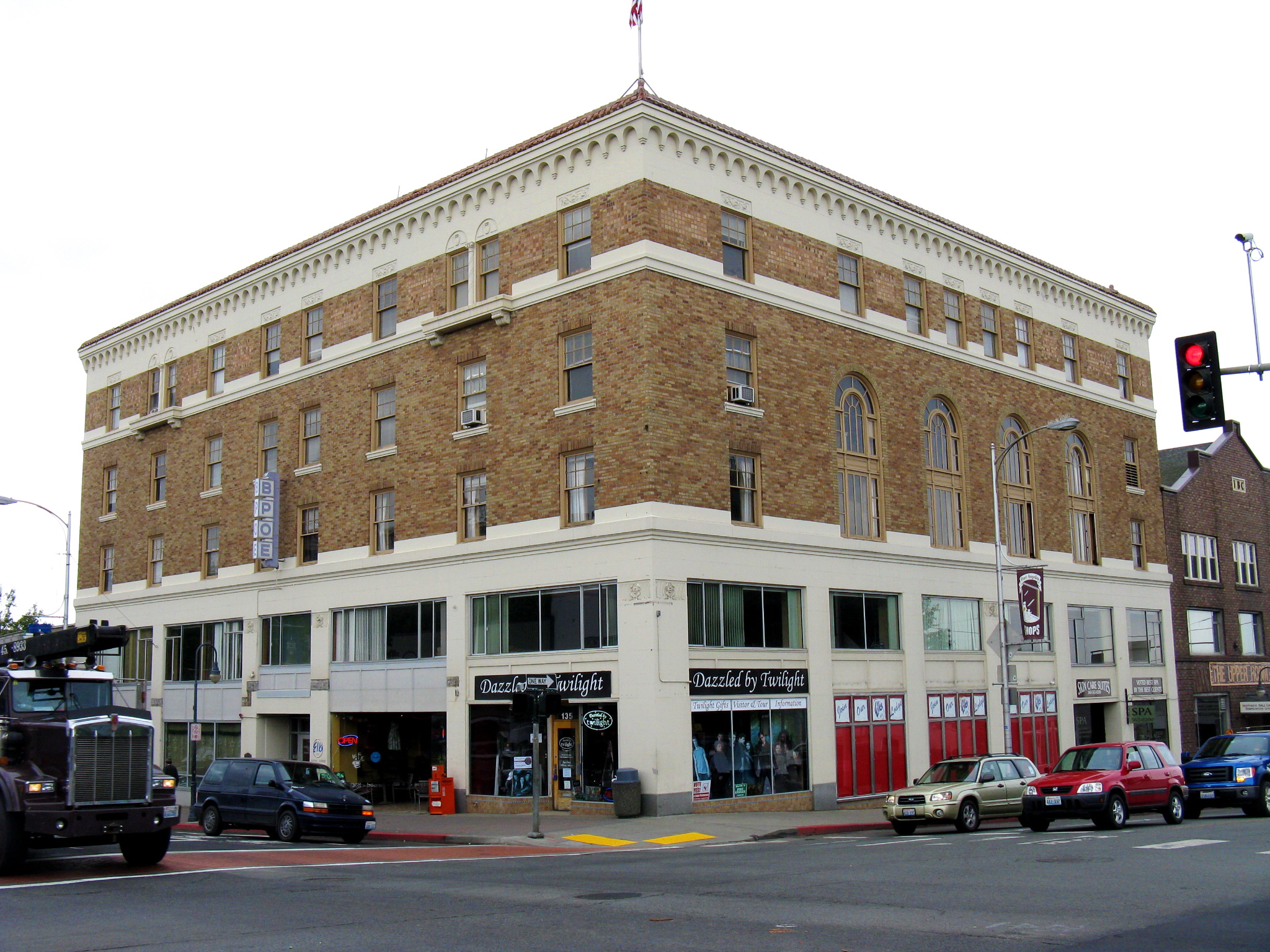
47°57′12″N 123°33′11″W / 47.953333°N 123.553056°WPort Angeles 28 Naval Lodge Elks Building 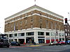
May 2, 1986 131 E. First St.
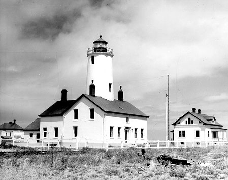
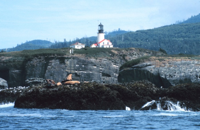
48°07′07″N 123°25′51″W / 48.118611°N 123.430833°WPort Angeles 29 New Dungeness Light Station 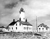
November 30, 1993 Dungeness Spit
48°10′56″N 123°06′17″W / 48.182222°N 123.104722°WSequim 30 North Fork Sol Duc Shelter July 13, 2007 Approx. 9.5 mi. from North Fork Sol Duc Trailhead
47°59′56″N 123°45′42″W / 47.998889°N 123.761667°WPort Angeles 31 Olympic National Park Headquarters Historic District July 13, 2007 600 E. Park Ave.
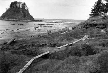
48°06′03″N 123°25′58″W / 48.100833°N 123.432778°WPort Angeles 32 Ozette Indian Village Archeological Site 
January 11, 1974 Address Restricted La Push 33 Joseph Paris House November 5, 1987 101 E. Fifth St.
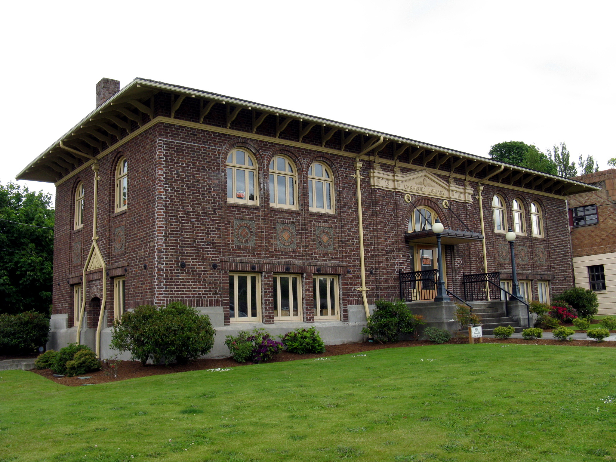
48°06′57″N 123°26′06″W / 48.115833°N 123.435°WPort Angeles 34 Port Angeles Civic Historic District 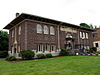
May 4, 2011 205, 215, 217 & 319 S. Lincoln St.
48°07′01″N 123°25′58″W / 48.116944°N 123.432778°WPort Angeles Includes former Carnegie Library (1918), City Building (1930) and former Clallam County Courthouse, which is individually listed on the register. 35 Pyramid Peak Aircraft Warning Service Lookout 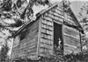
July 13, 2007 3.5 miles up Pyramid Pk.trail at end of Camp David Jr. Rd.
48°04′30″N 123°48′44″W / 48.075°N 123.812222°WPort Angeles 36 Peter Roose Homestead July 13, 2007 Along Indian Village Trail; approximately 1.5 miles north of trailhead
48°9′42″N 124°42′24″W / 48.16167°N 124.70667°W[4]Port Angeles 37 Rosemary Inn 
July 17, 1979 SW of Port Angeles on Barnes Point
48°03′36″N 123°47′33″W / 48.06°N 123.7925°WPort Angeles 38 Sekiu School May 1, 1991 Rice St.
48°15′47″N 124°18′02″W / 48.263056°N 124.300556°WSekiu Rural Public Schools of Washington State MPS 39 Sequim Opera House 
May 28, 1991 119 N. Sequim Ave.
48°04′49″N 123°06′04″W / 48.080278°N 123.101111°WSequim 40 Singer's Lake Crescent Tavern 
July 13, 2007 Barnes Point, south shore of Lake Crescent, WA 101
48°03′25″N 123°48′00″W / 48.056944°N 123.8°WPort Angeles 41 St. Andrew's Episcopal Church 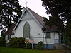
November 5, 1987 206 S. Peabody St.
48°06′58″N 123°25′41″W / 48.116111°N 123.428056°WPort Angeles 42 Storm King Ranger Station 
July 13, 2007 Barnes Pt., S side of Lake Crescent off US 101
48°03′29″N 123°47′14″W / 48.058056°N 123.787222°WPort Angeles 43 Tatoosh Island 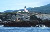
March 16, 1972 NW of Cape Flattery
48°23′31″N 124°44′01″W / 48.391944°N 124.733611°WOlympic Peninsula 44 Three Forks Shelter July 13, 2007 Approx. 4.5 mi. from the Three Fords Trailhead at Deer Park Campground
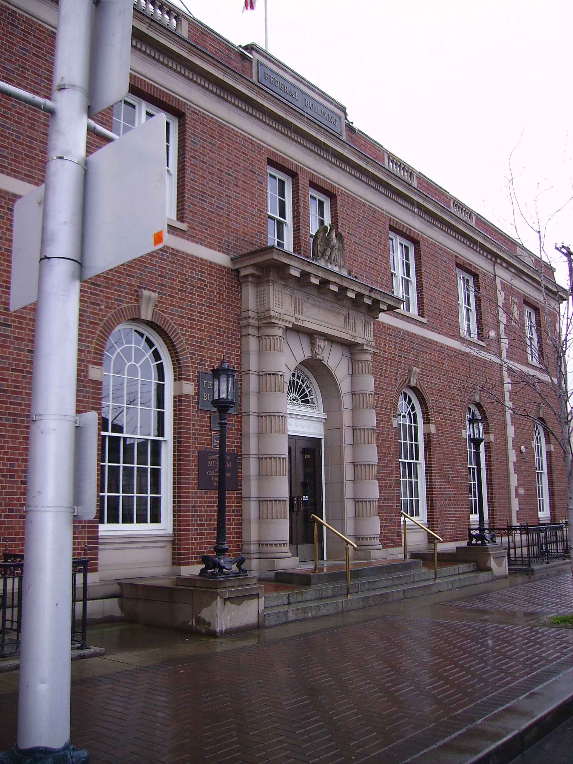
47°54′56″N 123°14′44″W / 47.915556°N 123.245556°WPort Angeles 45 U.S. Post Office 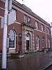
September 1, 1983 W. 1st and Oak Sts.
48°07′10″N 123°26′02″W / 48.119444°N 123.433889°WPort Angeles 46 US Quarantine Station Surgeon's Residence May 11, 1989 101 Discovery Way, Diamond Point
48°05′40″N 122°55′10″W / 48.094444°N 122.919444°WSequim 47 Wedding Rock Petroglyphs 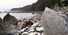
April 3, 1976 Address Restricted Forks 48 Wendel Property July 13, 2007 5 miles north on East Shore Rd.
48°05′42″N 123°47′59″W / 48.095°N 123.799722°WPort Angeles See also
References
- ^ "National Register of Historic Places: Weekly List Actions". National Park Service, United States Department of the Interior. Retrieved on November 10, 2011.
- ^ Numbers represent an ordering by significant words. Various colorings, defined here, differentiate National Historic Landmark sites and National Register of Historic Places Districts from other NRHP buildings, structures, sites or objects.
- ^ "National Register Information System". National Register of Historic Places. National Park Service. . http://nrhp.focus.nps.gov/natreg/docs/All_Data.html.
- ^ Geocode coordinates derived from The Ozette Prairies of Olympic National Park: Their Former Indigenous Uses and Management.
U.S. National Register of Historic Places Topics Lists by states Alabama • Alaska • Arizona • Arkansas • California • Colorado • Connecticut • Delaware • Florida • Georgia • Hawaii • Idaho • Illinois • Indiana • Iowa • Kansas • Kentucky • Louisiana • Maine • Maryland • Massachusetts • Michigan • Minnesota • Mississippi • Missouri • Montana • Nebraska • Nevada • New Hampshire • New Jersey • New Mexico • New York • North Carolina • North Dakota • Ohio • Oklahoma • Oregon • Pennsylvania • Rhode Island • South Carolina • South Dakota • Tennessee • Texas • Utah • Vermont • Virginia • Washington • West Virginia • Wisconsin • WyomingLists by territories Lists by associated states Other  Category:National Register of Historic Places •
  Portal:National Register of Historic Places
Municipalities and communities of Clallam County, Washington County seat: Port Angeles Cities Forks | Port Angeles | Sequim
CDPs Bell Hill | Blyn | Carlsborg | Neah Bay | Port Angeles East | River Road
Unincorporated
communitiesAgnew | Beaver | Clallam Bay | Diamond Point | Dungeness | Elwha | Fairholm | Joyce | La Push | Ozette | Piedmont | Sappho | Schoolhouse Point | Sekiu
Indian reservations Lower Elwah Reservation | Makah Reservation
Categories:- National Register of Historic Places in Washington (state) by county
- Clallam County, Washington
- History of Clallam County, Washington


Wikimedia Foundation. 2010.