- Ozette, Washington
-
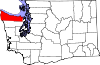
Ozette — Unincorporated community — Location within the state of Washington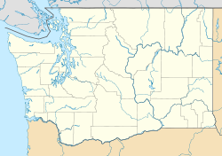
 Ozette
Coordinates: 48°09′17″N 124°40′02″W / 48.15472°N 124.66722°WCoordinates: 48°09′17″N 124°40′02″W / 48.15472°N 124.66722°W Country United States State Washington County Clallam Time zone Pacific (PST) (UTC-8) – Summer (DST) PDT (UTC-7) ZIP code: WA98326 FIPS code GNIS feature ID Ozette is an unincorporated community in Clallam County, Washington, United States. At 124 degrees, 40 minutes, 1 second West longitude, it is the westernmost populated area in the contiguous United States. The 22 mile long Hoko-Ozette Road, accessed via Washington State Route 112, terminates at the NPS Lake Ozette Ranger Station, within the coastal strip of Olympic National Park. The Lake Ozette Ranger Station, positioned at the north end of Ozette Lake, is approximately 3 miles from the Ozette Indian Village Archeological Site — an important archaeological site of the Makah people, located in the now unpopulated Ozette Indian Reservation. The land between the Pacific coast and the Ozette River was settled by a small community of Scandinavian immigrants at the end of the 19th Century; these being amongst the first Europeans to establish a permanent presence on the extreme western fringe of the Olympic Peninsula.
The area is popular with back-packers and day-hikers, many of whom undertake to complete the 9.5 mile long Ozette Loop trail; commencing/terminating at Lake Ozette Ranger Station and taking in the coastal locations of Sand Point and Cape Alava.
In 1997, a delegation from Mihama came to Ozette to commemorate the souls of three Japanese sailors whose ship ran aground in the area in 1834, and who were held briefly by the Makah before being released to Fort Vancouver.[1]
References
Municipalities and communities of Clallam County, Washington Cities Forks | Port Angeles | Sequim
CDPs Bell Hill | Blyn | Carlsborg | Neah Bay | Port Angeles East | River Road
Unincorporated
communitiesAgnew | Beaver | Clallam Bay | Diamond Point | Dungeness | Elwha | Fairholm | Joyce | La Push | Ozette | Piedmont | Sappho | Schoolhouse Point | Sekiu
Indian reservations Lower Elwah Reservation | Makah Reservation
Categories:- Unincorporated communities in Washington (state)
- Populated places in Clallam County, Washington
- Washington (state) geography stubs


Wikimedia Foundation. 2010.