- Port Angeles East, Washington
Infobox Settlement
official_name = Port Angeles East, Washington
settlement_type = CDP
nickname =
motto =
imagesize =
image_caption =
image_
imagesize =
image_caption =
image_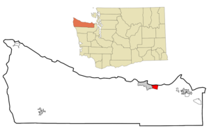
mapsize = 250px
map_caption = Location of Port Angeles East, Washington
mapsize1 =
map_caption1 =subdivision_type = Country
subdivision_name =United States
subdivision_type1 = State
subdivision_name1 =Washington
subdivision_type2 = County
subdivision_name2 = Clallamgovernment_footnotes =
government_type =
leader_title =
leader_name =
leader_title1 =
leader_name1 =
established_title =
established_date =unit_pref = Imperial
area_footnotes =area_magnitude =
area_total_km2 = 12.0
area_land_km2 = 9.8
area_water_km2 = 2.2
area_total_sq_mi = 4.6
area_land_sq_mi = 3.8
area_water_sq_mi = 0.8population_as_of = 2000
population_footnotes =
population_total = 3053
population_density_km2 = 310.2
population_density_sq_mi = 803.5timezone = Pacific (PST)
utc_offset = -8
timezone_DST = PDT
utc_offset_DST = -7
elevation_footnotes =
elevation_m =
elevation_ft =
latd = 48 |latm = 6 |lats = 16 |latNS = N
longd = 123 |longm = 22 |longs = 38 |longEW = Wpostal_code_type =
postal_code =
area_code =
blank_name = FIPS code
blank_info = 53-55400GR|2
blank1_name =
blank1_info =
website =
footnotes =Port Angeles East is a
census-designated place (CDP) inClallam County, Washington ,United States . The population was 3,053 at the 2000 census. This unincorporated urban growth area bordering the city of Port Angeles is known by locals as Gales Addition.Geography
Port Angeles East is located at coor dms|48|6|16|N|123|22|38|W|city (48.104420, -123.377296)GR|1.
According to the
United States Census Bureau , the CDP has a total area of 4.6square mile s (12.0km² ), of which, 3.8 square miles (9.8 km²) of it is land and 0.8 square miles (2.2 km²) of it (18.10%) is water.Demographics
As of the
census GR|2 of 2000, there were 3,053 people, 1,345 households, and 876 families residing in the CDP. Thepopulation density was 803.5 people per square mile (310.2/km²). There were 1,484 housing units at an average density of 390.6/sq mi (150.8/km²). The racial makeup of the CDP was 94.76% White, 0.26% African American, 1.97% Native American, 0.52% Asian, 0.16% Pacific Islander, 0.43% from other races, and 1.90% from two or more races. Hispanic or Latino of any race were 2.13% of the population.There were 1,345 households out of which 25.6% had children under the age of 18 living with them, 52.9% were married couples living together, 8.5% had a female householder with no husband present, and 34.8% were non-families. 28.6% of all households were made up of individuals and 12.9% had someone living alone who was 65 years of age or older. The average household size was 2.27 and the average family size was 2.77.
In the CDP the population was spread out with 21.5% under the age of 18, 6.5% from 18 to 24, 23.8% from 25 to 44, 28.2% from 45 to 64, and 20.0% who were 65 years of age or older. The median age was 44 years. For every 100 females there were 99.9 males. For every 100 females age 18 and over, there were 95.4 males.
The median income for a household in the CDP was $34,730, and the median income for a family was $43,333. Males had a median income of $32,292 versus $25,758 for females. The
per capita income for the CDP was $19,108. About 11.8% of families and 16.0% of the population were below thepoverty line , including 21.3% of those under age 18 and 11.4% of those age 65 or over.References
External links
Wikimedia Foundation. 2010.