- National Register of Historic Places listings in Olympic National Park
-
This is a list of the National Register of Historic Places listings in Olympic National Park.
This is intended to be a complete list of the properties and districts on the National Register of Historic Places in Olympic National Park, Washington, United States. The locations of National Register properties and districts for which the latitude and longitude coordinates are included below, may be seen in a Google map.[1]
There are 28 properties and districts listed on the National Register in the park.
-
- This National Park Service list is complete through NPS recent listings posted November 10, 2011.[2]
Current listings
[3] Landmark name[4] Image Date listed Location City or Town Summary 1 Altair Campground Community Kitchen July 13, 2007 Approx. 4 mi. S of US 101
48°0′42″N 123°35′30″W / 48.01167°N 123.59167°WPort Angeles Campground central kitchen built by the Civilian Conservation Corps 2 Botten Cabin 
July 13, 2007 20.9 mi. from Whiskey Bend Trailhead on the Elwha River Trail
47°45′50″N 123°27′16″W / 47.76389°N 123.45444°WPort Angeles 3 Canyon Creek Shelter 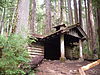
July 13, 2007 Approx. .9 mi. N of the Upper Sol Duc River Trailhead
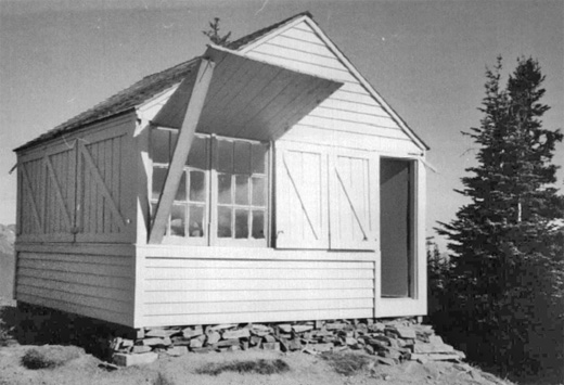
47°3′9″N 123°48′17″W / 47.0525°N 123.80472°WPort Angeles Rustic trail shelter 4 Coastie Head Cabin July 13, 2007 Approx. 2.4 miles south of Norwegian Memorial Port Angeles 5 Dodger Point Fire Lookout 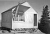
July 13, 2007 Approx. 13 mi. along Dodger Point Trail starting at the Whiskey Bend Trail
47°52′29″N 123°30′29″W / 47.87472°N 123.50806°WPort Angeles 6 Eagle Ranger Station July 13, 2007 Approx. 11.6 mi. S of WA 101 on Upper Sol Duc Rd. Port Angeles 7 Elkhorn Guard Station July 13, 2007 Apprx. 11.5 mi. along Elwha River Trail from the Whiskey Bend Trailhead Port Angeles 8 Elk Lick Lodge July 13, 2007 13 mi. from Whiskey Bend Trailhead on the Elwha River Trail
47°51′26″N 123°28′9″W / 47.85722°N 123.46917°WPort Angeles 9 Elwha Campground Community Kitchen July 13, 2007 3 mi S of US 101
48°1′39″N 123°35′13″W / 48.0275°N 123.58694°WPort Angeles Campground kitchen built by the Civilian Conservation Corps 10 Elwha Ranger Station 
July 13, 2007 Approx. 3 mi. SE of WA 101 on the Olympic Hot Springs Rd. Port Angeles 11 Enchanted Valley Chalet 
July 13, 2007 13 mi. upriver from Graves Cr. Trailhead
47°40′31″N 123°23′21″W / 47.67528°N 123.38917°WPort Angeles Backcountry concessioner lodge, now threatened by deterioration and shifting river channels 12 Fifteen Mile Shelter July 13, 2007 Approx. 12.4 mi. from park boundary on N Fork Bogachiel R Trail
47°54′10″N 124°1′14″W / 47.90278°N 124.02056°WPort Angeles 13 Graves Creek Ranger Station 
July 13, 2007 Approx. 22 mi. NE of WA 101 on Quinault River Rd. Port Angeles 13 Happy Four Shelter July 13, 2007 Approx. 5.4 along Hoh River Trail
47°52′6″N 123°49′41″W / 47.86833°N 123.82806°WPort Angeles 14 Hayes River Fire Cache July 13, 2007 Approx. 16.8 mi. up the Elwha River Trail
47°48′34″N 123°27′9″W / 47.80944°N 123.4525°WPort Angeles 15 Humes Ranch Cabin 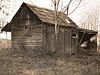
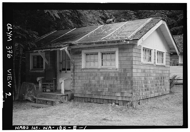
September 14, 1977 S of Port Angeles on Elwha River
47°56′53″N 123°32′39″W / 47.94806°N 123.54417°WPort Angeles 16 Hyak Shelter July 13, 2007 Approx. 15.4 mi. from park boundary on N Fork Bogachiel River Trail
47°55′27″N 123°58′14″W / 47.92417°N 123.97056°WPort Angeles 17 Kestner Homestead July 13, 2007 Quinalt River Valley, .5 mi. N of Quinalt River Ranger Station, along west side of Kestner Creek, Quinalt sub-distr Port Angeles 18 North Fork Quinault Ranger Station July 13, 2007 Approx. 18 mi. NE of WA 101 on N. Fork Rd. off N. Shore Quinault Rd. Port Angeles 19 North Fork Sol Duc Shelter July 13, 2007 Approx. 9.5 mi. from North Fork Sol Duc Trailhead
47°59′56″N 123°45′42″W / 47.99889°N 123.76167°WPort Angeles Rustic trail shelter 20 Olympic National Park Headquarters Historic District July 13, 2007 600 E. Park Ave. Port Angeles 21 Olympus Guard Station November 5, 2007 Approx. 9 mi. from Hoh River Trailhead at Hoh Ranger Station Port Angeles 22 Pyramid Peak Aircraft Warning Service Lookout 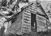
July 13, 2007 3.5 miles up Pyramid Pk.trail at end of Camp David Jr. Rd.
48°4′30″N 123°48′44″W / 48.075°N 123.81222°WPort Angeles Purpose-built station for early warning of airborne intruders during World War II 23 Peter Roose Homestead July 13, 2007 Along Indian Village Trail;approx. 1.5 mi. N of trailhead Port Angeles 24 Rosemary Inn 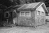
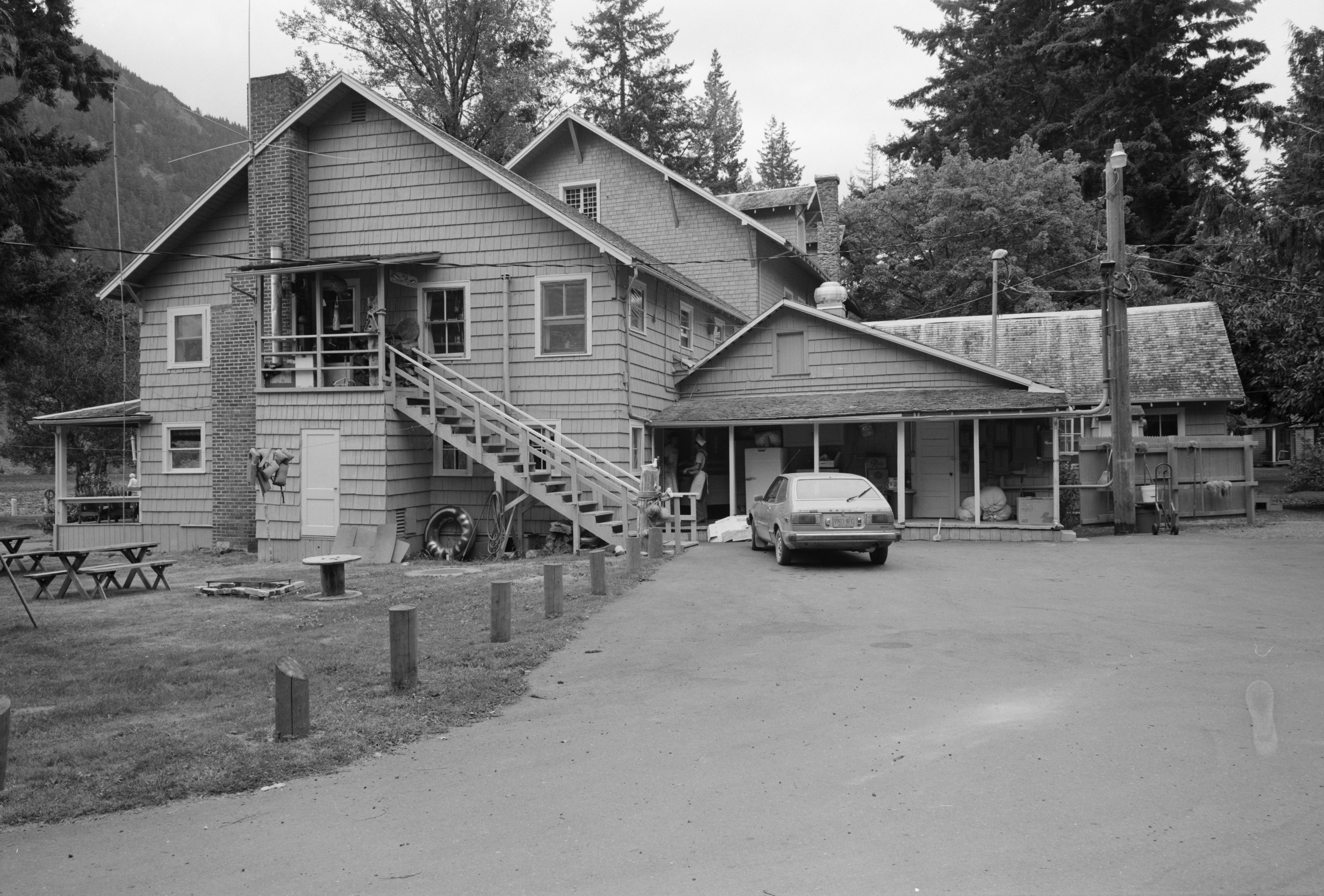
July 17, 1979 SW of Port Angeles on Barnes Point
48°3′36″N 123°47′33″W / 48.06°N 123.7925°WPort Angeles 25 Singer's Lake Crescent Tavern 
July 13, 2007 Barnes Point, S. Shore of Lake Crescent, WA 101 Port Angeles 26 Storm King Ranger Station 
July 13, 2007 Barnes Pt., S side of Lake Crescent off US 101
48°3′29″N 123°47′14″W / 48.05806°N 123.78722°WPort Angeles 27 Three Forks Shelter July 13, 2007 Approx. 4.5 mi. from the Three Fords Trailhead at Deer Park Campground
47°54′56″N 123°14′44″W / 47.91556°N 123.24556°WPort Angeles 28 Wendel Property July 13, 2007 5 mi. N on East Shore Rd.
48°5′42″N 123°47′59″W / 48.095°N 123.79972°WPort Angeles See also
- National Register of Historic Places listings in Clallam County, Washington
- National Register of Historic Places listings in Jefferson County, Washington
- National Register of Historic Places listings in Washington
References
- Evans, Gail E.H.; Toothman, Stephanie; Luxenberg, Gretchen; Wray, Jacilee. National Register of Historic Places Multiple Property Documentation Form:Historic Resources of Olympic National Park. National Park Service 1986, 1998, 2005
- ^ The latitude and longitude information provided in this table was derived originally from the National Register Information System, which has been found to be fairly accurate for about 99% of listings. For about 1% of NRIS original coordinates, experience has shown that one or both coordinates are typos or otherwise extremely far off; some corrections may have been made. A more subtle problem causes many locations to be off by up to 150 yards, depending on location in the country: most NRIS coordinates were derived from tracing out latitude and longitudes off of USGS topographical quadrant maps created under the North American Datum of 1927, which differs from the current, highly accurate WGS84 GPS system used by Google maps. Chicago is about right, but NRIS longitudes in Washington are higher by about 4.5 seconds, and are lower by about 2.0 seconds in Maine. Latitudes differ by about 1.0 second in Florida. Some locations in this table may have been corrected to current GPS standards.
- ^ "National Register of Historic Places: Weekly List Actions". National Park Service, United States Department of the Interior. Retrieved on November 10, 2011.
- ^ Numbers represent an ordering by significant words. Various colorings, defined here, differentiate National Historic Landmark sites and National Register of Historic Places Districts from other NRHP buildings, structures, sites or objects.
- ^ "National Register Information System". National Register of Historic Places. National Park Service. 2008-04-24. http://nrhp.focus.nps.gov/natreg/docs/All_Data.html.
National Register of Historic Places in Olympic National Park Historic districts Eagle Ranger Station | Elkhorn Guard Station | Graves Creek Ranger Station | Kestner Homestead | North Fork Quinault Ranger Station | Olympic National Park Headquarters Historic District | Olympus Guard Station | Peter Roose Homestead | Singer's Lake Crescent Tavern
Properties Altair Campground Community Kitchen | Botten Cabin | Canyon Creek Shelter | Coastie Head Cabin | Dodger Point Fire Lookout | Elk Lick Lodge | Elwha Campground Community Kitchen | Enchanted Valley Chalet | Fifteen Mile Shelter | Happy Four Shelter | Hayes River Fire Cache | Humes Ranch Cabin | Hyak Shelter | North Fork Sol Duc Shelter | Pyramid Peak Aircraft Warning Service Lookout | Rosemary Inn | Storm King Ranger Station | Three Forks Shelter | Wendel Property
See also: National Register of Historic Places listings in Olympic National ParkU.S. National Register of Historic Places Topics Lists by states Alabama • Alaska • Arizona • Arkansas • California • Colorado • Connecticut • Delaware • Florida • Georgia • Hawaii • Idaho • Illinois • Indiana • Iowa • Kansas • Kentucky • Louisiana • Maine • Maryland • Massachusetts • Michigan • Minnesota • Mississippi • Missouri • Montana • Nebraska • Nevada • New Hampshire • New Jersey • New Mexico • New York • North Carolina • North Dakota • Ohio • Oklahoma • Oregon • Pennsylvania • Rhode Island • South Carolina • South Dakota • Tennessee • Texas • Utah • Vermont • Virginia • Washington • West Virginia • Wisconsin • WyomingLists by territories Lists by associated states Other Categories:- Buildings and structures in Olympic National Park
- National Register of Historic Places lists in the National Park Service
-


Wikimedia Foundation. 2010.