- May Creek, Washington
-
This article is about the census-designated place of May Creek in Washington. For the creek in British Columbia, see May Creek, British Columbia.
May Creek, Washington — CDP — Location of May Creek, Washington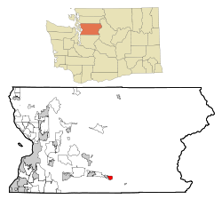
Coordinates: 47°51′15″N 121°40′19″W / 47.85417°N 121.67194°WCoordinates: 47°51′15″N 121°40′19″W / 47.85417°N 121.67194°W Country United States State Washington County Snohomish Area - Total 1.7 sq mi (4.4 km2) - Land 1.7 sq mi (4.4 km2) - Water 0.0 sq mi (0.0 km2) Elevation 256 ft (78 m) Population (2010) - Total 818 - Density 586.4/sq mi (226.4/km2) Time zone Pacific (PST) (UTC-8) - Summer (DST) PDT (UTC-7) FIPS code 53-44260[1] GNIS feature ID 1852950[2] May Creek is a census-designated place (CDP) in Snohomish County, Washington, United States. The population was 818 at the 2010 census.
Geography
May Creek is located at 47°51′15″N 121°40′19″W / 47.85417°N 121.67194°W (47.854245, -121.671851).[3]
According to the United States Census Bureau, the CDP has a total area of 1.7 square miles (4.4 km²), all of it land.
Demographics
As of the census[1] of 2000, there were 1,004 people, 373 households, and 264 families residing in the CDP. The population density was 586.4 people per square mile (226.7/km²). There were 434 housing units at an average density of 253.5/sq mi (98.0/km²). The racial makeup of the CDP was 95.92% White, 1.00% Native American, 0.50% Asian, 1.00% from other races, and 1.59% from two or more races. Hispanic or Latino of any race were 3.49% of the population.
There were 373 households out of which 40.5% had children under the age of 18 living with them, 57.4% were married couples living together, 8.3% had a female householder with no husband present, and 29.2% were non-families. 22.5% of all households were made up of individuals and 5.6% had someone living alone who was 65 years of age or older. The average household size was 2.69 and the average family size was 3.14.
In the CDP the age distribution of the population shows 28.6% under the age of 18, 7.5% from 18 to 24, 36.3% from 25 to 44, 21.8% from 45 to 64, and 5.9% who were 65 years of age or older. The median age was 35 years. For every 100 females there were 107.0 males. For every 100 females age 18 and over, there were 106.0 males.
The median income for a household in the CDP was $46,310, and the median income for a family was $49,028. Males had a median income of $45,000 versus $30,521 for females. The per capita income for the CDP was $20,322. About 4.9% of families and 6.4% of the population were below the poverty line, including 11.3% of those under age 18 and 1.9% of those age 65 or over.
References
- ^ a b "American FactFinder". United States Census Bureau. http://factfinder.census.gov. Retrieved 2008-01-31.
- ^ "US Board on Geographic Names". United States Geological Survey. 2007-10-25. http://geonames.usgs.gov. Retrieved 2008-01-31.
- ^ "US Gazetteer files: 2010, 2000, and 1990". United States Census Bureau. 2011-02-12. http://www.census.gov/geo/www/gazetteer/gazette.html. Retrieved 2011-04-23.
Categories:- Populated places in Snohomish County, Washington
- Census-designated places in Washington (state)


Wikimedia Foundation. 2010.