- Decatur County, Tennessee
-
Decatur County, Tennessee 
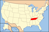
Location in the state of Tennessee
Tennessee's location in the U.S.Founded November 1845 Seat Decaturville Largest city Parsons Area
- Total
- Land
- Water
345 sq mi (893 km²)
334 sq mi (865 km²)
11 sq mi (29 km²), 3.19%Population
- (2010)
- Density
11,757
35/sq mi (14/km²)Time zone Central: UTC-6/-5 Decatur County is a county located in the U.S. state of Tennessee. As of 2010, the population is 11,757. Its county seat is Decaturville[1].
This county is named after naval hero Stephen Decatur, Jr., who gained national recognition in the Barbary Wars and the War of 1812 by his leadership and achievements at sea. The county was created in November 1845 from the part of Perry County west of the Tennessee River in response to a petition by citizens on the west side of the river who lacked easy access to the county seat, on the east side of the river.
Contents
Geography
According to the U.S. Census Bureau, the county has a total area of 345 square miles (893.5 km2), of which 334 square miles (865.1 km2) is land and 11 square miles (28.5 km2) (3.19%) is water.
Adjacent counties
- Benton County (north)
- Perry County (east)
- Wayne County (southeast)
- Hardin County (south)
- Henderson County (west)
- Carroll County (northwest)
National protected area
Demographics
As of the census[2] of 2000, there were 11,731 people, 4,908 households, and 3,415 families residing in the county. The population density was 35 people per square mile (14/km²).
There were 6,448 housing units at an average density of 19 per square mile (7/km²). The racial makeup of the county was 94.12% White, 3.47% Black or African American, 0.23% Native American, 0.20% Asian, 0.03% Pacific Islander, 1.20% from other races, and 0.76% from two or more races. 1.95% of the population were Hispanic or Latino of any race.
There were 4,908 households out of which 27.30% had children under the age of 18 living with them, 56.70% were married couples living together, 9.00% had a female householder with no husband present, and 30.40% were non-families. 27.60% of all households were made up of individuals and 13.40% had someone living alone who was 65 years of age or older. The average household size was 2.34 and the average family size was 2.82.
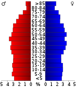
In the county, the population was spread out with 21.70% under the age of 18, 7.90% from 18 to 24, 25.90% from 25 to 44, 26.30% from 45 to 64, and 18.20% who were 65 years of age or older. The median age was 41 years. For every 100 females there were 94.50 males. For every 100 females age 18 and over, there were 91.90 males.
The median income for a household in the county was $28,741, and the median income for a family was $34,919. Males had a median income of $25,945 versus $20,155 for females. The per capita income for the county was $17,285. About 13.80% of families and 16.00% of the population were below the poverty line, including 18.90% of those under age 18 and 22.20% of those age 65 or over.
Cities and towns
See also
References
- ^ "Find a County". National Association of Counties. http://www.naco.org/Counties/Pages/FindACounty.aspx. Retrieved 2011-06-07.
- ^ "American FactFinder". United States Census Bureau. http://factfinder.census.gov. Retrieved 2008-01-31.
- ^ Based on 2000 census data
External links

Carroll County Benton County 
Henderson County 
Perry County  Decatur County, Tennessee

Hardin County Wayne County Municipalities and communities of Decatur County, Tennessee City Towns Unincorporated
communitiesBath Springs | Bible Hill | Lick Skillet
Footnotes ‡This populated place also has portions in an adjacent county or counties
Categories:- Tennessee counties
- Decatur County, Tennessee
- 1845 establishments in the United States
Wikimedia Foundation. 2010.

