- Montgomery County, Tennessee
-
Montgomery County, Tennessee 

Seal
Location in the state of Tennessee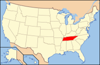
Tennessee's location in the U.S.Founded December 15, 1818 Named for John Montgomery, founder of Clarksville, TN. Seat Clarksville Area
- Total
- Land
- Water
544 sq mi (1,409 km²)
539 sq mi (1,396 km²)
5 sq mi (13 km²), 0.84%Population
- (2000)
- Density
134,768
249/sq mi (96/km²)Website www.montgomerycountytn.org Montgomery County is a county located in the U.S. state of Tennessee. The county seat is Clarksville[1]. The population was 172,331 at the 2010 census. It is one of the four counties included in the Clarksville, TN–KY Metropolitan Statistical Area.
Contents
History
The county was named for John Montgomery, a settler who founded the city of Clarksville, Tennessee, in Montgomery County. The county was initially organized as Tennessee County, North Carolina, but its name was changed in 1796, the year that Tennessee was admitted as a state, to reduce confusion. In the same year, much of the eastern portion of the county was removed from its jurisdiction and incorporated with territory taken from Sumner County to form Robertson County. Subsequent acts of the Tennessee General Assembly further reduced the area of the county; it obtained its current size and boundaries in 1871.[2]
Montgomery County was the site of several saltpeter mines. Saltpeter is the main ingredient of gunpowder and was obtained by leaching the earth from several local caves. Bellamy Cave, located near Stringtown, contains the remains of two dozen saltpeter leaching vats and was apparently a large operation. Cooper Creek Cave also shows evidence of extensive mining and contains the remains of "many saltpeter hoppers" (Barr, 1961). Dunbar Cave is also reported to have been mined for saltpeter during the Mexican War, but commercial development has erased any evidence of this mining. In all likelihood, Bellamy Cave and Cooper Creek Cave were mined during the War of 1812. Little mining in this area is likely to have occurred duing the Civil War, because this part of Tennessee fell under Federal control very early in the war. (Larry E. Matthews, "Dunbar Cave: The Showplace of the South", 2011, ISBN 978-1-879961-41-8, 240 pages.)
Geography
According to the U.S. Census Bureau, the county has a total area of 544 square miles (1,410 km2), of which 539 square miles (1,400 km2) is land and 5 square miles (13 km2) (0.84%) is water.
Montgomery County lies in a region of well-developed karst topography and has a cave system named Dunbar Cave. Dunbar Cave is the centerpiece of Dunbar State Park, which encompasses approximately 110 acres and is one of the most visited units in the Tennessee State Park System.
Dunbar Cave
Dunbar Cave was explored by prehistoric Indians. Remains of their cane torches have been found in the cave and archaeologists have excavated numerous artifacts inside the entrance. (Larry E. Matthews, "Dunbar Cave", 2005, ISBN 1-879961-22-9). During a research trip into the cave on January 15, 2005, Park Ranger Amy Wallace, History Professor Joe Douglas, local historian Billyfrank Morrison, and Geologist Larry E. Matthews, discovered Indian Glyphs on the walls of the cave. Subsequent investigations by archaeologists from the University of Tennessee at Knoxville confirmed that these drawings were left by Mississippian Era Indians. (Jan F. Simek, Joseph C. Douglas, and Amy Wallace, "Ancient Cave Art at Dunbar Cave State Natural Area", Tennessee Conservationist Magazine, September/October 2007, pages 24 – 26). These Indian Glyphs were featured on the tour of the cave. However, in 2009 the cave was closed due to the presence of White Nose Syndrome detected in one single bat. The above ground portion of the Park is still open to the public.
Adjacent counties
- Christian County, Kentucky (north)
- Todd County, Kentucky (northeast)
- Robertson County (east)
- Cheatham County (southeast)
- Dickson County (south)
- Houston County (southwest)
- Stewart County (west)
Government
Elected officials
- County Mayor: Carolyn P. Bowers
- Assessor of Property: Betty M. Burchett
- Trustee: Brenda E. Radford
- Sheriff: Norman E. Lewis
- Circuit Court Clerk: Cheryl J. Castle
- County Clerk: Kellie A. Jackson
- Register of Deeds: Connie W. Bell
- Highway Supervisor: Robert M. Frost
Appointed department heads
- Administration and Development: Phil Harpel
- Accounts & Budgets: Erinne J. Hester
- Human Resources: Sheryl R. Gossard
- Adult Probation: Sherry Robertson
- Ambulance Service (EMS): Jimmie Edwards
- Animal Control & Adoption: David Selby
- Archives & Preservation of Records: Jill Hastings-Johnson
- Bi-County Landfill & Solid Waste Management System: Pete Reed
- Building & Codes: Rod Streeter
- Building Maintenance: Clint Camp
- Clerk & Master of Chancery Court: Ted Crozier
- Community Corrections: Rex Cummings
- Court Safety Program: Lisa McClain
- Health Department: Andre Fresco
- Information Systems: Marcus Johnson
- Juvenile Court: Larry Ross
- Parks & Recreation: Jerry Allbert
- Projects & Facilities: Clint Camp
- Public Information Officer: Elizabeth Black
- Purchasing: Jane Davis
- Veterans Service Organization: Jerry Rivers
- Lieutenant of Patrol MCSO: John R. Smith
Demographics

As of the census[4] of 2000, there were 134,768 people, 48,330 households, and 35,957 families residing in the county. The population density was 250 people per square mile (96/km²). There were 52,167 housing units at an average density of 97 per square mile (37/km²). The racial makeup of the county was 73.17% White, 19.18% Black or African American, 0.53% Native American, 1.82% Asian, 0.21% Pacific Islander, 2.18% from other races, and 2.91% from two or more races. 5.16% of the population were Hispanic or Latino of any race.
There were 48,330 households out of which 40.70% had children under the age of 18 living with them, 58.70% were married couples living together, 12.20% had a female householder with no husband present, and 25.60% were non-families. 20.20% of all households were made up of individuals and 5.50% had someone living alone who was 65 years of age or older. The average household size was 2.70 and the average family size was 3.11.
In the county, the population was spread out with 28.40% under the age of 18, 12.30% from 18 to 24, 34.30% from 25 to 44, 17.20% from 45 to 64, and 7.80% who were 65 years of age or older. The median age was 30 years. For every 100 females there were 101.20 males. For every 100 females age 18 and over, there were 98.80 males.
The median income for a household in the county was $38,981, and the median income for a family was $43,023. Males had a median income of $30,696 versus $22,581 for females. The per capita income for the county was $17,265. About 7.90% of families and 10.00% of the population were below the poverty line, including 12.70% of those under age 18 and 10.70% of those age 65 or over.
Cities, towns, and unincorporated communities
- Clarksville
- Cunningham
- Dotsonville
- Excell
- Fredonia
- Needmore
- New Providence
- Oakwood
- Oakridge
- Orgains Crossroads
- Palmyra
- Port Royal
- Sango
- Southside
- Shiloh
- Rossview
- St. Bethlehem
- Sailors Rest
- Tarsus
- Woodlawn
See also
References
- ^ "Find a County". National Association of Counties. http://www.naco.org/Counties/Pages/FindACounty.aspx. Retrieved 2011-06-07.
- ^ Tennessee Blue Book, 2005-06 edition, p. 508-513
- ^ Based on 2000 census data
- ^ "American FactFinder". United States Census Bureau. http://factfinder.census.gov. Retrieved 2008-01-31.
External links

Christian County, Kentucky Todd County, Kentucky Stewart County 
Robertson County  Montgomery County, Tennessee

Houston County Dickson County Cheatham County Municipalities and communities of Montgomery County, Tennessee City 
Unincorporated
communitiesCunningham | Oakridge | Palmyra | Port Royal | Saint Bethlehem | Sango | Southaven | Southside | Woodlawn
Military base Categories:- Tennessee counties
- Montgomery County, Tennessee
- 1818 establishments in the United States
- Populated places established in 1818
- Clarksville metropolitan area


Wikimedia Foundation. 2010.