- Montgomery County, Kentucky
-
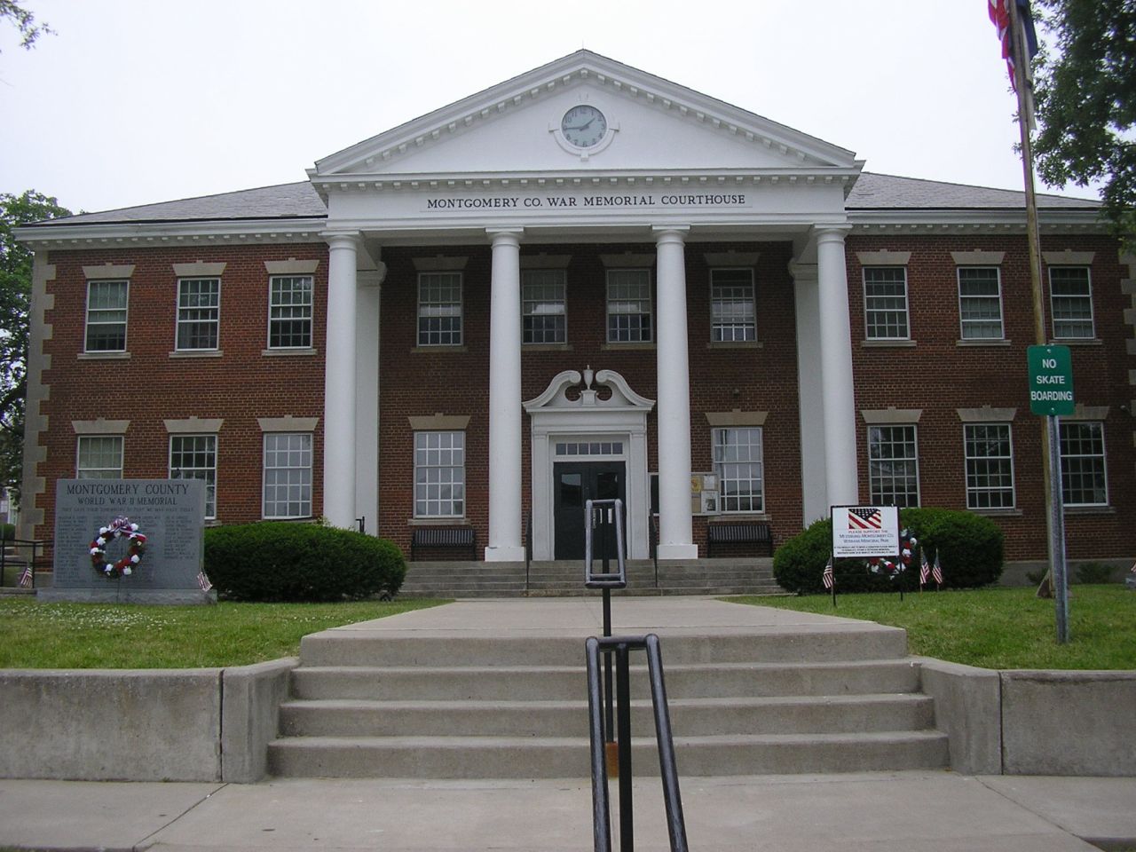
Montgomery County, Kentucky 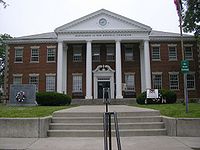 Montgomery County courthouse in Mount Sterling, Kentucky
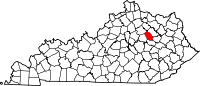
Location in the state of Kentucky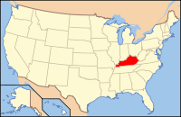
Kentucky's location in the U.S.Founded 1797 Named for Richard Montgomery (1736–1775), military general killed at the Battle of Quebec. Seat Mount Sterling Area
- Total
- Land
- Water
198.80 sq mi (515 km²)
198.59 sq mi (514 km²)
0.21 sq mi (1 km²), 0.11%Population
- (2010)
- Density
26,499
114/sq mi (44/km²)Time zone Eastern: UTC-5/-4 Website www.mtsterlingchamber.com Montgomery County is a county located in the U.S. state of Kentucky. The population was 26,499. Its county seat is Mount Sterling[1]. With regard to the sale of alcohol, it is classified as a moist county—a county in which alcohol sales are prohibited (a dry county), but containing a "wet" city where package alcohol sales are allowed, in this case Mount Sterling.[2]
Montgomery County is part of the Mount Sterling Micropolitan Statistical Area.
Contents
Geography
According to the 2000 census, the county has a total area of 198.80 square miles (514.9 km2), of which 198.59 square miles (514.3 km2) (or 99.89%) is land and 0.21 square miles (0.54 km2) (or 0.11%) is water.[3]
Adjacent counties
- Bourbon County (northwest)
- Bath County (northeast)
- Menifee County (southeast)
- Powell County (south)
- Clark County (west)
History
Montgomery County was named in honor of Richard Montgomery, an American Revolutionary War Brigadier General killed in 1775 while attempting to capture Quebec City, Canada. An alternative story holds that the County was named for Thomas Montgomery, from Virginia, who served in the Revolutionary War. In 1793 Thomas Montgomery settled in Mt. Sterling. In 1805, Thomas Montgomery moved on to Gibson County, Indiana.
Demographics
Historical populations Census Pop. %± 1800 7,082 — 1810 12,975 83.2% 1820 9,587 −26.1% 1830 10,240 6.8% 1840 9,332 −8.9% 1850 9,903 6.1% 1860 7,859 −20.6% 1870 7,557 −3.8% 1880 10,566 39.8% 1890 12,367 17.0% 1900 12,834 3.8% 1910 12,868 0.3% 1920 12,245 −4.8% 1930 11,660 −4.8% 1940 12,280 5.3% 1950 13,025 6.1% 1960 13,461 3.3% 1970 15,364 14.1% 1980 20,046 30.5% 1990 19,561 −2.4% 2000 22,554 15.3% 2010 26,499 17.5% http://ukcc.uky.edu/~census/21173.txt As of the census[4] of 2000, there were 22,554 people, 8,902 households, and 6,436 families residing in the county. The population density was 114 per square mile (44 /km2). There were 9,682 housing units at an average density of 49 per square mile (19 /km2). The racial makeup of the county was 95.07% White, 3.48% Black or African American, 0.15% Native American, 0.11% Asian, 0.03% Pacific Islander, 0.35% from other races, and 0.82% from two or more races. 1.15% of the population were Hispanic or Latino of any race.
There were 8,902 households out of which 33.60% had children under the age of 18 living with them, 57.70% were married couples living together, 11.20% had a female householder with no husband present, and 27.70% were non-families. 23.90% of all households were made up of individuals and 10.50% had someone living alone who was 65 years of age or older. The average household size was 2.49 and the average family size was 2.93.
The age distribution was 24.90% under the age of 18, 8.70% from 18 to 24, 30.20% from 25 to 44, 23.40% from 45 to 64, and 12.90% who were 65 years of age or older. The median age was 36 years. For every 100 females there were 94.60 males. For every 100 females age 18 and over, there were 91.00 males.
The median income for a household in the county was $31,746, and the median income for a family was $36,939. Males had a median income of $31,428 versus $20,941 for females. The per capita income for the county was $16,701. About 12.50% of families and 15.20% of the population were below the poverty line, including 18.10% of those under age 18 and 17.30% of those age 65 or over.
Cities and towns
See also
References
- ^ "Find a County". National Association of Counties. http://www.naco.org/Counties/Pages/FindACounty.aspx. Retrieved 2011-06-07.
- ^ "Wet & Dry Counties in Kentucky" (PDF). Kentucky Office of Alcoholic Beverage Control. http://www.abc.ky.gov/NR/rdonlyres/88403470-8A7E-410C-9816-8B520F7649C8/0/WetDryList.pdf. Retrieved March 21, 2007.[dead link]
- ^ "Census 2000 U.S. Gazetteer Files: Counties". United States Census. http://www.census.gov/tiger/tms/gazetteer/county2k.txt. Retrieved 2011-02-13.
- ^ "American FactFinder". United States Census Bureau. http://factfinder.census.gov. Retrieved 2008-01-31.
External links
Municipalities and communities of Montgomery County, Kentucky Cities Unincorporated
communityEastern Mountain Coal Fields Counties Cities and towns
10k-25kCities and towns
5k-10kCities and towns
1k-5kBarbourville • Beattyville • Catlettsburg • Clay City • Cumberland • Elkhorn City • Evarts • Grayson • Greenup • Harlan • Hazard • Jackson • Jeffersonville • Jenkins • Louisa • Manchester • Olive Hill • Paintsville • Pineville • Prestonsburg • Raceland • Russell • Salyersville • South Shore • Stanton • West Liberty • Wheelwright • Whitesburg • Worthington • WurtlandCities and towns
under 1kAllen • Bellefonte • Benham • Blackey • Blaine • Booneville • Buckhorn • Camargo • Campton • Cedarville • Coal Run Village • Fleming-Neon • Frenchburg • Hindman • Hyden • Inez • Lakeview Heights • Loyall • Lynch • Martin • McKee • Pippa Passes • Sandy Hook • Vicco • Wallins Creek • Warfield • WaylandStatistical areas Categories:- Kentucky counties
- Montgomery County, Kentucky
- Mount Sterling micropolitan area


Wikimedia Foundation. 2010.