- Owsley County, Kentucky
-
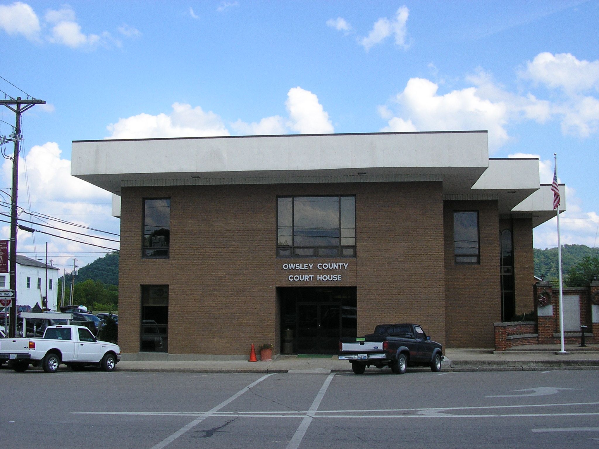
Owsley County, Kentucky  Owsley County courthouse in Booneville, Kentucky
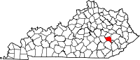
Location in the state of Kentucky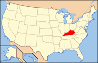
Kentucky's location in the U.S.Founded 1843 Seat Booneville Area
- Total
- Land
- Water
198.09 sq mi (513 km²)
198.09 sq mi (513 km²)
0.00 sq mi (0 km²), 0%Population
- (2000)
- Density
4,858
24/sq mi (9/km²)Time zone Eastern: UTC-5/-4 Website www.owsleycountykentucky.org Owsley County is a county located in the U.S. state of Kentucky. As of 2000, the population was 4,858. Its county seat is Booneville[1]. The county is named for William Owsley, the Governor of Kentucky from 1844 to 1848. It is a prohibition or dry county. It is the third poorest county in the United States with a median household income of less than $11,000 (Lowest-income counties in the United States).[2]
Contents
Geography
According to the 2000 census, the county has a total area of 198.09 square miles (513.1 km2), all land.[3]
Adjacent counties
- Lee County (north)
- Breathitt County (east)
- Perry County (southeast)
- Clay County (south)
- Jackson County (west)
National protected area
- Daniel Boone National Forest (part)
Demographics
Historical populations Census Pop. %± 1850 3,774 — 1860 5,335 41.4% 1870 3,889 −27.1% 1880 4,942 27.1% 1890 5,975 20.9% 1900 6,874 15.0% 1910 7,979 16.1% 1920 7,820 −2.0% 1930 7,223 −7.6% 1940 8,957 24.0% 1950 7,324 −18.2% 1960 5,369 −26.7% 1970 5,023 −6.4% 1980 5,709 13.7% 1990 5,036 −11.8% 2000 4,858 −3.5% Est. 2008 4,634 −4.6% http://ukcc.uky.edu/~census/21189.txt As of the census[4] of 2000, there were 4,858 people, 1,894 households, and 1,388 families residing in the county. The population density was 24 per square mile (9.3 /km2). There were 2,247 housing units at an average density of 11 per square mile (4.2 /km2). The racial makeup of the county was 99.22% White, 0.10% Black or African American, 0.06% Native American, 0.04% Asian, 0.02% Pacific Islander, 0.02% from other races, and 0.54% from two or more races. 0.72% of the population were Hispanics or Latinos of any race.
There were 1,894 households out of which 32.6% had children under the age of 18 living with them, 54.8% were married couples living together, 12.7% had a female householder with no husband present, and 26.7% were non-families. 24.5% of all households were made up of individuals and 10.7% had someone living alone who was 65 years of age or older. The average household size was 2.51 and the average family size was 2.98.
The age distribution was 24.6% under the age of 18, 8.9% from 18 to 24, 27.0% from 25 to 44, 24.5% from 45 to 64, and 15.0% who were 65 years of age or older. The median age was 38 years. For every 100 females there were 101.8 males. For every 100 females age 18 and over, there were 96.7 males.
The median income for a household in the county was $15,805, which is the third lowest in the nation and the lowest among counties with a non-Hispanic white majority population, and the median income for a family was $18,034. Males had a median income of $25,100 versus $18,203 for females. The per capita income for the county was $10,742. About 41.7% of families and 45.4% of the population were below the poverty line, including 56.3% of those under age 18 and 34.5% of those age 65 or over. Poverty rates are therefore among the 10 highest of any county in the United States.
Abraham Lincoln Relief Sculpture
The Abraham Lincoln Relief Sculpture, locally known as 'Abe Lincoln Rock' or 'Abraham Lincoln Rock', is located just off Highway 846 in the Conkling community of Owsley County. The sculpture is listed in the inventory of folk art in the Smithsonian American Art Museum. The sculpture was carved by a traveling pack peddler, Granville Johnson, in the 1930s. Local Legend has it that Johnson had come to Owsley County ill and in need of assistance. The John Williams family cared for him on their farm located south of Booneville. As he began to recover his strength, Mr. Johnson would take a hammer and chisel and climb the hill behind the Williams' home each day. Once recovered well enough to travel again he revealed the sculpture, which he had created as a gift of appreciation to the family. The Owsley County Fiscal Court purchased the sculpture and surrounding land in 2008.
Famous people from Owsley County
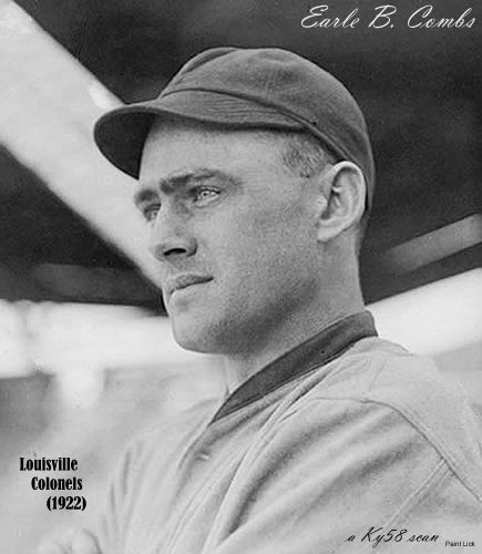
Earle Combs, who played baseball for the New York Yankees from 1924 to 1935 and was inducted into the Baseball Hall of Fame in 1970, is from Owsley County. A plaque to honor his birthplace stands on Highway 11 in Pebworth.[5]
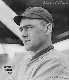 Combs in a photograph taken while he was playing for the Louisville Colonels
Cemeteries
- Botner Cemetery
- Callahan Cemetery
- Cortland Cemetery
- Elijah Isaacs Graveyard
- Griffith Cemetery
- Horn Hill Cemetery
- John Tyler Brewer Cemetery
- King Cemetery
- Lerose Cemetery
- McIntosh Cemetery
- Morris Cemetery
- Noble Cemetery
- Pendergrass Cemetery
- Shepherd Cemetery
- Stewart Cemetery
Churches
- Anglin Church
- Bee Branch Bible Church
- Booneville Baptist Church
- Booneville Presbyterian Church
- Booneville United Methodist Church
- Calvary Church
- Clifty United Methodist Church
- Cowcreek Presbyterian Church
- Elk Lick Church
- Essau Church
- Faith Hill Church
- Fish Creek Bible Church
- Fountainhead Church
- Howland Chapel
- Island City Church
- Mount Carmel Church
- New Hope Church
- Riverside Church
- Rock Springs Church
- Royal Oak Church
- Seven Candles Pentecostal
- Spencer Fork Community Church
- Walnut Grove Church
- Warrens Chappel United Methodist Church
- Zion Church
Populated places
- Arnett
- Big Spring Neighborhood
- Blake
- Booneville
- Brewer Neighborhood
- Chestnut Gap
- Chestnut Neighborhood
- Conkling
- Couch Fork Neighborhood
- Couch Town Neighborhood
- Cowcreek
- Elk Lick Neighborhood
- Endee
- Eversole
- Fish Creek Neighborhood
- Hall Neighborhood
- Hogg Neighborhood
- Indian Creek Neighborhood
- Island City
- Lerose
- Levi
- Lucky Fork
- Major
- Mistletoe
- Moors Neighborhood
- Needmore Neighborhood
- Pebworth
- Pleasant Neighborhood
- Ricetown
- Rock Spring Neighborhood
- Rockhouse Neighborhood
- Scoville
- Sebastian
- Shephard Neighborhood
- Southfork
- Stacey Neighborhood
- Stay
- Sturgeon
- Sugar Camp Neighborhood
- Taft
- Travellers Rest
- Vincent
- Whoopflarea
Post Offices
- Booneville Post Office
- Vincent Post Office
Schools
Current
Historical
- Anglin School
- Bee Branch School
- Bethlehem School
- Bradshaw School
- Brookside School
- Cane Fork School
- Chestnut Gap School
- Cortland School
- Do Creek School
- Essau School
- Fish Creek School
- Grassy Branch School
- Hall School
- Indian Creek School
- Lerose School
- Leroy School
- Lucky Fork School
- Moores School
- Needmore School
- Pleasant Grove School
- Riverside School
- Rockhouse School
- Royal Oak School
- Shephard School
- Sturgeon Consolidate School
- Sugar Camp School
- Upper Wolf Creek School
- Walnut Grove School
- White Oak School
Streams
- Amis Branch
- Anglin Creek
- Baker Branch
- Barbecue Branch
- Beals Fork
- Bear Run
- Bear Gap Branch
- Beatty Fork
- Bee Branch
- Beech Fork
- Betty Bowman Creek
- Betty Thomas Branch
- Big Branch
- Big Branch
- Big Twin Creek
- Bill Oak Branch
- Billy Branch
- Board Branch
- Brewer Fork
- Brier Branch
- Broker Branch
- Brushy Creek
- Buck Creek
- Buck Fork
- Buck Branch
- Buffalo Creek
- Bunches Branch
- Bungeon Branch
- Burger Branch
- Cabin Branch
- Caney Fork
- Caney Branch
- Cool Branch
- Cortland Fork
- Cow Creek
- Crane Fork
- Crane Creek
- Davis Branch
- Deer Lick
- Doe Creek
- Drowned Branch
- Dry Fork
- Duck Fork
- Elk Lick
- Eversole Branch
- Fish Creek
- Gabbard Branch
- Gabriel Fork
- Gay Branch
- Gilbert Branch
- Granny Dismal Creek
- Grassy Fork
- Grassy Branch
- Guy Camp Branch
- Hacker Branch
- Harlan Branch
- Harris Branch
- Harrison Branch
- Hartsock Branch
- Holly Fork
- Horn Branch
- Horse Branch
- Ikie Branch
- Indian Creek
- Jeff Branch
- Jennings Branch
- Jerushia Branch
- Jesse Branch
- Joyce Fork
- Laurel Fork
- Left Fork Buffalo Creek
- Left Fork Island Creek
- Left Fork Cow Creek
- Lick Branch
- Little Sturgeon Creek
- Little Twin Branch
- Little McJonkin Branch
- Lower Twin Branch
- Lower Buffalo Creek
- Lower Allen Branch
- Lower Island Creek
- Lower Wolf Creek
- Lucky Fork
- McGuire Fork
- McJonkin Branch
- Meadow Creek
- Meadow Fork
- Merill Branch
- Middle Allen Branch
- Mike Branch
- Mill Timber Branch
- Mill Town Branch
- Moore Fork
- Mud Lick
- Niers Branch
- Peachtree Branch
- Pig Pen Branch
- Poletown Fork
- Rattlesnake Creek
- Right Fork Buffalo Creek
- Right Fork Cow Creek
- Riley Fork
- Rockhouse Branch
- Rone Fork Branch
- Rose Fork
- Rowland Branch
- Rowlette Branch
- Schoolhouse Branch
- Sexton Creek
- Smith Fork
- South Fork Kentucky River
- Spencer Fork
- Spencer Fork
- Split Poplar Fork
- Spruce Fork
- Spruce Fork
- Stable Branch
- Stamper Branch
- Steel Trap Branch
- Straight Fork
- Stringtown Branch
- Sturgeon Creek
- Sugar Camp Creek
- Sulphur Springs Fork
- Ten Acre Fork
- Trace Branch
- Trace Branch
- Upper Allen Branch
- Upper Twin Branch
- Upper Wolf Creek
- Warren Chapel Branch
- Watches Fork
- Wheatfield Branch
- White Oak Creek
- Wild Dog Creek
- Wilson Fork
- Wilson Fork
- Wolf Creek
- Zeke Branch
Summits
- Bargers Knob
- Cherry Tree Knob
- High Rock Mountain
- Hunters Knob
- Island Creek Knob
- Mine Knob
- Rice Knob
- Rose Knob
- Turkey Knob
Valleys
- Bald Head Hollow
- Barn Hollow
- Becky Hollow
- Black Pool Hollow
- Greenville Hollow
- Ground Hog Hollow
- Halcomb Hollow
- Pigpen Hollow
- Pole Cat Hollow
- Poplar Hollow
- Seng Cove
- Still House Hollow
- Tabletree Hollow
- Toenail Hollow
- Wolfpen Hollow
See also
References
- ^ "Find a County". National Association of Counties. http://www.naco.org/Counties/Pages/FindACounty.aspx. Retrieved 2011-06-07.
- ^ http://en.wikipedia.org/wiki/Lowest-income_counties_in_the_United_States
- ^ "Census 2000 U.S. Gazetteer Files: Counties". United States Census. http://www.census.gov/tiger/tms/gazetteer/county2k.txt. Retrieved 2011-02-13.
- ^ "American FactFinder". United States Census Bureau. http://factfinder.census.gov. Retrieved 2008-01-31.
- ^ Earle Combs Statistics - Baseball-Reference.com
- ^ USGS Geographic Name Information System (GNIS)
External links
- Eastern Kentucky Arts Project
- Owsley Family Historical Society website
- The Kentucky Highlands Project
Municipalities and communities of Owsley County, Kentucky City Unincorporated
communitiesEastern Mountain Coal Fields Counties Cities and towns
10k-25kCities and towns
5k-10kCities and towns
1k-5kBarbourville • Beattyville • Catlettsburg • Clay City • Cumberland • Elkhorn City • Evarts • Grayson • Greenup • Harlan • Hazard • Jackson • Jeffersonville • Jenkins • Louisa • Manchester • Olive Hill • Paintsville • Pineville • Prestonsburg • Raceland • Russell • Salyersville • South Shore • Stanton • West Liberty • Wheelwright • Whitesburg • Worthington • WurtlandCities and towns
under 1kAllen • Bellefonte • Benham • Blackey • Blaine • Booneville • Buckhorn • Camargo • Campton • Cedarville • Coal Run Village • Fleming-Neon • Frenchburg • Hindman • Hyden • Inez • Lakeview Heights • Loyall • Lynch • Martin • McKee • Pippa Passes • Sandy Hook • Vicco • Wallins Creek • Warfield • WaylandStatistical areas Categories:- Kentucky counties
- Owsley County, Kentucky
- Dry counties of Kentucky


Wikimedia Foundation. 2010.