- Fleming-Neon, Kentucky
-
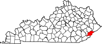
Fleming-Neon, Kentucky — City — Location of Fleming-Neon, Kentucky
Coordinates: 37°11′40″N 82°42′21″W / 37.19444°N 82.70583°WCoordinates: 37°11′40″N 82°42′21″W / 37.19444°N 82.70583°W Country United States State Kentucky County Letcher Established (merger) July 7, 1977 Government – Type Mayor-Council – Mayor Susan Polis Area – Total 1.7 sq mi (4.3 km2) – Land 1.7 sq mi (4.3 km2) – Water 0.0 sq mi (0.0 km2) Elevation 1,391 ft (424 m) Population (2000) – Total 840 – Density 509.0/sq mi (196.5/km2) Time zone Eastern (EST) (UTC-5) – Summer (DST) EDT (UTC-4) ZIP code 41840 Area code(s) 606 FIPS code 21-27846 GNIS feature ID 1681811 Fleming-Neon is a city in Letcher County, Kentucky, United States. The population was 840 at the 2000 census.
Contents
History
The city was established by the Elkhorn Coal Corporation which moved in to the area in 1913. Fleming was the location of the mine and named for its first president George W. Fleming. A city named Chip existed near the community that became Fleming and it was quickly built up and served as a trading center for the nearby coal towns. The train that hauled the coal out of Fleming would make stops in Neon and it is an accepted legend by locals that a man on the train would yell instructions to people climbing on board the train saying "Knee On" This was soon changed to Neon and replaced the name Chip. In 1977 the two towns merged becoming Fleming-Neon.[1]
Geography
Fleming-Neon is located at 37°11′40″N 82°42′21″W / 37.19444°N 82.70583°W (37.194421, -82.705937).[2]
According to the United States Census Bureau, the city has a total area of 1.6 square miles (4.1 km2), all land.
Demographics
As of the census[3] of 2000, there were 840 people, 351 households, and 244 families residing in the city. The population density was 509.0 people per square mile (196.6/km²). There were 403 housing units at an average density of 244.2 per square mile (94.3/km²). The racial makeup of the city was 96.55% White, 2.86% African American, and 0.60% from two or more races. Hispanic or Latino of any race were 0.60% of the population.
There were 351 households out of which 27.9% had children under the age of 18 living with them, 49.9% were married couples living together, 16.0% had a female householder with no husband present, and 30.2% were non-families. 26.5% of all households were made up of individuals and 11.7% had someone living alone who was 65 years of age or older. The average household size was 2.39 and the average family size was 2.88.
Historical populations Census Pop. %± 1980 1,195 — 1990 759 −36.5% 2000 840 10.7% Est. 2009 778 [4] −7.4% In the city the population was spread out with 23.5% under the age of 18, 6.9% from 18 to 24, 25.5% from 25 to 44, 26.1% from 45 to 64, and 18.1% who were 65 years of age or older. The median age was 41 years. For every 100 females there were 97.6 males. For every 100 females age 18 and over, there were 88.6 males.
The median income for a household in the city was $18,421, and the median income for a family was $20,795. Males had a median income of $25,625 versus $23,750 for females. The per capita income for the city was $9,029. About 33.3% of families and 39.4% of the population were below the poverty line, including 55.8% of those under age 18 and 16.8% of those age 65 or over.
Education
Fleming-Neon High School served as the high school for the area for about 80 years. It was built in 1925 by the Elkhorn Coal Corporation to provide an educational system for the children of the coal miners. The school's mascot was a pirate and the school colors were purple and gold. The original building was destroyed by fire on the night of February 11, 1958. Classes were held in the evenings in the Fleming-Neon Elementary School building until a new building was constructed in the same location as the old building. Classes resumed on the hill until June 6, 2005. The graduating class of 2005 was the last for Fleming-Neon High School due to consolidation with two other county schools, Whitesburg High School and Letcher High School, to form Letcher County Central High School.[5]
Notable natives
- Martha Carson – Gospel country singer from Neon, which was absorbed to make Fleming-Neon.
References
- ^ http://www.uky.edu/KentuckyAtlas/ky-fleming-neon.html
- ^ "US Gazetteer files: 2010, 2000, and 1990". United States Census Bureau. 2011-02-12. http://www.census.gov/geo/www/gazetteer/gazette.html. Retrieved 2011-04-23.
- ^ "American FactFinder". United States Census Bureau. http://factfinder.census.gov. Retrieved 2008-01-31.
- ^ Annual Estimates of Resident Population for Incorporated Cities in Kentucky: April 1, 2000 to July 1, 2009 United States Census Bureau. Retrieved on 2010-07-08
- ^ http://www.piratehistory.friendpages.com--17:19, 3 July 2009 (UTC)
External links
Municipalities and communities of Letcher County, Kentucky Cities Blackey | Fleming-Neon | Jenkins | Whitesburg
CDP Unincorporated
communitiesEastern Mountain Coal Fields Counties Cities and towns
10k-25kCities and towns
5k-10kCities and towns
1k-5kBarbourville • Beattyville • Catlettsburg • Clay City • Cumberland • Elkhorn City • Evarts • Grayson • Greenup • Harlan • Hazard • Jackson • Jeffersonville • Jenkins • Louisa • Manchester • Olive Hill • Paintsville • Pineville • Prestonsburg • Raceland • Russell • Salyersville • South Shore • Stanton • West Liberty • Wheelwright • Whitesburg • Worthington • WurtlandCities and towns
under 1kAllen • Bellefonte • Benham • Blackey • Blaine • Booneville • Buckhorn • Camargo • Campton • Cedarville • Coal Run Village • Fleming-Neon • Frenchburg • Hindman • Hyden • Inez • Lakeview Heights • Loyall • Lynch • Martin • McKee • Pippa Passes • Sandy Hook • Vicco • Wallins Creek • Warfield • WaylandStatistical areas Categories:- Cities in Kentucky
- Populated places in Letcher County, Kentucky
- Mining communities in Kentucky
- Company towns in Kentucky


Wikimedia Foundation. 2010.