- Mount Sterling, Kentucky
-
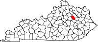
Mount Sterling, Kentucky — City — Downtown Mount Sterling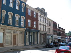 Location of Mount Sterling, Kentucky
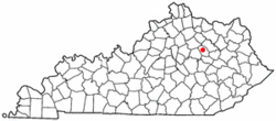
Coordinates: 38°3′24″N 83°56′40″W / 38.05667°N 83.94444°WCoordinates: 38°3′24″N 83°56′40″W / 38.05667°N 83.94444°W Country United States State Kentucky County Montgomery Area – Total 3.4 sq mi (8.9 km2) – Land 3.4 sq mi (8.9 km2) – Water 0.0 sq mi (0.0 km2) Elevation 974 ft (297 m) Population (2000) – Total 5,876 – Density 1,708.9/sq mi (659.8/km2) Time zone Eastern (EST) (UTC-5) – Summer (DST) EDT (UTC-4) ZIP code 40353 Area code(s) 859 FIPS code 21-54084 GNIS feature ID 0498865 Mount Sterling is a city in Montgomery County, Kentucky, United States. The population was 5,876 at the 2000 census. It is the principal city of the Mount Sterling Micropolitan Statistical Area.
Contents
Geography
Mount Sterling is located at 38°3′24″N 83°56′40″W / 38.05667°N 83.94444°W (38.056613, -83.944500)[1].
According to the United States Census Bureau, the city has a total area of 3.4 square miles (8.8 km2), all of it land.
Demographics
As of the census[2] of 2000, there were 5,876 people, 2,478 households, and 1,536 families residing in the city. The population density was 1,708.9 people per square mile (659.5/km²). There were 2,768 housing units at an average density of 805.0 per square mile (310.7/km²). The racial makeup of the city was 89.09% White, 8.73% African American, 0.22% Native American, 0.19% Asian, 0.75% from other races, and 1.02% from two or more races. Hispanic or Latino of any race were 1.68% of the population.
There were 2,478 households out of which 28.9% had children under the age of 18 living with them, 44.8% were married couples living together, 14.2% had a female householder with no husband present, and 38.0% were non-families. 33.3% of all households were made up of individuals and 17.4% had someone living alone who was 65 years of age or older. The average household size was 2.28 and the average family size was 2.89.
In the city the population was spread out with 22.7% under the age of 18, 10.6% from 18 to 24, 28.4% from 25 to 44, 21.0% from 45 to 64, and 17.4% who were 65 years of age or older. The median age was 37 years. For every 100 females there were 86.0 males. For every 100 females age 18 and over, there were 83.1 males.
The median income for a household in the city was $27,050, and the median income for a family was $34,074. Males had a median income of $30,584 versus $21,081 for females. The per capita income for the city was $17,585. About 17.1% of families and 19.4% of the population were below the poverty line, including 29.4% of those under age 18 and 17.8% of those age 65 or over.
Libraries
Historical populations Census Pop. %± 1850 533 — 1860 754 41.5% 1870 1,040 37.9% 1880 2,087 100.7% 1890 3,629 73.9% 1900 3,561 −1.9% 1910 3,932 10.4% 1920 3,995 1.6% 1930 4,350 8.9% 1940 4,782 9.9% 1950 5,294 10.7% 1960 9,303 75.7% 1970 5,083 −45.4% 1980 5,820 14.5% 1990 5,362 −7.9% 2000 5,876 9.6% Est. 2009 7,051 [3] 20.0% U.S. Census Bureau[4] The Mt. Sterling-Montgomery County Library was established in 1871. The Mt. Sterling – Montgomery County Library moved to the current location, accessible from both Main and Locust Streets, in July 1984. The building was officially dedicated on September 30, 1984. The local library added a branch in Camargo in October, 2008.
List of Registered Historical Places
- Bondurant House
- Chesapeake and Ohio Railroad Passenger and Baggage Depots
- Church of the Ascension
- East Mount Sterling Historic District
- Enoch Smith House
- Gaitskill Mound Archeological Site
- John Bell Hood House
- KEAS Tabernacle Christian Methodist Episcopal Church
- Machpelah Cemetery
- Methodist Episcopal Church South
- Miss Emma Hicks Bungalow
- Monarch Milling Company
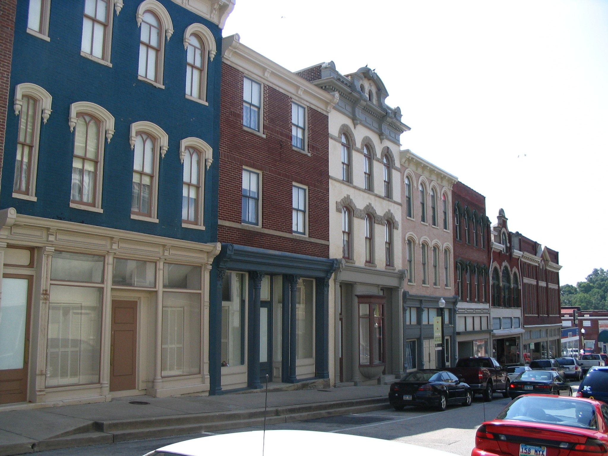
- Mount Sterling Commercial District
- Ralph Morgan Stone House
- W. T. Fitzpatrick House
- William Chiles House
- Wright-Greene Mound Complex
- Confederate Monument of Mt. Sterling
- Northwest Residential District
October Court Day
Every year, hundreds of thousands of visitors flock to Mount Sterling for Court Day. The event is held on the third Monday of October, with festivities beginning on the prior Friday (recently changed from Saturday by city since school is out anyway on that Friday).
==Notable residents==
- Henry Daniel (March 15, 1786 - October 5, 1873) was a United States Representative from Kentucky.
- Amos Davis (August 15, 1794 - June 11, 1835) was a United States Representative from Kentucky.
- Ernie Fletcher (November 12, 1952 - ), Governor of Kentucky (2003–2007).
- Nancy Green - (November 17, 1834 - September 23, 1923) was born a slave in Montgomery County. Also the original Aunt Jemima.
- Jeremy Sumpter, actor, raised in Mount Sterling.
References
- ^ "US Gazetteer files: 2010, 2000, and 1990". United States Census Bureau. 2011-02-12. http://www.census.gov/geo/www/gazetteer/gazette.html. Retrieved 2011-04-23.
- ^ "American FactFinder". United States Census Bureau. http://factfinder.census.gov. Retrieved 2008-01-31.
- ^ Annual Estimates of Resident Population for Incorporated Cities in Kentucky: April 1, 2000 to July 1, 2009 United States Census Bureau. Retrieved on 2010-07-08
- ^ Census Bureau Retrieved on 2010-2-14
External links
Municipalities and communities of Montgomery County, Kentucky County seat: Mount SterlingCities Camargo | Jeffersonville | Mount Sterling
Unincorporated
communityEastern Mountain Coal Fields Counties Cities and towns
10k-25kCities and towns
5k-10kCities and towns
1k-5kBarbourville • Beattyville • Catlettsburg • Clay City • Cumberland • Elkhorn City • Evarts • Grayson • Greenup • Harlan • Hazard • Jackson • Jeffersonville • Jenkins • Louisa • Manchester • Olive Hill • Paintsville • Pineville • Prestonsburg • Raceland • Russell • Salyersville • South Shore • Stanton • West Liberty • Wheelwright • Whitesburg • Worthington • WurtlandCities and towns
under 1kAllen • Bellefonte • Benham • Blackey • Blaine • Booneville • Buckhorn • Camargo • Campton • Cedarville • Coal Run Village • Fleming-Neon • Frenchburg • Hindman • Hyden • Inez • Lakeview Heights • Loyall • Lynch • Martin • McKee • Pippa Passes • Sandy Hook • Vicco • Wallins Creek • Warfield • WaylandStatistical areas County seats in Kentucky Albany • Alexandria • Barbourville • Bardstown • Bardwell • Beattyville • Bedford • Benton • Booneville • Bowling Green • Brandenburg • Brooksville • Brownsville • Burkesville • Burlington • Cadiz • Calhoun • Campbellsville • Campton • Carlisle • Carrollton • Catlettsburg • Clinton • Columbia • Covington • Cynthiana • Danville • Dixon • Eddyville • Edmonton • Elizabethtown • Elkton • Falmouth • Flemingsburg • Frankfort • Franklin • Frenchburg • Georgetown • Glasgow • Grayson • Greensburg • Greenup • Greenville • Hardinsburg • Harlan • Harrodsburg • Hartford • Hawesville • Hazard • Henderson • Hickman • Hindman • Hodgenville • Hopkinsville • Hyden • Independence • Inez • Irvine • Jackson • Jamestown • La Grange • Lancaster • Lawrenceburg • Lebanon • Leitchfield • Lexington • Liberty • London • Louisa • Louisville • Madisonville • Manchester • Marion • Mayfield • Maysville • McKee • Monticello • Morehead • Morganfield • Morgantown • Mount Olivet • Mount Sterling • Mount Vernon • Munfordville • Murray • New Castle • Nicholasville • Owensboro • Owenton • Owingsville • Paducah • Paintsville • Paris • Pikeville • Pineville • Prestonsburg • Princeton • Richmond • Russellville • Salyersville • Sandy Hook • Scottsville • Shelbyville • Shepherdsville • Smithland • Somerset • Springfield • Stanford • Stanton • Taylorsville • Tompkinsville • Vanceburg • Versailles • Warsaw • West Liberty • Whitesburg • Whitley City • Wickliffe • Williamsburg • Williamstown • WinchesterCategories:- Cities in Kentucky
- Populated places in Montgomery County, Kentucky
- County seats in Kentucky
- Mount Sterling micropolitan area


Wikimedia Foundation. 2010.