- Morgantown, Kentucky
-
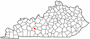
Morgantown — City — Butler County Courthouse in Morgantown Location of Morgantown within Kentucky.
Coordinates: 37°13′10″N 86°41′33″W / 37.21944°N 86.6925°WCoordinates: 37°13′10″N 86°41′33″W / 37.21944°N 86.6925°W Country United States State Kentucky County Butler Government – Mayor Linda Keown Area – Total 3.4 sq mi (8.7 km2) – Land 3.4 sq mi (8.7 km2) – Water 0.0 sq mi (0.0 km2) Elevation 564 ft (172 m) Population (2000) – Total 2,544 Time zone CST (UTC-6) – Summer (DST) CDT (UTC-5) ZIP Code 42261 Area code(s) 270 FIPS code 21-53490 GNIS feature ID 0498600 Morgantown is a city in and the county seat of Butler County, Kentucky, United States.[1] The population was 2,544 at the 2000 census. The city had a sister city in Tatsuruhama, Ishikawa, Japan, which city is now part of Nanao, Ishikawa, Japan.
Contents
History
The etymology of the city's name is uncertain. According to The Kentucky Encyclopedia, it may have, at one time, been named Funkhouser Hill after Christopher Funkhouser, who donated land for the city. The Encyclopedia further speculates that Funkhouser may have given the city its present name to honor a hunter named Morgan or Daniel Morgan Smith, the first child born in the city.[2]
Civil War
Granville Allen, a member of the 17th Kentucky Infantry, was one of the first Union soldiers to die in the war, in a skirmish on October 29, 1861. A monument was erected by the Granville Allen Post #98 GAR. This first skirmish between the north and south took place on the Daniel Boone Johnson Property. The Johnson Cemetery is still there and is directly above the Monument, which is a limestone marker cut into the side of the old Logansport road, you will need to walk through some over growth to reach the monument. Morgantown has one of only two monuments dedicated to soldiers of both sides that died in the Civil War, and it is located at the county courthouse, the Confederate-Union Veterans' Monument in Morgantown.
Geography
Morgantown is located at 37°13′10″N 86°41′33″W / 37.21944°N 86.6925°W (37.219465, -86.692513)[3].
According to the United States Census Bureau, the city has a total area of 3.4 square miles (8.8 km2), all of it land.
Demographics
As of the census[4] of 2000, there were 2,544 people, 1,051 households, and 627 families residing in the city. The population density was 754.8 people per square mile (291.5/km²). There were 1,148 housing units at an average density of 340.6 per square mile (131.5/km²). The racial makeup of the city was 95.52% White, 1.10% African American, 0.16% Native American, 0.31% Asian, 2.36% from other races, and 0.55% from two or more races. Hispanic or Latino of any race were 3.22% of the population.
There were 1,051 households out of which 29.0% had children under the age of 18 living with them, 40.9% were married couples living together, 15.3% had a female householder with no husband present, and 40.3% were non-families. 36.9% of all households were made up of individuals and 18.5% had someone living alone who was 65 years of age or older. The average household size was 2.23 and the average family size was 2.90.
In the city the population was spread out with 23.0% under the age of 18, 11.2% from 18 to 24, 24.8% from 25 to 44, 21.0% from 45 to 64, and 19.9% who were 65 years of age or older. The median age was 38 years. For every 100 females there were 82.9 males. For every 100 females age 18 and over, there were 76.9 males.
The median income for a household in the city was $19,912, and the median income for a family was $27,218. Males had a median income of $24,671 versus $18,594 for females. The per capita income for the city was $12,100. About 24.9% of families and 27.6% of the population were below the poverty line, including 36.0% of those under age 18 and 21.2% of those age 65 or over.
Transportation
Prior to 1917, the city's primary channel of transportation was the Green River. However, in 1917, the river froze, leaving the city without supplies for two months. A subsequent period of road-building began, and in 1930, a road connecting Morgantown with Bowling Green provided an alternate conduit for commerce.[2]
Morgantown is now served by the William H. Natcher Parkway, which is designated as part of the future Interstate 66 corridor. Other roads include U.S. Highway 231, Kentucky Route 79, and Kentucky Route 70.
The city does not have railroad service.
Events of interest
Morgantown's municipal park, Charles Black City Park, is home to the annual Green River Catfish Festival held the week of July 4.[2]
Notable natives
- John Moore - bishop of the Methodist Episcopal Church, South
References
- ^ "Find a County". National Association of Counties. http://www.naco.org/Counties/Pages/FindACounty.aspx. Retrieved 2011-06-07.
- ^ a b c Kleber, John E., ed (1992). "Morgantown". The Kentucky Encyclopedia. Associate editors: Thomas D. Clark, Lowell H. Harrison, and James C. Klotter. Lexington, Kentucky: The University Press of Kentucky. ISBN 0813117720.
- ^ "US Gazetteer files: 2010, 2000, and 1990". United States Census Bureau. 2011-02-12. http://www.census.gov/geo/www/gazetteer/gazette.html. Retrieved 2011-04-23.
- ^ "American FactFinder". United States Census Bureau. http://factfinder.census.gov. Retrieved 2008-01-31.
Municipalities and communities of Butler County, Kentucky County seat: MorgantownCities  Categories:
- Populated places in Butler County, Kentucky
- Cities in Kentucky
- County seats in Kentucky


Wikimedia Foundation. 2010.