- Carlisle, Kentucky
Infobox Settlement
official_name = Carlisle, Kentucky
settlement_type =City
nickname =
motto =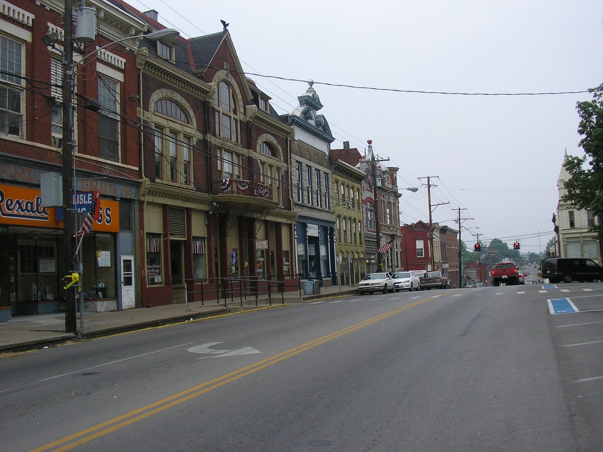
imagesize = 250px
image_caption = Main Street in Carlisle
image_
mapsize = 250px
map_caption = Location of Carlisle, Kentucky
mapsize1 =
map_caption1 =subdivision_type = Country
subdivision_name =United States
subdivision_type1 = State
subdivision_name1 =Kentucky
subdivision_type2 = County
subdivision_name2 = Nicholas
government_footnotes =
government_type =
leader_title =
leader_name =
leader_title1 =
leader_name1 =
established_title =
established_date =unit_pref = Imperial
area_footnotes =
area_magnitude =
area_total_km2 = 3.3
area_land_km2 = 3.3
area_water_km2 = 0.0
area_total_sq_mi = 1.3
area_land_sq_mi = 1.3
area_water_sq_mi = 0.0population_as_of = 2000
population_footnotes =
population_total = 1917
population_density_km2 = 579.0
population_density_sq_mi = 1499.7timezone = Eastern (EST)
utc_offset = -5
timezone_DST = EDT
utc_offset_DST = -4
elevation_footnotes =
elevation_m = 262
elevation_ft = 860
latd = 38 |latm = 18 |lats = 57 |latNS = N
longd = 84 |longm = 1 |longs = 55 |longEW = Wpostal_code_type =
ZIP code s
postal_code = 40311, 40350
area_code = 859
blank_name = FIPS code
blank_info = 21-12898
blank1_name = GNIS feature ID
blank1_info = 0488935
website =
footnotes =Carlisle is a city in Nicholas County,
Kentucky ,United States . The population was 1,917 at the 2000 census. It is thecounty seat of Nicholas CountyGR|6. It is located at the junction ofKentucky Route 32 andKentucky Route 36 , about halfway between Lexington and Maysville.History
Carlisle was founded in 1816 when John Kincart separated 50 acres of his peach orchard into 139 lots and laid out roads. The town was probably named for
Carlisle, Pennsylvania , hometown of Kincart's father. The county seat was moved from Ellisville to Carlisle in that same year, and a permanent brick courthouse was built in 1818. The fourth, and final, courthouse was built in 1893-1894.By 1830 the population was over 600, but the town's growth in the 19th century was slowed by numerous fires, a cholera epidemic in 1833, and the lack of turnpike access. However, a wide, macadamized turnpike connecting the town directly to Maysville was opposed by local residents in the 1830s, fearing economic competition to small local shippers. It was eventually built three miles (5 km) west of the town and became
US 68 .The
Trans Kentucky Terminal Railroad was built along the south side of Carlisle in 1871, and as a result the town became a thriving tobacco market in the early 20th century. The market declined starting in 1921.Due to its rural nature and lack of interest in modern developments, the town was well preserved into the 21st century. The 1893 Railroad depot serves as museum and community center, and the eclectic courthouse is one of Kentucky's most interesting.
It is one of Kentucky's smallest county seats by population. The population has grown from 1,579 in 1970. The local paper, the "Carlisle Mercury", was founded in 1867.
Geography
Carlisle is located at coor dms|38|18|57|N|84|1|55|W|city (38.315870, -84.031813)GR|1.
According to the
United States Census Bureau , the city has a total area of 1.3 square miles (3.3 km²), all of it land.Demographics
As of the
census GR|2 of 2000, there were 1,917 people, 887 households, and 542 families residing in the city. Thepopulation density was 1,499.7 people per square mile (578.2/km²). There were 982 housing units at an average density of 768.2/sq mi (296.2/km²). The racial makeup of the city was 97.50% White, 2.19% African American, 0.10% Asian, 0.10% from other races, and 0.10% from two or more races. Hispanic or Latino of any race were 0.52% of the population.There were 887 households out of which 24.2% had children under the age of 18 living with them, 45.8% were married couples living together, 11.8% had a female householder with no husband present, and 38.8% were non-families. 36.6% of all households were made up of individuals and 21.6% had someone living alone who was 65 years of age or older. The average household size was 2.16 and the average family size was 2.78.
In the city the population was spread out with 20.9% under the age of 18, 7.2% from 18 to 24, 24.0% from 25 to 44, 25.3% from 45 to 64, and 22.6% who were 65 years of age or older. The median age was 43 years. For every 100 females there were 81.9 males. For every 100 females age 18 and over, there were 79.2 males.
The median income for a household in the city was $29,199, and the median income for a family was $35,769. Males had a median income of $30,479 versus $19,167 for females. The
per capita income for the city was $17,485. About 8.1% of families and 11.0% of the population were below thepoverty line , including 8.1% of those under age 18 and 14.1% of those age 65 or over.References
External links
Unofficial Website(s) Related to Carlisle, KY USA (40311-1006)
* http://www.carlisleky.com
* http://www.cityofcarlisle.com
* http://www.carlisle-nicholascounty.org
Wikimedia Foundation. 2010.