- Covington, Kentucky
-
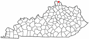
Covington, Kentucky — City — Location in Kenton County, Kentucky, USA
Coordinates: 39°3′54″N 84°30′35″W / 39.065°N 84.50972°WCoordinates: 39°3′54″N 84°30′35″W / 39.065°N 84.50972°W Country United States State Kentucky County Kenton Founded 1815 Government - Type Commission-City Manager - Mayor Denny Bowman (D) Area - Total 13.7 sq mi (35.4 km2) - Land 13.1 sq mi (34.0 km2) - Water 0.5 sq mi (1.4 km2) Elevation 509 ft (155 m) Population (2010) - Total 40,640 - Density 3,301.3/sq mi (1,274.4/km2) Time zone EST (UTC-5) - Summer (DST) EDT (UTC-4) ZIP code 41011-41012, 41014-41019 Area code(s) 859 FIPS code 21-17848 GNIS feature ID 0490167 Website www.covingtonky.gov Covington is a city in Kenton County, Kentucky, United States. As of the 2010 census, the city population was 40,640; it is the fifth-most-populous city in Kentucky.[1] It is one of two county seats of Kenton County.[2] Covington is located at the confluence of the Ohio and Licking Rivers. Covington is part of the Cincinnati – Northern Kentucky metropolitan area and is separated from Cincinnati by the Ohio River and from Newport by the Licking River. Covington is located within the Upland South region of the United States of America.
Contents
History
Main article: History of Covington, KentuckyCovington was established in 1814 when John Gano, Richard Gano, and Thomas Carneal purchased 150 acres (0.6 km2) on the west side of the Licking River at its confluence with the Ohio River, referred to as "the Point," from Thomas Kennedy for $50,000. The city was incorporated by the Kentucky General Assembly a year later. Covington experienced growth during most of the 19th century, only to decline during the Great Depression and the middle 20th century. The city has seen some redevelopment during the late 20th and early 21st centuries.
Covington Blue Sox
In 1912, city leaders attempted to acquire a baseball franchise in the Class D Blue Grass League; the Cincinnati Reds, whose park was just five miles away across the Ohio River, nixed the move. Instead (after several larger cities backed out), Covington was awarded a team in the new "outlaw" circuit, the Federal League.
The city raised $12,500, with $6,000 budgeted to build the ballpark. Bernard Wisehall, a prominent local architect, designed Federal Park (also known as Riverbreeze Park) with a capacity to 6,000. The playing field was tiny, believed to be smallest for any pro baseball park ever built: just 194 feet down the right-field line, 267 feet to dead center and 218 feet down the left-field line. [1] Construction didn't even begin until a month before Opening Day; after starting the season on a long road trip, the Blue Sox managed to sell out their home opener in late May, with thousands of fans turned away.[2]
But Covington simply didn't have the populace to support such an ambitious endeavor. On June 26, the team moved to Kansas City and ownership of the team reverted to creditors. Federal Park was used for other events the next few years, but it was eventually torn down and a tobacco warehouse was put up in its place; Covington has never hosted a professional team in any sport since.
Geography
According to the United States Census Bureau, Covington has a total area of 13.7 square miles (35 km2), of which 13.1 square miles (34 km2) is land and 0.5 square miles (1.3 km2) (3.88%) is water.
Climate
Covington is located within a climatic transition zone; it is nestled within the southern end of the humid continental climate zone and the northern periphery of the humid subtropical climate of the Upland South, with hot, humid summers and cool winters. Evidence of both a humid subtropical climate and a humid continental climate can be found here, particularly noticeable by the presence of plants indicative of each climatic region; for example, the Southern magnolia (Magnolia grandiflora) from the subtropics and the blue spruce from cooler regions are successful landscape plants in and around Covington.
Climate data for Covington, Kentucky Month Jan Feb Mar Apr May Jun Jul Aug Sep Oct Nov Dec Year Record high °F (°C) 77
(25)77
(25)88
(31)90
(32)95
(35)102
(39)108
(42)103
(39)101
(38)92
(33)83
(28)75
(24)108
(42)Average high °F (°C) 38
(3)44
(7)55
(13)66
(19)75
(24)83
(28)87
(31)86
(30)79
(26)67
(19)54
(12)43
(6)64.8 Average low °F (°C) 23
(−5)27
(−3)35
(2)43
(6)54
(12)62
(17)67
(19)65
(18)58
(14)46
(8)37
(3)27
(−3)45.3 Record low °F (°C) −16
(−27)−9
(−23)3
(−16)18
(−8)28
(−2)40
(4)48
(9)44
(7)32
(0)20
(−7)1
(−17)−13
(−25)−16
(−27)Precipitation inches (mm) 2.70
(68.6)2.30
(58.4)3.49
(88.6)3.81
(96.8)4.50
(114.3)3.71
(94.2)3.25
(82.6)3.46
(87.9)3.04
(77.2)2.80
(71.1)3.49
(88.6)3.02
(76.7)39.57
(1,005.1)Source: The Weather Channel.[3] Demographics
Historical populations Census Pop. %± 1830 743 — 1840 2,026 172.7% 1850 9,408 364.4% 1860 16,471 75.1% 1870 24,505 48.8% 1880 29,720 21.3% 1890 37,371 25.7% 1900 42,938 14.9% 1910 53,270 24.1% 1920 57,121 7.2% 1930 65,252 14.2% 1940 62,018 −5.0% 1950 64,452 3.9% 1960 60,376 −6.3% 1970 52,535 −13.0% 1980 49,585 −5.6% 1990 43,264 −12.7% 2000 43,370 0.2% 2010 40,640 −6.3% U.S. Census Bureau[4] As of the census[5] of 2000, there were 43,370 people, 18,257 households, and 10,132 families residing in the city. The population density was 3,301.3 people per square mile (1,274.4/km²). There were 20,448 housing units at an average density of 1,556.5 per square mile (600.8/km²). The racial makeup of the city was 87.05% White, 10.14% African American, 0.24% Native American, 0.34% Asian, 0.03% Pacific Islander, 0.63% from other races, and 1.57% from two or more races. Hispanics or Latinos of any race were 1.38% of the population.
There were 18,257 households out of which 28.8% had children under the age of 18 living with them, 34.3% were married couples living together, 16.5% had a female householder with no husband present, and 44.5% were non-families. 36.5% of all households were made up of individuals and 12.0% had someone living alone who was 65 years of age or older. The average household size was 2.31 and the average family size was 3.08.
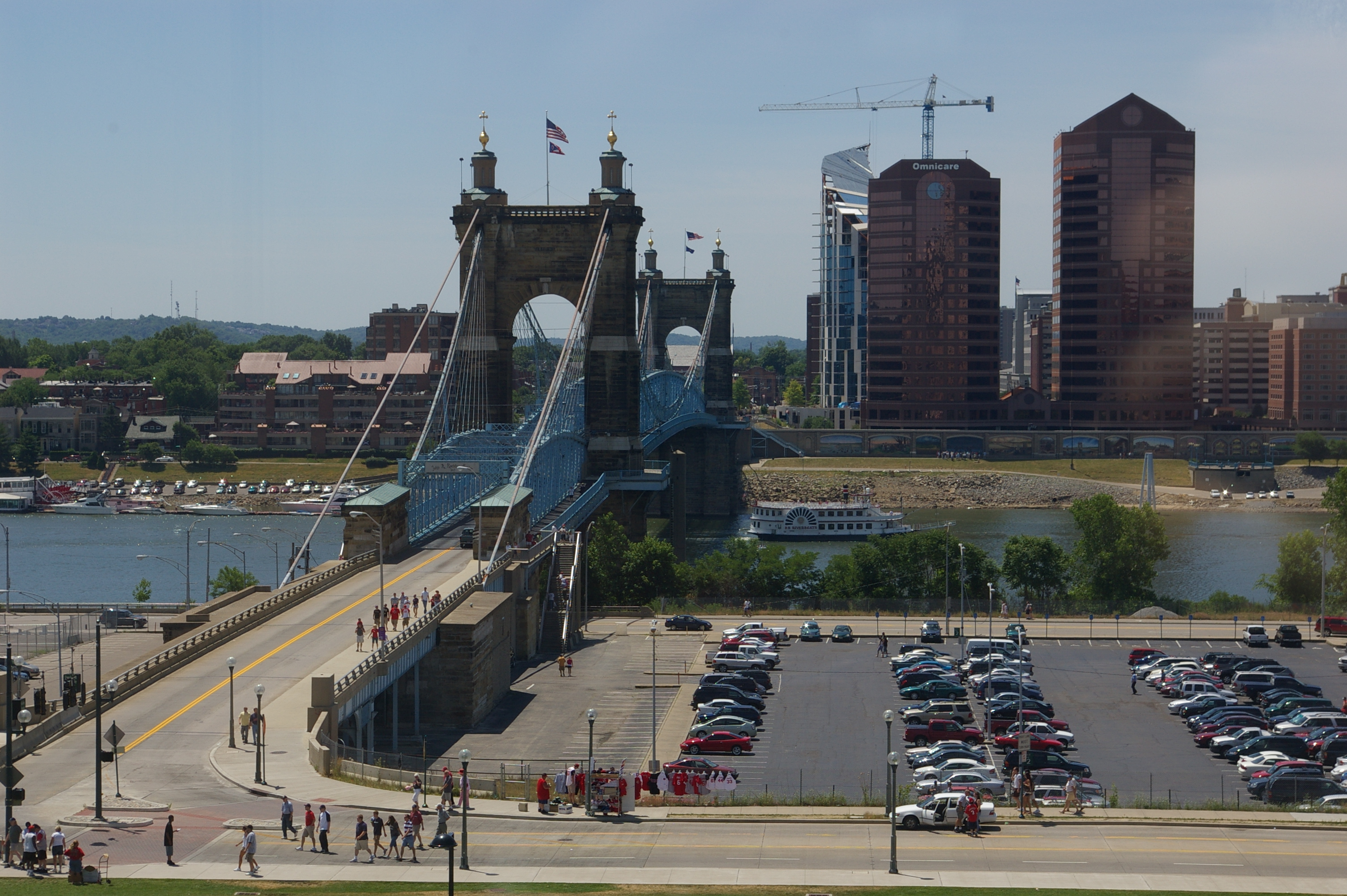
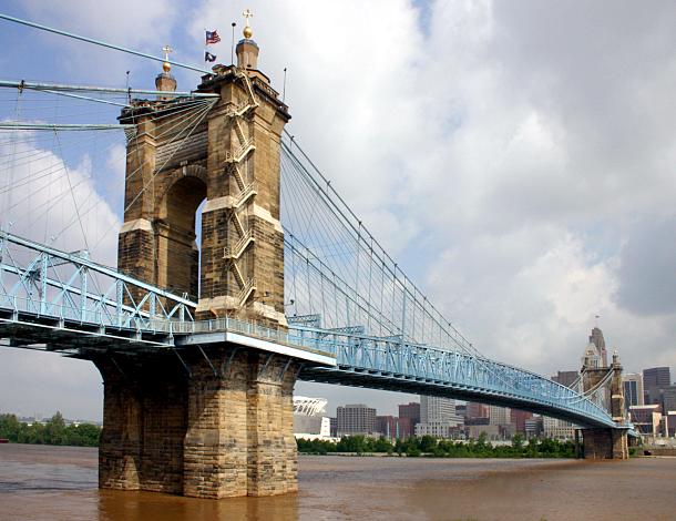
 A view of the John A. Roebling Suspension Bridge, looking towards Covington, Ky
The age distribution was 25.9% under the age of 18, 10.0% from 18 to 24, 33.3% from 25 to 44, 19.0% from 45 to 64, and 11.9% who were 65 years of age or older. The median age was 33 years. For every 100 females there were 95.9 males. For every 100 females age 18 and over, there were 92.0 males.
The median income for a household in the city was $30,735, and the median income for a family was $38,307. Males had a median income of $31,238 versus $24,487 for females. The per capita income for the city was $16,841. About 15.5% of families and 18.4% of the population were below the poverty line, including 25.0% of those under age 18 and 13.4% of those age 65 or over.
Economy
Omnicare and Ashland are based in Covington.
Top employers
According to Covington's 2009 Comprehensive Annual Financial Report,[6] the top employers in the city are:
# Employer # of Employees 1 St. Elizabeth Healthcare 6,300 2 Fidelity Investments 3,900 3 Covington Independent Schools 925 4 Roman Catholic Diocese of Covington 800 5 ACNielsen 400 6 State of Kentucky 360 7 Omnicare 325 8 Club Chef 300 9 NorthKey 280 10 Atkins & Pearce 225 Historic Churches
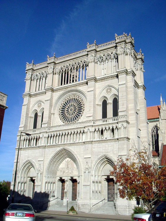
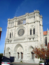 Cathedral Basilica of the Assumption in Covington
- Cathedral Basilica of the Assumption in Covington
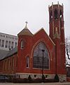
- Holy Cross Roman Catholic Church
- Latonia Christian Church
- Mother of God Parish (Covington, KY)
- Trinity Episcopal Church (Covington, Kentucky)
- Eastside Church of the Nazerine
Notable residents
- Gary Bauer, former Republican presidential hopeful born in Covington in 1946.
- Daniel Carter Beard, his life-size bronze statue, created by sculptor Kenneth Bradford, stands in town.
- Adrian Belew, a musician best known for his role as vocalist and guitarist of King Crimson since the early 1980s, he was born in Covington, December 23, 1949.
- Gail Borden, inventor of condensed milk lived in Covington during his childhood.
- Steve Cauthen, U.S. Racing Hall of Fame jockey born in Covington in 1960 to parents who lived in the community of Walton.
- Bob Charles, Australian politician, member of the Australian House of Representatives.
- Byrd Spilman Dewey, writer and Florida pioneer, was born in Covington February 16, 1856.
- Asa Drury (1802–1870), educator, Baptist minister and first superintendent of Covington public schools.
- Frank Duveneck, realist painter born in Covington on October 9, 1848.
- Mitch English, national television personality best known as one of the hosts on the show The Daily Buzz also featured in theatrical releases and other television programs was born St. Elizabeth Hospital on October 2, 1969
- Henry Forrest (1907–1975), U.S. Racing Hall of Fame Thoroughbred racehorse trainer born in Covington.
- Frederick William Franz, religious leader and theologian 4th president of the Jehovah's Witnesses born in Covington on September 12, 1893.
- Haven Gillespie, songwriter born in Covington, February 6, 1888 and died there on March 14, 1975. He is remembered primarily for "Santa Claus Is Coming to Town".
- Nannie Emory Holding, a Covington native, was a 30-year superintendent and the namesake of the former Holding Institute boarding school in Laredo, Texas.[7]
- David Justice, former Major League Baseball player graduated from Covington Latin School.
- Durward Kirby, actor best known as the co-host of Candid Camera was born in Covington, August 24, 1912.
- Una Merkel, actress born in Covington December 10, 1903.
- Gertrude Orr, screenwriter born in Covington, January 17, 1891.
- Eddie Peabody, Banjo player died of a stroke at St. Elizabeth Hospital on November 7, 1970; he had collapsed on stage on November 6, 1970 at the Lookout House in Fort Wright, Kentucky.
- Lee Roy Reams, Broadway actor born in Covington, August 23, 1942.
- Jack Roush, Champion NASCAR owner of the Roush Fenway Racing team, born in Covington, April 19, 1942.
- William Wright Southgate, Northern Kentucky Congressman
- John W. Stevenson Governor and Senator
- Ron Ziegler, White House Press Secretary during U.S. President Richard Nixon's administration, was born in Covington on May 12, 1939.
See also
Gallery
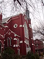
-
Historic Trinity Episcopal Church
-
Historic First United Methodist Church
References
- ^ http://travel.ky.gov/facts_populations.aspx
- ^ "Find a County". National Association of Counties. http://www.naco.org/Counties/Pages/FindACounty.aspx. Retrieved 2011-06-07.
- ^ "MONTHLY AVERAGES for Covington, KY". The Weather Channel. http://www.weather.com/weather/wxclimatology/monthly/USKY0801from=month_bottomnav_undeclared. Retrieved 2010-05-26.
- ^ Historical Census Data Retrieved on 2010-05-26
- ^ "American FactFinder". United States Census Bureau. http://factfinder.census.gov. Retrieved 2008-01-31.
- ^ City of Covington CAFR
- ^ "John H. McNeely, "Holding Institute"". The Handbook of Texas. http://www.tshaonline.org/handbook/online/articles/HH/kbh7.html. Retrieved September 30, 2009.
External links
- CovingtonUSA, online newspaper
- Historical Images and Texts of Covington, Kentucky
- Mortimer Murray Benton, First Mayor of Covington, Kentucky
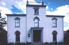
- Oldest House in Covington, Ky. Built 1798
- Garrard Street, circa 1890
- Northern Kentucky Roller Derby
- Railroads of Cincinnati and Northern Kentucky
- Austinburg Neighborhood Association
- South Covington Community Action Association
- Old Seminary Square Neighborhood Association
- A Byrd's Eye View of Covington, Kentucky Photobank
Municipalities and communities of Kenton County, Kentucky County seats: Covington and Independence Cities Bromley | Covington | Crescent Springs | Crestview Hills | Edgewood | Elsmere | Erlanger | Fairview | Fort Mitchell | Fort Wright | Independence | Kenton Vale | Lakeside Park | Ludlow | Park Hills | Ryland Heights | Taylor Mill | Villa Hills | Walton

Unincorporated
communitiesAtwood | Latonia Lakes | Nicholson | Visalia
County seats in Kentucky Albany • Alexandria • Barbourville • Bardstown • Bardwell • Beattyville • Bedford • Benton • Booneville • Bowling Green • Brandenburg • Brooksville • Brownsville • Burkesville • Burlington • Cadiz • Calhoun • Campbellsville • Campton • Carlisle • Carrollton • Catlettsburg • Clinton • Columbia • Covington • Cynthiana • Danville • Dixon • Eddyville • Edmonton • Elizabethtown • Elkton • Falmouth • Flemingsburg • Frankfort • Franklin • Frenchburg • Georgetown • Glasgow • Grayson • Greensburg • Greenup • Greenville • Hardinsburg • Harlan • Harrodsburg • Hartford • Hawesville • Hazard • Henderson • Hickman • Hindman • Hodgenville • Hopkinsville • Hyden • Independence • Inez • Irvine • Jackson • Jamestown • La Grange • Lancaster • Lawrenceburg • Lebanon • Leitchfield • Lexington • Liberty • London • Louisa • Louisville • Madisonville • Manchester • Marion • Mayfield • Maysville • McKee • Monticello • Morehead • Morganfield • Morgantown • Mount Olivet • Mount Sterling • Mount Vernon • Munfordville • Murray • New Castle • Nicholasville • Owensboro • Owenton • Owingsville • Paducah • Paintsville • Paris • Pikeville • Pineville • Prestonsburg • Princeton • Richmond • Russellville • Salyersville • Sandy Hook • Scottsville • Shelbyville • Shepherdsville • Smithland • Somerset • Springfield • Stanford • Stanton • Taylorsville • Tompkinsville • Vanceburg • Versailles • Warsaw • West Liberty • Whitesburg • Whitley City • Wickliffe • Williamsburg • Williamstown • Winchester50 most populous cities of Kentucky Categories:- Populated places established in 1814
- Covington, Kentucky
- Cities in Kentucky
- Kentucky populated places on the Ohio River
- Populated places in Kenton County, Kentucky
- County seats in Kentucky
- Municipalities of Greater Cincinnati


Wikimedia Foundation. 2010.