- McCracken County, Kentucky
-
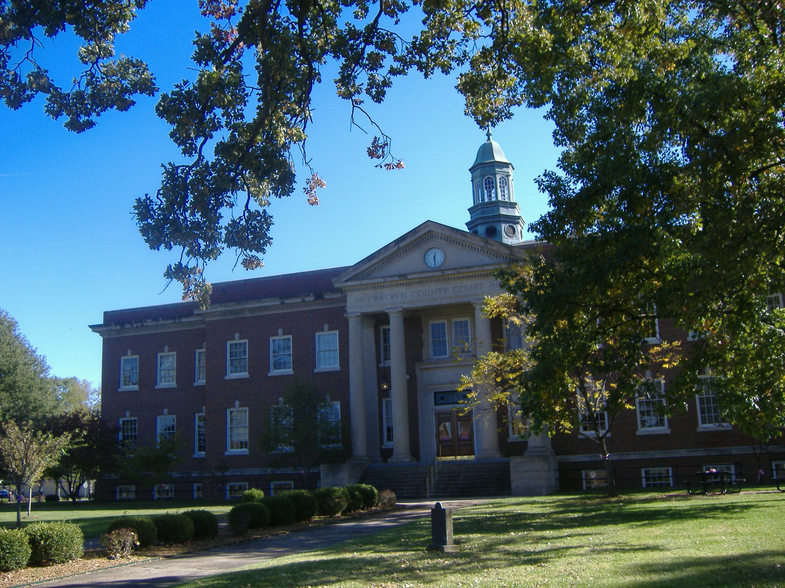
McCracken County, Kentucky 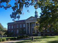 McCracken County courthouse in Paducah, Kentucky
Location in the state of Kentucky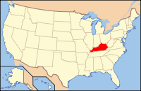
Kentucky's location in the U.S.Founded 1825 Named for Virgil McCracken, military captain killed at the Battle of River Raisin. Seat Paducah Area
- Total
- Land
- Water
268.08 sq mi (694 km²)
251.02 sq mi (650 km²)
17.05 sq mi (44 km²), 6.36%Population
- (2000)
- Density
65,514
261/sq mi (101/km²)Time zone Central: UTC-6/-5 Website www.mccrackencountykentucky.com McCracken County is a county located in the Jackson Purchase, the extreme western end of the U.S. state of Kentucky. As of 2000, the population was 65,514. The county seat, largest city, and only incorporated community is Paducah.[1]
McCracken County is part of the Paducah, KY-IL Micropolitan Statistical Area.
Contents
History
McCracken County was founded in 1825, from Hickman County. The county was named for Captain Virgil McCracken of Woodford County, Kentucky, who was killed in the Battle of Frenchtown in southeastern Michigan during the War of 1812.
The Battle of Paducah occurred in McCracken County on March 25, 1864. The skirmish between the Union and Confederate troops ended in a Confederate victory. Altogether 140 men fell in the battle.
Law and Government
McCracken County is represented congressionally as District 1 of the Commonwealth of Kentucky.
Geography
According to the 2000 census, the county has a total area of 268.08 square miles (694.3 km2), of which 251.02 square miles (650.1 km2) (or 93.64%) is land and 17.05 square miles (44.2 km2) (or 6.36%) is water.[2]
Adjacent counties
- Massac County, Illinois (north, across the Ohio River)
- Livingston County (northeast, across the Tennessee River)
- Marshall County (east)
- Graves County (south)
- Carlisle County (southwest)
- Ballard County (west)
National protected area
Demographics
Historical populations Census Pop. %± 1830 1,297 — 1840 4,745 265.8% 1850 6,067 27.9% 1860 10,360 70.8% 1870 13,988 35.0% 1880 16,262 16.3% 1890 21,051 29.4% 1900 28,733 36.5% 1910 35,064 22.0% 1920 37,246 6.2% 1930 46,271 24.2% 1940 48,534 4.9% 1950 49,137 1.2% 1960 57,306 16.6% 1970 58,281 1.7% 1980 61,310 5.2% 1990 62,879 2.6% 2000 65,514 4.2% http://ukcc.uky.edu/~census/21145.txt As of the census[3] of 2000, there were 65,514 people, 27,736 households, and 18,444 families residing in the county. The population density was 261 per square mile (101 /km2). There were 30,361 housing units at an average density of 121 per square mile (47 /km2). The racial makeup of the county was 86.76% White, 10.88% Black or African American, 0.22% Native American, 0.51% Asian, 0.05% Pacific Islander, 0.40% from other races, and 1.18% from two or more races. 1.06% of the population were Hispanics or Latinos of any race.
There were 27,736 households out of which 29.60% had children under the age of 18 living with them, 51.10% were married couples living together, 12.20% had a female householder with no husband present, and 33.50% were non-families. 29.70% of all households were made up of individuals and 12.30% had someone living alone who was 65 years of age or older. The average household size was 2.31 and the average family size was 2.86.
The age distribution was 23.40% under the age of 18, 7.90% from 18 to 24, 28.10% from 25 to 44, 24.70% from 45 to 64, and 15.90% who were 65 years of age or older. The median age was 39 years. For every 100 females there were 90.50 males. For every 100 females age 18 and over, there were 86.30 males.
The median income for a household in the county was $33,865, and the median income for a family was $42,513. Males had a median income of $36,417 versus $22,704 for females. The per capita income for the county was $19,533. About 11.40% of families and 15.10% of the population were below the poverty line, including 21.90% of those under age 18 and 12.30% of those age 65 or over.
Localities
Cities
Census-designated places
Other unincorporated areas
- Lone Oak
- West Paducah
Education
Public elementary and secondary education in the county is provided by two school districts:
- McCracken County Public Schools, which serves the entire county except for the bulk of the city of Paducah, served by:
- Paducah Public Schools
Several private schools also provide K-12 education.
Higher education is provided by West Kentucky Community and Technical College in Paducah, part of the Kentucky Community and Technical College System. Like all other schools in this system, WKCTC offers associate degrees. The state's largest public university, the University of Kentucky, operates a branch campus of its College of Engineering at WKCTC. The Paducah Regional Campus of Murray State University located on the city's south side, offers several bachelor's degree completion programs and master's degrees. On September 12, 2008, Murray State's Board of Regents approved exercising an option to purchase 23 acres (93,000 m2) of land near WKCTC for the construction of a new Paducah campus. Murray State assumed ownership of the property on April 6, 2009. An agreement was reached in May, 2011, between Murray State, the City of Paducah, McCracken County Fiscal Court, and the Greater Paducah Economic Development Council to fund construction of a new facility. It is anticipated that work will begin in Fall, 2011. Murray State intends to expand upper level undergraduate and graduate programs once the new facility is completed. Mid-Continent University operates its bachelor's degree completion program in Paducah and also offers master's degrees. This institution is developing plans to construct a campus on 19 acres (77,000 m2) in Paducah near WKCTC and the new Murray State campus. Private Daymar College/Paducah Technical College offers several technical degree programs. In addition, Lindsey Wilson College offers a human services degree program at WKCTC and McKendree University operates a Bachelor of Science in Nursing completion degree. Western Kentucky University provides a Master of Social Work program in Paducah.
See also
References
- ^ "Find a County". National Association of Counties. http://www.naco.org/Counties/Pages/FindACounty.aspx. Retrieved 2011-06-07.
- ^ "Census 2000 U.S. Gazetteer Files: Counties". United States Census. http://www.census.gov/tiger/tms/gazetteer/county2k.txt. Retrieved 2011-02-13.
- ^ "American FactFinder". United States Census Bureau. http://factfinder.census.gov. Retrieved 2008-01-31.
External links
Municipalities and communities of McCracken County, Kentucky City CDPs Unincorporated
communitiesFootnotes ‡This populated place also has portions in an adjacent county or counties
Categories:- Kentucky counties
- McCracken County, Kentucky
- Ohio River counties
- Paducah micropolitan area


Wikimedia Foundation. 2010.