- Lebanon, Kentucky
Infobox Settlement
official_name = Lebanon, Kentucky
settlement_type =City
nickname =
motto =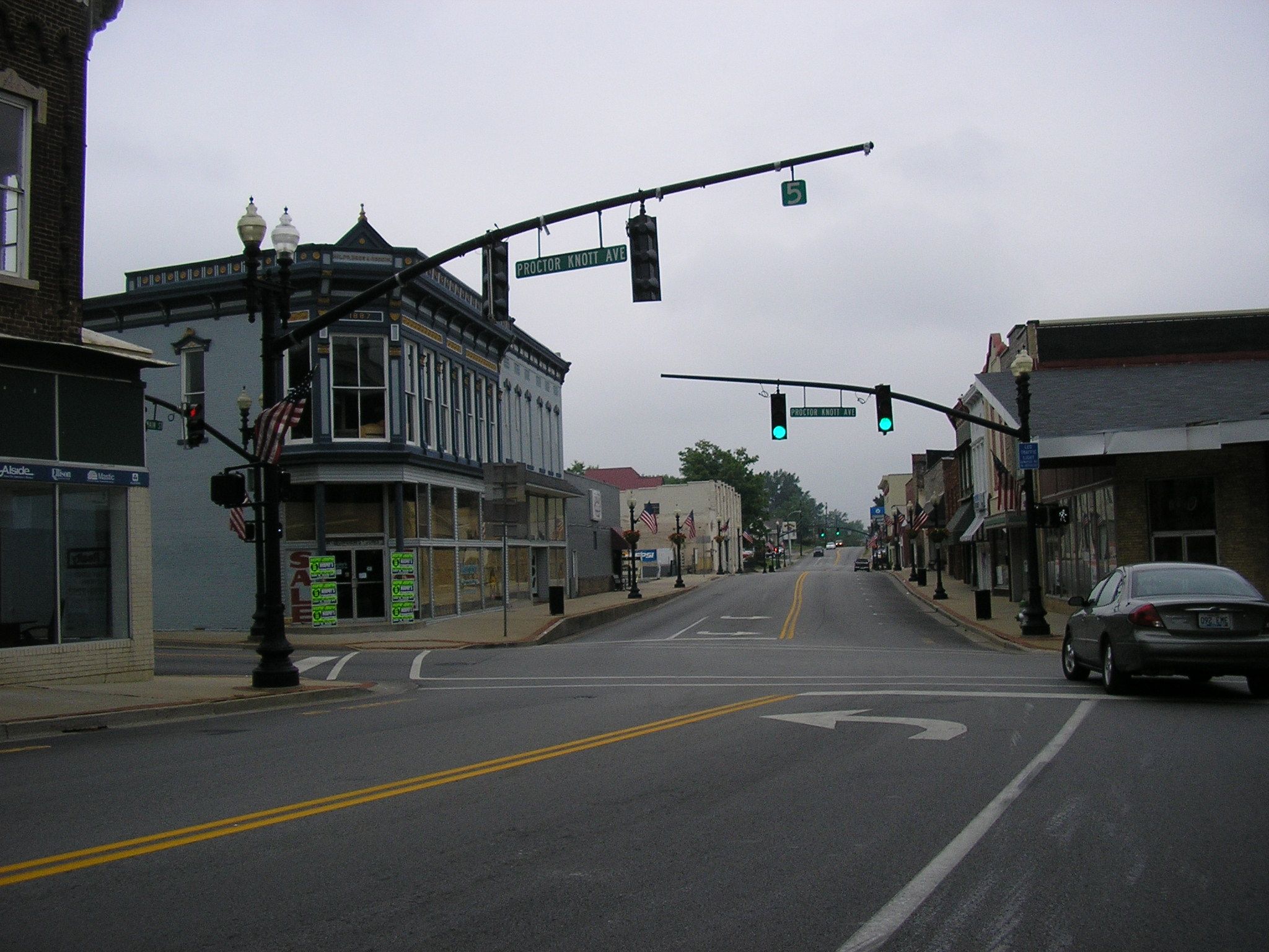
imagesize = 250px
image_caption = Downtown Lebanon
image_
mapsize = 250px
map_caption = Location of Lebanon, Kentucky
mapsize1 =
map_caption1 =subdivision_type = Country
subdivision_name =United States
subdivision_type1 = State
subdivision_name1 =Kentucky
subdivision_type2 = County
subdivision_name2 = Marion
government_footnotes =
government_type =
leader_title =
leader_name =
leader_title1 =
leader_name1 =
established_title =
established_date =unit_pref = Imperial
area_footnotes =area_magnitude =
area_total_km2 = 11.4
area_land_km2 = 11.4
area_water_km2 = 0.0
area_total_sq_mi = 4.4
area_land_sq_mi = 4.4
area_water_sq_mi = 0.0population_as_of = 2000
population_footnotes =
population_total = 5718
population_density_km2 = 500.6
population_density_sq_mi = 1296.6timezone = Eastern (EST)
utc_offset = -5
timezone_DST = EDT
utc_offset_DST = -4
elevation_footnotes =
elevation_m = 241
elevation_ft = 791
latd = 37 |latm = 34 |lats = 14 |latNS = N
longd = 85 |longm = 15 |longs = 23 |longEW = Wpostal_code_type =
ZIP code
postal_code = 40033
area_code = 270
blank_name = FIPS code
blank_info = 21-44344
blank1_name = GNIS feature ID
blank1_info = 0496130
website =
footnotes =Lebanon is a city in Marion County,
Kentucky ,United States . The population was 5,718 at the 2000 census. It is thecounty seat of Marion County.GR|6 Lebanon is located in central Kentucky, southeast of Louisville. A national cemetery is located nearby.It is located at the junction of
US 68 andKentucky Route 55 .Geography
Lebanon is located at coor dms|37|34|14|N|85|15|23|W|city (37.570623, -85.256263).GR|1
According to the
United States Census Bureau , the city has a total area of 4.4square mile s (11.4km² ), all of it land. This area is rich in Civil War History including being burned to the ground by Confederate Army General John Hunt Morgan twice.Demographics
As of the
census GR|2 of 2000, there were 5,718 people, 2,332 households, and 1,476 families residing in the city. Thepopulation density was 1,296.6 people per square mile (500.6/km²). There were 2,555 housing units at an average density of 579.3/sq mi (223.7/km²). The racial makeup of the city was 77.88% White, 19.92% African American, 0.12% Native American, 0.73% Asian, 0.47% from other races, and 0.87% from two or more races. Hispanic or Latino of any race were 1.03% of the population.There were 2,332 households out of which 29.5% had children under the age of 18 living with them, 39.5% were married couples living together, 20.2% had a female householder with no husband present, and 36.7% were non-families. 33.1% of all households were made up of individuals and 16.0% had someone living alone who was 65 years of age or older. The average household size was 2.31 and the average family size was 2.92.
In the city the population was spread out with 23.7% under the age of 18, 9.5% from 18 to 24, 26.8% from 25 to 44, 21.5% from 45 to 64, and 18.5% who were 65 years of age or older. The median age was 37 years. For every 100 females there were 85.4 males. For every 100 females age 18 and over, there were 80.8 males.
The median income for a household in the city was $21,860, and the median income for a family was $26,552. Males had a median income of $25,889 versus $18,680 for females. The
per capita income for the city was $14,311. About 26.7% of families and 30.3% of the population were below thepoverty line , including 42.8% of those under age 18 and 20.9% of those age 65 or over.The population was 5,528 in 1970; 6,590 in 1980; and 5,695 in 1990.
History
It was established in 1814 and named for the Biblical
Lebanon because of the abundant cedar trees. The founding community traces back to the Hardin's Creek Meeting House, built byPresbyterians fromVirginia . It became the county seat of Marion County by 1835.A branch of the
Louisville & Nashville Railroad was built to Lebanon in 1857, but the promising growth of the town was halted by the Civil War. Three battles were fought near the town, and control over the railroad branch passed between Union and Confederate hands several times. Confederates burnt the railroad depot, a hotel, several residences onJuly 5 1863 by men ofJohn Hunt Morgan 's cavalry.The town rebounded after the war and became a trade center, but declined as railroads became less important to commerce in the 1900s.
References
External links
Wikimedia Foundation. 2010.