- Greenville, Kentucky
:otherplaces3|Greenville
Infobox Settlement
official_name = Greenville
settlement_type =City 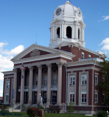
imagesize =
image_caption = The courthouse in Greenville, KY
image_
mapsize = 250px
map_caption = Location of Greenville withinKentucky .
mapsize1 =
map_caption1 =
subdivision_type = Country
subdivision_name =United States
subdivision_type1 = State
subdivision_name1 =Kentucky
subdivision_type2 = County
subdivision_name2 = Muhlenberg
government_type =
leader_title = Mayor
leader_name = Eddie DeArmond
leader_title1 =
leader_name1 =
established_title = Settled
established_date = Caney Station, 1799 [http://www.tennkin.com/hist/greenvillehist.htm History of Greenville, Muhlenberg County, Kentucky] ]
established_title2 = Incorporated
established_date2 = Greenville, 1812
area_magnitude =
area_total_km2 = 12.4
area_land_km2 = 12.4
area_water_km2 = 0.0
area_total_sq_mi = 4.8
area_land_sq_mi = 4.8
area_water_sq_mi = 0.0
elevation_m = 160
elevation_ft = 525
latd = 37 |latm = 12 |lats = 26 |latNS = N
longd = 87 |longm = 10 |longs = 35 |longEW = W
population_as_of = 2000
population_note =
population_total = 4398
timezone = CST
utc_offset = -6
timezone_DST = CDT
utc_offset_DST = -5
postal_code_type = ZIP Code
postal_code = 42345
area_code = 270
blank_name = FIPS code
blank_info = 21-33022
blank1_name = GNIS feature ID
blank1_info = 0493344
footnotes =
website =Greenville is a city in and the
county seat of Muhlenberg County,Kentucky ,United States .GR|6 It is named for Revolutionary War General Nathan Greene. The population was 4,398 at the 2000 census.Geography
Greenville is located at coor dms|37|12|26|N|87|10|35|W|city (37.207158, -87.176499)GR|1.
According to the
United States Census Bureau , the city has a total area of 4.8square mile s (12.4km² ), of which, 4.8 square miles (12.4 km²) of it is land and 0.21% is water.Demographics
As of the
census GR|2 of 2000, there were 4,398 people, 1,859 households, and 1,217 families residing in the city. Thepopulation density was 921.7 people per square mile (356.0/km²). There were 2,047 housing units at an average density of 429.0/sq mi (165.7/km²). The racial makeup of the city was 89.88% White, 8.75% African American, 0.16% Native American, 0.09% Asian, 0.11% from other races, and 1.00% from two or more races. Hispanic or Latino of any race were 0.30% of the population.There were 1,859 households out of which 25.4% had children under the age of 18 living with them, 49.8% were married couples living together, 12.9% had a female householder with no husband present, and 34.5% were non-families. 32.7% of all households were made up of individuals and 18.2% had someone living alone who was 65 years of age or older. The average household size was 2.19 and the average family size was 2.75.
In the city the population was spread out with 19.1% under the age of 18, 7.6% from 18 to 24, 23.7% from 25 to 44, 25.2% from 45 to 64, and 24.4% who were 65 years of age or older. The median age was 45 years. For every 100 females there were 77.7 males. For every 100 females age 18 and over, there were 73.9 males.
The median income for a household in the city was $25,521, and the median income for a family was $35,571. Males had a median income of $37,454 versus $18,375 for females. The
per capita income for the city was $19,708. About 14.2% of families and 19.0% of the population were below thepoverty line , including 24.1% of those under age 18 and 15.4% of those age 65 or over.Economy
The 1987 "Encyclopedia of Kentucky" refers to Greenville as "the unofficial capital of the Black Belt", a reference to the area's production of
coal and darktobacco . [cite book |title="Encyclopedia of Kentucky" |chapter=Dictionary of Places: Greenville |publisher=Somerset Publishers |location=New York, New York |year=1987 |isbn=0403099811]ites of interest
Duncan Cultural Center
The Duncan Cultural Center occupies the former home of William Graham Duncan on Cherry Street in Greenville. Constructed in 1912, the home was donated to the city of Greenville by Hamilton Richardson Duncan, Sr., the last of the Duncan family to reside there, in 1986. It became the Duncan Cultural Center a year later, but did not open to the public until 1989. [ [http://www.duncanculturalcenter.com/history.htm Duncan Cultural Center History] ]
Today, the Center displays a number of artifacts related to the history and culture of Muhlenberg County, including a coal museum. It is also available for rent to host parties and other special events.
Muhlenberg County Rail Trail
The Muhlenberg County
Rail Trail is a paved trail following an old Paducah and Louisville railway route betweenCentral City, Kentucky and Greenville that is open to pedestrian and non-motorized vehicle traffic. Kentucky's most extensive rail trail conversion to date, the Muhlenberg Rail Trail openedOctober 20 ,2000 and was named "Trail of the Month" by the Rails to Trails Conservancy in May 2004. [ [http://www.railtrails.org/find/totm/archives/04-05.asp Trail of the Month - Muhlenberg County Rail Trail] ] A viewing platform and birding guide are available where the trail passes through a local wetland. [ [http://www.traillink.com/TL_Active_Pages/TrailSearch/default.asp?Action=DisplayDetails&ID=1753&Trail=Muhlenberg+County+Rail-Trail&SearchQueryString=Action=StateSearch&Keyword=&State=KY&Activity=&UseOther=&AS_State=&AS_Countie Rails to Trails Conservancy - Muhlenberg County Rail Trail] ] The Muhlenberg County Rails to Trails Committee has railbanked an additional 3 miles of abandoned rail, possibly for a later extension into McLean County. [ [http://www.kyrailtrail.org/projects/muhlenberg.php Kentucky Rails to Trails Council - Muhlenberg County Rail Trail] ]Notable natives
*Actor
Warren Oates was born in Depoy, just outside of Greenville
*Alney McLean (1779-1841) was aUnited States Representative from Kentucky.
*Edward Rumsey (1796-1868) was a United States Representative from Kentucky.
*Vernard Eugene Bivin (1921-1942) was a recipient of theNavy Cross and was the namesake of thedestroyer escort USS Bivin (DE-536) References
External links
* [http://www.muhlenbergchamber.org Greater Muhlenberg Chamber of Commerce]
Wikimedia Foundation. 2010.