- Muhlenberg County, Kentucky
-
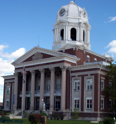
Muhlenberg County, Kentucky  Muhlenberg County Courthouse in Greenville, Kentucky.
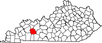
Location in the state of Kentucky
Kentucky's location in the U.S.Founded 1798 Named for John Peter Muhlenberg (1746–1807), American Revolutionary War general. Seat Greenville Area
- Total
- Land
- Water
479.43 sq mi (1,242 km²)
474.72 sq mi (1,230 km²)
4.71 sq mi (12 km²), 0.98%Population
- (2010)
- Density
31,839
67/sq mi (26/km²)Time zone Central: UTC-6/-5 Website www.muhlenbergchamber.org Muhlenberg County is a county located in the U.S. state of Kentucky. As of the 2010 Census, the population was 31,499. The county is named for Peter Muhlenberg. Its county seat is Greenville.
The Central City Micropolitan Statistical Area includes all of Muhlenberg County. Central City is the largest city in the county with a 2010 Census of 5,978 residents.
Contents
Geography
Muhlenberg County is part of the Western Coal Fields region of Kentucky. According to the 2010 census, the county has a total area of 479.43 square miles (1,241.7 km2), of which 474.72 square miles (1,229.5 km2) (or 99.02%) is land and 4.71 square miles (12.2 km2) (or 0.98%) is water.[1]
Geographic features
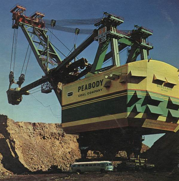
The two primary aquatic features of Muhlenberg County are the Green River and Lake Malone. The northern portion of the county is typically gently rolling hills, river flatlands, and some sizeable bald cypress swamps along Cypress Creek and its tributaries. The southern portion consist of rolling hills with higher relief. Many of the valleys in the southern part of the county are rather deep and in places and somewhat rugged. This area is also known for many sandstone formations and some small limestone caves, of which only two known limestone caves are thought to be in the county, both in the far southern region. A number of faults cross the county at roughly the half-way point between neighboring counties to the north and south. Coal has been, and continues to be, a large natural resource found in the central portion of the county. Most deposits reside deep underground where in the past, the deposits were closer to the surface. In the recent past, it was common to see machines such as the "Big Brother" Power Shovel (pictured on the right) throughout the county. During the 1970s and early 1980s, Muhlenberg County was the state leader in Coal Production and in some cases, the top producer of coal in the United States.
 The Bucyrus Erie 3850-B Power Shovel named "Big Brother" went to work next door to Paradise Fossil Plant for Peabody Coal Company's Sinclair Surface Mine in 1962. When it started work it was received with grand fanfare and was the Largest Shovel in The World with a bucket size of 115 cubic yards. After it finished work in the mid-1980s, it was buried in a pit on the mine's property. It remains there still today.
Muhlenberg County's predominate rock type is sandstone. As one travels south and gets closer to the southern border, one begins to notice limestone outcroppings become more numerous and much closer to the surface. Early attempts at extracting iron ore were tried at Old Airdrie on the banks of the Green River and at Buckner Furnace south of Greenville, Kentucky. Both operations were in operation in the late 19th century and early 20th century. Neither of which were successful in the long run.
Green River
The 300 miles (483 km) long Green River is a tributary of the Ohio River. It provides a commercial outlet for goods (primarily coal) to be shipped from the county to the major trade centers along the Mississippi River. Muhlenberg County and the Green River first entered the popular conscience due to the John Prine song "Paradise", which was popularized by John Denver, about a now-defunct coal-mining town in Muhlenberg County.
While John Denver may have aided in the popularity, the song gained most of its popularity from loyal Prine fans in the midwest.[citation needed]
Lake Malone
Spanning 788 acres (3.19 km2) near the small town of Dunmor in southern Muhlenberg County, Lake Malone provides a locale for water recreation such as swimming, boating, and fishing. Lake Malone and the surrounding hardwood forest form Lake Malone State Park. Lake Malone is maintained by the Kentucky Department of Fish and Wildlife. The lakes surface extends into two neighboring counties. The lake is known for its sandstone cliffs and natural sandstone formations along the lake shore including a natural bridge. The bridge itself is not in the boundaries of the state park.
Adjacent counties
- McLean County (north)
- Ohio County (northeast)
- Butler County (east)
- Logan County (southeast)
- Todd County (south)
- Christian County (southwest)
- Hopkins County (west)
Demographics
Historical populations Census Pop. %± 1900 20,741 — 1910 28,598 37.9% 1920 33,353 16.6% 1930 37,784 13.3% 1940 37,554 −0.6% 1950 32,501 −13.5% 1960 27,791 −14.5% 1970 27,537 −0.9% 1980 32,238 17.1% 1990 31,318 −2.9% 2000 31,839 1.7% 2010 31,499 −1.1% Kentucky Census Data 1900-1990 As of the census[2] of 2010, there were 31,499 people, 12,979 households, and 9,057 families residing in the county. The population density was 67 per square mile (26 /km2). There were 13,675 housing units at an average density of 29 per square mile (11 /km2). The racial makeup of the county was 94.19% White, 4.65% Black or African American, 0.13% Native American, 0.13% Asian, 0.19% from other races, and 0.72% from two or more races. 0.73% of the population were Hispanic or Latino of any race.
There were 12,979 households out of which 30.70% had children under the age of 18 living with them, 59.70% were married couples living together, 10.40% had a female householder with no husband present, and 26.70% were non-families. 24.30% of all households were made up of individuals and 12.60% had someone living alone who was 65 years of age or older. The average household size was 2.45 and the average family size was 2.90.
In the county the population was spread out with 22.60% under the age of 18, 9.20% from 18 to 24, 28.00% from 25 to 44, 24.80% from 45 to 64, and 15.50% who were 65 years of age or older. The median age was 39 years. For every 100 females there were 98.00 males. For every 100 females age 18 and over, there were 96.20 males.
The median income for a household in the county was $28,566, and the median income for a family was $33,513. Males had a median income of $29,952 versus $18,485 for females. The per capita income for the county was $14,798. About 15.50% of families and 19.70% of the population were below the poverty line, including 26.00% of those under age 18 and 17.00% of those age 65 or over.
Cities and towns
Economy
Muhlenberg County has been a major coal-producing region for the United States for many years. In fact, during most of the 1970s Muhlenberg County annually produced more coal than anywhere else in the world. It led the state of Kentucky in coal production throughout the 1970s and even into the early 1980s before falling off. Although the use of coal waned in the late 1980s and early 1990s, as the 21st Century rolled around, the coal-mining industry in Muhlenberg and surrounding counties began to expand again and has once again provided a significant number of jobs in the region. One reason for this is the willingness of utility operators to install flue gas cleaning systems so that Bituminous Coal can be burned much cleaner than in decades past. Another reason is that coal from "out west" tends to burn cooler, thus causing a utility to have to buy larger quantities of western coal and mix (or "Blend") it with other compounds or other types of coal. This has proven to be an issue with many East Coast Utility Operators. Muhlenberg County is the home of Kentucky's first commercial coal mine. That mine, while not what one would think of today, opened in 1820 as the "McLean Drift Bank". It was located along the Green River in the former village of Paradise. The mine and its impact on the community are referenced in the John Prine song Paradise. Other major employers in Muhlenberg County have supplemented the coal industry or expanded in other areas of expertise. Those industry's include:
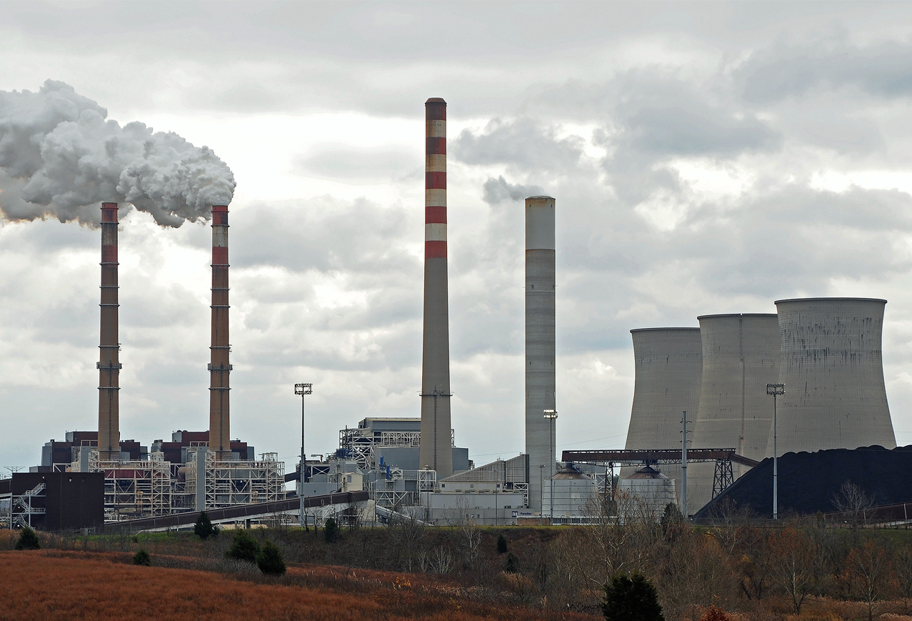
 Paradise Fossil Plant sits close to the original site of the village of Paradise, Kentucky. The power plant is the second largest plant in the TVA Fossil Fuels Plant Inventory with a rated output of 2,630 megawatts. It's composed of three units. Units 1&2 are twin 740 MW units while Unit 3 is the largest Cyclonic Boiler Unit in the World rated at 1,150 MW.
- The Tennessee Valley Authority Paradise Fossil Plant in Drakesboro
- The Green River Correctional Complex in Central City
- Dyno Nobel in Graham
- EBA&D in Graham
- Muhlenberg Community Hospital in Greenville
- Muhlenberg County Board of Education in Powderly
- The Department of the Army, Kentucky National Guard Wendell H. Ford Regional Training Center & Kentucky UTES
- Armstrong Coal Company in Central City
- Ken-American Resources: Paradise Underground Mine in Central City
- Kentucky Utilities Customer Service Center in Greenville
- Kentucky Utilities Green River Generating Station in Central City
- Wal-Mart in Central City. Wal-Mart operates a 136,000 sq ft (12,600 m2). full service Supercenter along US 62.
- Uncle Lee's / Wing Supply in Greenville, Kentucky
Chamber of commerce
In January 2006, the chambers of commerce from Central City and Greenville merged to form the Greater Muhlenberg Chamber of Commerce. The new, unified chamber consists of over 155 local businesses.[3]
Incoming industries
Peabody Energy's new Thoroughbred Energy Plant, a coal-burning power generation facility expected to bring 450 permanent jobs to the area, is to be located in Central City.[4] The plant was projected to begin electricity generation sometime in 2007,[5] but a dispute over Peabody's air quality permit has halted construction plans.[6] The power plant plans have now been scraped and instead, a new partnership between Peabody Energy and ConocoPhillips Oil Company called, "Kentucky NewGas" has been formed. Kentucky NewGas is a state-of-the-art energy center that will transform Kentucky coal into clean natural gas, while creating 500 long-term jobs and $100 million in annual economic benefits. The location of this new, large state-of-the-art facility is on the outskirts of Central City close to the Green River. More information about the project can be found on their website: Kentucky NewGas
On April 25, 2006, frozen food company Gourmet Express announced plans to locate a facility in Greenville. The company has renovated the facility vacated by food distribution company SuperValu in 2001, and is in the process of creating up to 200 permanent jobs.[7]
Education
Schools
Public schools in Muhlenberg County are under the purview of the Muhlenberg County Board of Education. They include:
Elementary (K-5)
- Bremen Elementary School in Bremen
- Central City Elementary School in Central City
- Greenville Elementary School in Greenville
- Longest Elementary School in Powderly
- Muhlenberg South Elementary School in Belton
Middle (6-8)
- Muhlenberg North Middle School in Powderly
- Muhlenberg South Middle School in Greenville
High (9-12)
- Muhlenberg County High School East and Muhlenberg County High School West
Postsecondary
The Muhlenberg Campus of Madisonville Community College is located in Central City. The Muhlenberg Career Development Center is located between Central City & Greenville.
Libraries
There are two public libraries in Muhlenberg County: Harbin Memorial Library in Greenville and Central City Library in Central City. Both locations provide residents with free access to high speed Internet service. These libraries have been joined together as Muhlenberg County Library, although both locations remain open.
History of Education in Muhlenberg County
There were once eight schools in Muhlenberg County, however in 1990, the school board consolidated the middle and high school students into two middle and two high schools. Bremen High School, Central City High School, Graham High School, and half of Muhlenberg Central High School became Muhlenberg North Middle School and Muhlenberg North High School, while the other half of Muhlenberg Central High School, Drakesboro High School, Hughes-Kirkpatrick High School, Greenville High School, and Lake Malone School (which housed some middle school students) became Muhlenberg South Middle School and Muhlenberg South High School. The eight distinct schools continued to house elementary school students.
In 2004, the school board began consolidating the badly deteriorating elementary schools, closing Graham Elementary School and transferring students to Longest Elementary School and the expanded Greenville Elementary School, and closing Lake Malone School transferring those students to Hughes-Kirkpatrick Elementary School. Consolidation continued in 2005 with the closure of Drakesboro Elementary School. Students from Drakesboro spent a year at Hughes-Kirkpatrick Elementary School until the opening of the newly constructed Muhlenberg South Elementary School in 2006 (and subsequent closing of Hughes-Kirkpatrick.)
On February 5, 2008, three communities in Muhlenberg County received major damage during the 2008 Super Tuesday tornado outbreak. These communities were Greenville, Powderly, and Central City. Three residents were killed outside Greenville when the EF-3 tornado struck.
In November 2008 the Muhlenberg County school board announced that both Muhlenberg South High School and Muhlenberg North High School will combine and no longer be the Suns and Stars but will be Muhlenberg County High School home of the Mustangs. The change took effect in June 2009.
Media
- WMTA AM 1380 Radio established in 1955, Central City
- WNES AM 1050 Radio established in 1955, Central City
- Times Argus established in 1909, Central City
- Leader-News established in Greenville now located in Central City
- WKYA FM 105.5 radio station in Greenville
- WQXQ FM 101.9 100,000 watts studios in Central City with tower and transmitter at Pleasant Ridge, Kentucky in Ohio County
Sites and events of interest
- Lake Malone State Park in Dunmor
- Muhlenberg County Rail to Trails, 6-mile (9.7 km) converted railroad track running between Central City and Greenville
- Brewco Motorsports shop in Central City
- Duncan Center Museum & Art Gallery in Greenville
- Four Legends Fountain in Drakesboro
- Labor Day Cruise-In in Central City
- Muhlenberg County Agriculture and Convention Center in Powderly
- Paradise Park in Powderly, includes:
- Coal Mines Shotgun House
- Merle Travis Birthplace
- Paradise Park Museum
- Springridge School
- Tennessee Valley Authority Paradise Fossil Plant in Drakesboro, one of the largest Coal-Fired Power Plants in the United States. Site includes:
- Public Boat Launch Ramp along the Green River
- Public Fishing Lakes
- Historic Village of Paradise Cemetery, the only remnant of the village along the Green River.
Some Notable natives
- James Best (Sheriff Rosco P. Coltrane of the Dukes of Hazzard) was born in Powderly.
- Don Everly of the The Everly Brothers was born in the now-defunct community of Brownie, near Central City.
- Kennedy Jones, guitarist
- Warren Oates, actor, was born in Depoy near Greenville
- Merle Travis, legendary country and western musician was born in Rosewood, Kentucky
See also
References
- ^ "Census 2000 U.S. Gazetteer Files: Counties". United States Census. http://www.census.gov/tiger/tms/gazetteer/county2k.txt. Retrieved 2011-02-13.
- ^ "American FactFinder". United States Census Bureau. http://factfinder.census.gov. Retrieved 2008-01-31.
- ^ Greater Muhlenberg Chamber of Commerce - Message from the President
- ^ http://www.peabodyenergy.com/Operations/Thoroughbred.asp
- ^ Kentucky Issues Air Permit for Peabody's Thoroughbred Energy Campus
- ^ Bruggers, James (2007-08-08). "Ruling delays power plant in Western Ky.". The Courier-Journal. http://www.courier-journal.com/apps/pbcs.dll/article?AID=/20070808/NEWS01/708081149. Retrieved 2007-08-08.[dead link]
- ^ Governor Ernie Fletcher Announces Gourmet Express to Locate in Greenville
External links
- Muhlenberg County Schools
- Greater Muhlenberg Chamber of Commerce
- Photos of the damage path caused by the 2008 Super Tuesday tornado outbreak
Municipalities and communities of Muhlenberg County, Kentucky County seat: Greenville Cities Ghost town Categories:- Kentucky counties
- Muhlenberg County, Kentucky
- 1799 establishments in the United States
- Populated places established in 1799


Wikimedia Foundation. 2010.