- Mount Sterling, Ohio
-
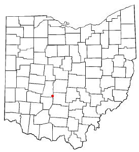
Mount Sterling, Ohio — Village — Location of Mount Sterling, Ohio
Coordinates: 39°43′10″N 83°16′5″W / 39.71944°N 83.26806°WCoordinates: 39°43′10″N 83°16′5″W / 39.71944°N 83.26806°W Country United States State Ohio County Madison Area – Total 1.0 sq mi (2.5 km2) – Land 1.0 sq mi (2.5 km2) – Water 0.0 sq mi (0.0 km2) Elevation[1] 902 ft (275 m) Population (2000) – Total 1,865 – Density 1,897.9/sq mi (732.8/km2) Time zone Eastern (EST) (UTC-5) – Summer (DST) EDT (UTC-4) ZIP code 43143 Area code(s) 740 FIPS code 39-53046[2] GNIS feature ID 1065077[1] Mount Sterling is a village in Madison County, Ohio, United States. The population was 1,865 at the 2000 census. It is a part of the Columbus, Ohio Metropolitan Statistical Area.
The Mount Sterling Public Library in 2005 loaned more than 57,000 items to its 3,000 cardholders. Total holdings in 2005 were over 37,000 volumes with over 30 periodical subscriptions.[3]
Contents
Geography
Mount Sterling is located at 39°43′10″N 83°16′5″W / 39.71944°N 83.26806°W (39.719528, -83.267999)[4].
According to the United States Census Bureau, the village has a total area of 1.0 square mile (2.6 km2), all of it land.
History
Mount Sterling was laid out in 1826 or 1828 by John J. Smith, Esq. of Mount Sterling, Kentucky, named after Smith's hometown, and recorded at London on June 26, 1829.[5] The Mount Sterling Post Office was established on June 8, 1830,[6] with Rowland Wilson as the first postmaster.[5] The post office was discontinued on November 15, 1831, but re-established on April 6, 1832.[6] The town was incorporated on March 12, 1845,[5] and the corporation limits expanded in 1873.[7] As of 1875, the community contained three churches, one bank, five dry goods stores, three grocery stores, two drug stores, one hotel, two harness shops, one hardware store, one stove store, two boot and shoe stores, two blacksmith shops, a carriage manufacturing company, one wagon shop, four physicians, and one flour mill.[7] As of 1915, the town was lighted by electricity, had a city waterworks, and contained two grain elevators, one opera house, one high school, one grade school, and multiple churches and stores.[5]
Demographics
As of 1875, the population was 600,[7] and 1200 in 1915.[5]
As of the census[2] of 2000, there were 1,865 people, 780 households, and 497 families residing in the village. The population density was 1,897.9 people per square mile (734.8/km²). There were 828 housing units at an average density of 842.6 per square mile (326.2/km²). The racial makeup of the village was 97.32% White, 0.21% African American, 0.32% Native American, 0.11% Asian, 0.86% from other races, and 1.18% from two or more races. Hispanic or Latino of any race were 1.98% of the population.
There were 780 households out of which 32.6% had children under the age of 18 living with them, 44.7% were married couples living together, 14.6% had a female householder with no husband present, and 36.2% were non-families. 32.2% of all households were made up of individuals and 14.2% had someone living alone who was 65 years of age or older. The average household size was 2.39 and the average family size was 3.01.
In the village the population was spread out with 27.7% under the age of 18, 10.4% from 18 to 24, 29.7% from 25 to 44, 19.2% from 45 to 64, and 13.0% who were 65 years of age or older. The median age was 34 years. For every 100 females there were 86.7 males. For every 100 females age 18 and over, there were 84.5 males.
The median income for a household in the village was $33,412, and the median income for a family was $40,543. Males had a median income of $32,264 versus $25,819 for females. The per capita income for the village was $16,138. About 7.9% of families and 9.4% of the population were below the poverty line, including 9.3% of those under age 18 and 9.8% of those age 65 or over.
Notable residents
- John W. Bricker - Republican politician who served as a United States Senator and Governor of Ohio
- Bob Hill - basketball coach in the NBA
- Jeriah Swetland — Ohio state representative
References
- ^ a b "US Board on Geographic Names". United States Geological Survey. 2007-10-25. http://geonames.usgs.gov. Retrieved 2008-01-31.
- ^ a b "American FactFinder". United States Census Bureau. http://factfinder.census.gov. Retrieved 2008-01-31.
- ^ "2005 Ohio Public Library Statistics:Statistics by County and Town". State Library of Ohio. http://winslo.state.oh.us/publib/2005_stats_by_county.xls. Retrieved November 6, 2006.
- ^ "US Gazetteer files: 2010, 2000, and 1990". United States Census Bureau. 2011-02-12. http://www.census.gov/geo/www/gazetteer/gazette.html. Retrieved 2011-04-23.
- ^ a b c d e Bryan, Chester E., History of Madison County, Ohio, B.F. Bowen & Company, Inc., Indianapolis, Indiana, 1915, Pg. 183.
- ^ a b U.S. Geological Survey Geographic Names Information System: Mount Sterling Post Office
- ^ a b c J. A. Caldwell, Caldwell's Atlas of Madison County, Ohio, Condit, Ohio, 1875, Pg. 10.
External links
Municipalities and communities of Madison County, Ohio City 
Villages Midway | Mount Sterling | Plain City‡ | South Solon | West Jefferson
Townships CDP Unincorporated
communitiesFootnotes ‡This populated place also has portions in an adjacent county or counties
Categories:- Villages in Ohio
- Populated places in Madison County, Ohio
- Columbus, Ohio metropolitan area

Wikimedia Foundation. 2010.