- Mount Orab, Ohio
-
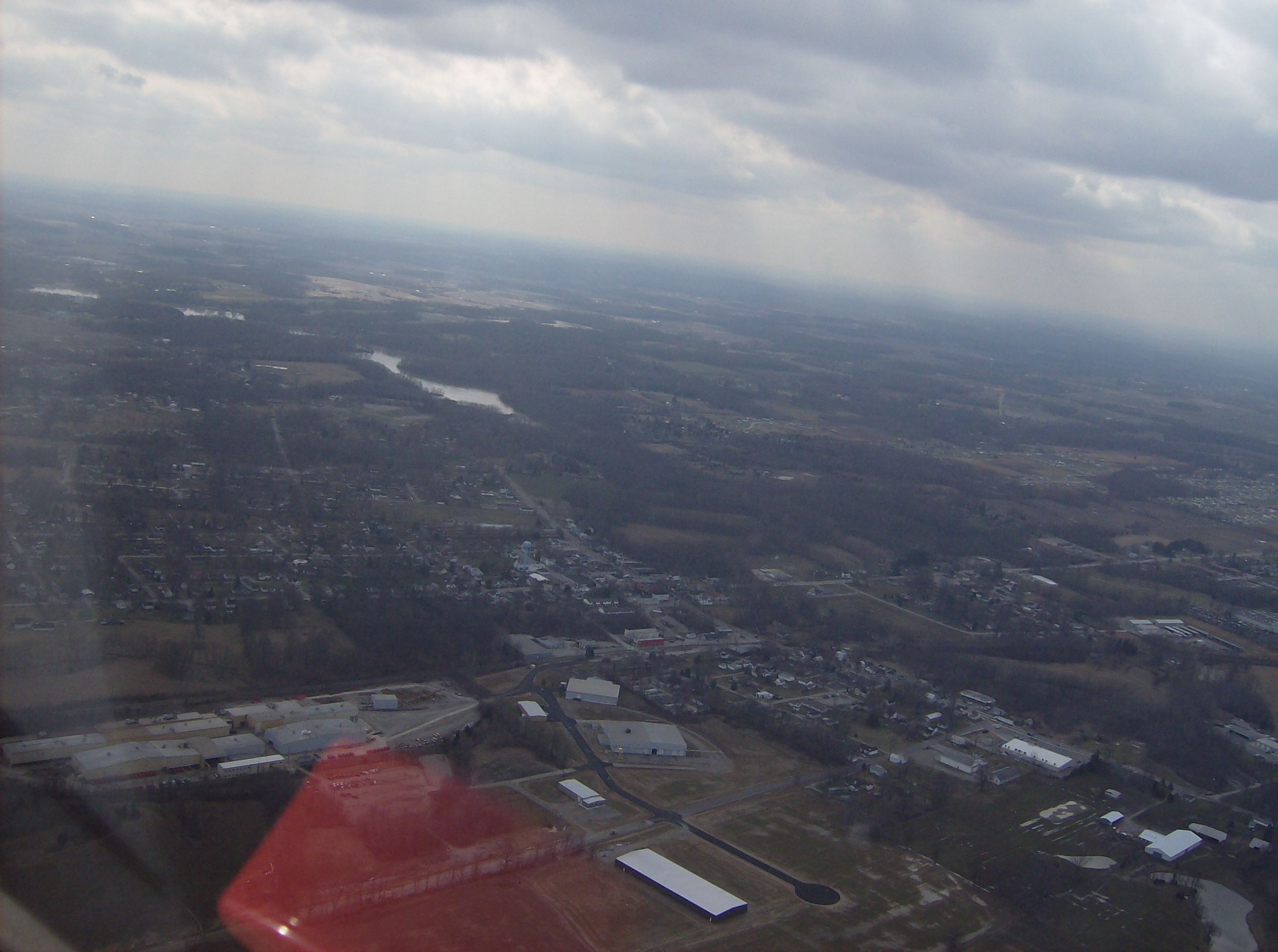
Mount Orab, Ohio — Village — Aerial view of central Mt. Orab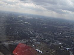 Location of Mount Orab, Ohio
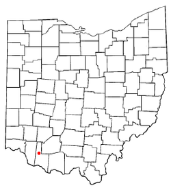
Coordinates: 39°1′47″N 83°55′30″W / 39.02972°N 83.925°WCoordinates: 39°1′47″N 83°55′30″W / 39.02972°N 83.925°W Country United States State Ohio County Brown Government – Mayor Bruce Lunsford Area – Total 3.8 sq mi (9.8 km2) – Land 3.8 sq mi (9.8 km2) – Water 0.0 sq mi (0.0 km2) Elevation[1] 942 ft (287 m) Population (2000) – Total 2,307 – Density 607.7/sq mi (234.6/km2) Time zone Eastern (EST) (UTC-5) – Summer (DST) EDT (UTC-4) ZIP code 45154 Area code(s) 937 FIPS code 39-52906[2] GNIS feature ID 1065073[1] Website http://www.mtoraboh.us/ Mount Orab is a village in Brown County, Ohio, United States. The population was 2,307 at the 2000 census.
Contents
Geography
Mount Orab is located at 39°1′47″N 83°55′30″W / 39.02972°N 83.925°W (39.029613, -83.924918).[3]
According to the United States Census Bureau, the village has a total area of 3.8 square miles (9.8 km2), all land.
Demographics
As of the census[2] of 2000, there were 2,307 people, 879 households, and 639 families residing in the village. The population density was 607.7 people per square mile (234.4/km²). There were 932 housing units at an average density of 245.5 per square mile (94.7/km²). The racial makeup of the village was 99.22% White, 0.13% African American, 0.22% Native American, 0.04% Asian, and 0.39% from two or more races. Hispanic or Latino of any race were 0.22% of the population.
There were 879 households out of which 40.6% had children under the age of 18 living with them, 51.5% were married couples living together, 16.6% had a female householder with no husband present, and 27.3% were non-families. 23.4% of all households were made up of individuals and 11.1% had someone living alone who was 65 years of age or older. The average household size was 2.61 and the average family size was 3.05.
In the village the population was spread out with 30.8% under the age of 18, 9.8% from 18 to 24, 30.6% from 25 to 44, 17.5% from 45 to 64, and 11.3% who were 65 years of age or older. The median age was 30 years. For every 100 females there were 86.7 males. For every 100 females age 18 and over, there were 80.5 males.
The median income for a household in the village was $33,798, and the median income for a family was $42,938. Males had a median income of $33,672 versus $21,339 for females. The per capita income for the town was $16,483. About 12.5% of families and 14.6% of the population were below the poverty line, including 20.2% of those under age 18 and 8.7% of those age 65 or over.
Education
Trivia
- Mount Orab was formerly home to the Lake Drive-In movie theater, which was destroyed by a storm in the late 1980s. After the theater was shut down, the management posted "Gone with the Wind" on the marquee, a punning reference to the storm. A local newspaper printed a picture of the marquee prompting rumors that a tornado had taken the theater out during a re-release of Gone with the Wind. [1]
- A 1942 photograph in the Library of Congress, long thought to be a picture of another small Ohio town (Mount Gilead), was recently identified as Mount Orab by sharp-eyed observers on the Shorpy.com website. [2]
References
- ^ a b "US Board on Geographic Names". United States Geological Survey. 2007-10-25. http://geonames.usgs.gov. Retrieved 2008-01-31.
- ^ a b "American FactFinder". United States Census Bureau. http://factfinder.census.gov. Retrieved 2008-01-31.
- ^ "US Gazetteer files: 2010, 2000, and 1990". United States Census Bureau. 2011-02-12. http://www.census.gov/geo/www/gazetteer/gazette.html. Retrieved 2011-04-23.
Municipalities and communities of Brown County, Ohio Villages Aberdeen | Fayetteville | Georgetown | Hamersville | Higginsport | Mount Orab | Ripley | Russellville | Sardinia‡ | St. Martin

Townships Unincorporated
communitiesFootnotes ‡This populated place also has portions in an adjacent county or counties
Categories:- Villages in Ohio
- Populated places in Brown County, Ohio


Wikimedia Foundation. 2010.