- Mount Gilead, Ohio
-
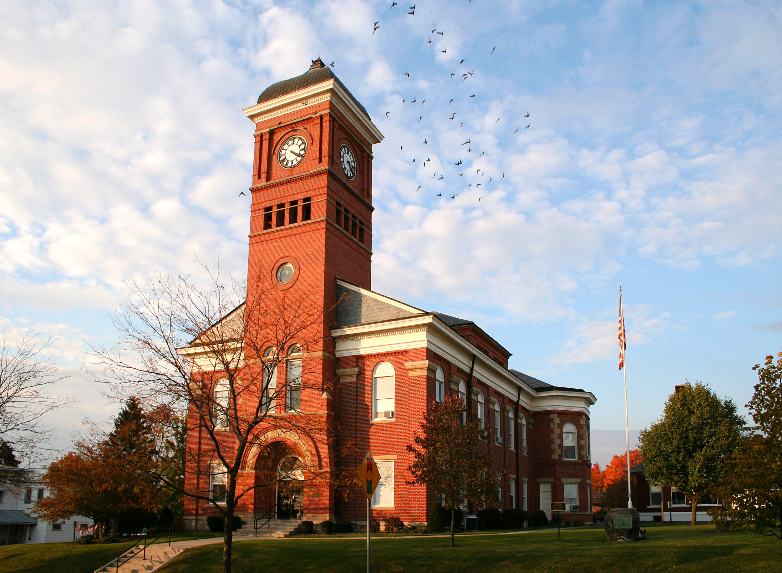
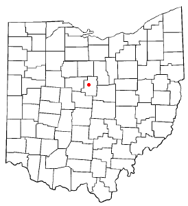
Mount Gilead, Ohio — Village — Morrow County Courthouse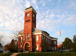 Location of Mount Gilead, Ohio
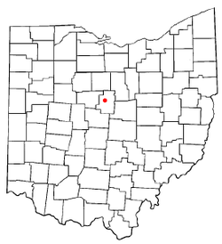
Coordinates: 40°33′8″N 82°49′54″W / 40.55222°N 82.83167°WCoordinates: 40°33′8″N 82°49′54″W / 40.55222°N 82.83167°W Country United States State Ohio County Morrow Government – Mayor Mike Porter Area – Total 3.2 sq mi (8.3 km2) – Land 3.2 sq mi (8.2 km2) – Water 0.0 sq mi (0.0 km2) Elevation[1] 1,135 ft (346 m) Population (2000) – Total 3,290 – Density 1,035.7/sq mi (399.9/km2) Time zone Eastern (EST) (UTC-5) – Summer (DST) EDT (UTC-4) ZIP code 43338 Area code(s) 419 FIPS code 39-52738[2] GNIS feature ID 1065069[1] Website http://www.mountgilead.net/ Mount Gilead is a village in Morrow County, Ohio, United States.
Mount Gilead's population was 3,290 at the 2000 census. It is the county seat of Morrow County and the center of population of Ohio[3].[1] The village was established in 1832, eight years after white settlers arrived in the region. Before their arrival, the forest was a hunting area for the Shawnee tribe.
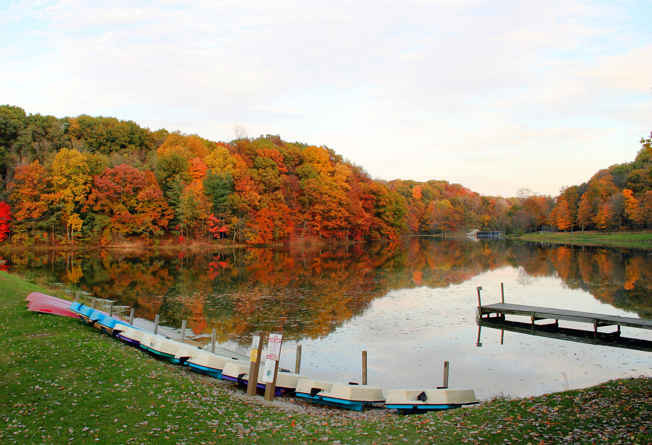
Located in the center of the village is Morrow County's historic World War I Victory Memorial Shaft, unique in the United States, and Mount Gilead State Park is nearby on State Route 95. Other areas drawing tourism include the Amish farms, shops and stores east of Mount Gilead, near Chesterville and Johnsville. Mount Gilead is also home to the Morrow County Hospital.
Contents
History
Four properties in Mount Gilead are listed on the National Register of Historic Places: the floral hall at the county fairgrounds, Levering Hall, the Morrow County Courthouse, and the James S. Trimble House.[4] Levering Hall in particular is distinguished by its ornate Italianate architecture and its place as the center of community life for several decades.[5]
Geography
Mount Gilead is located at 40°33′8″N 82°49′54″W / 40.55222°N 82.83167°W (40.552090, -82.831587)[6]. Its elevation is 1,081 feet above sea level.
According to the United States Census Bureau, the village has a total area of 3.2 square miles (8.3 km²), of which, 3.2 square miles (8.2 km²) of it is land and 0.31% is water.
Mount Gilead is considered to be a part of "Central Ohio."
Demographics
As of the census[2] of 2000, there were 3,290 people, 1,291 households, and 843 families residing in the village. The population density was 1,035.7 people per square mile (399.5/km²). There were 1,354 housing units at an average density of 426.3 per square mile (164.4/km²). The racial makeup of the village was 97.78% White, 0.12% Native American, 0.24% Asian, 0.30% from other races, 1.06% African American, and 0.49% from two or more races. Hispanic or Latino of any race were 1.03% of the population.
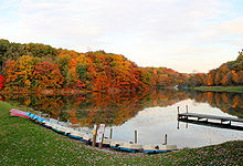 Mount Gilead State Park.
There were 1,291 households out of which 31.6% had children under the age of 18 living with them, 50.8% were married couples living together, 10.6% had a female householder with no husband present, and 34.7% were non-families. 31.1% of all households were made up of individuals and 18.1% had someone living alone who was 65 years of age or older. The average household size was 2.35 and the average family size was 2.91.
In the village the population was spread out with 24.0% under the age of 18, 8.4% from 18 to 24, 28.3% from 25 to 44, 20.5% from 45 to 64, and 18.8% who were 65 years of age or older. The median age was 38 years. For every 100 females there were 90.5 males. For every 100 females age 18 and over, there were 90.0 males.
The median income for a household in the village was $31,894, and the median income for a family was $42,529. Males had a median income of $35,714 versus $22,425 for females. The per capita income for the village was $19,064. About 10.1% of families and 13.2% of the population were below the poverty line, including 18.1% of those under age 18 and 16.4% of those age 65 or over.
Government
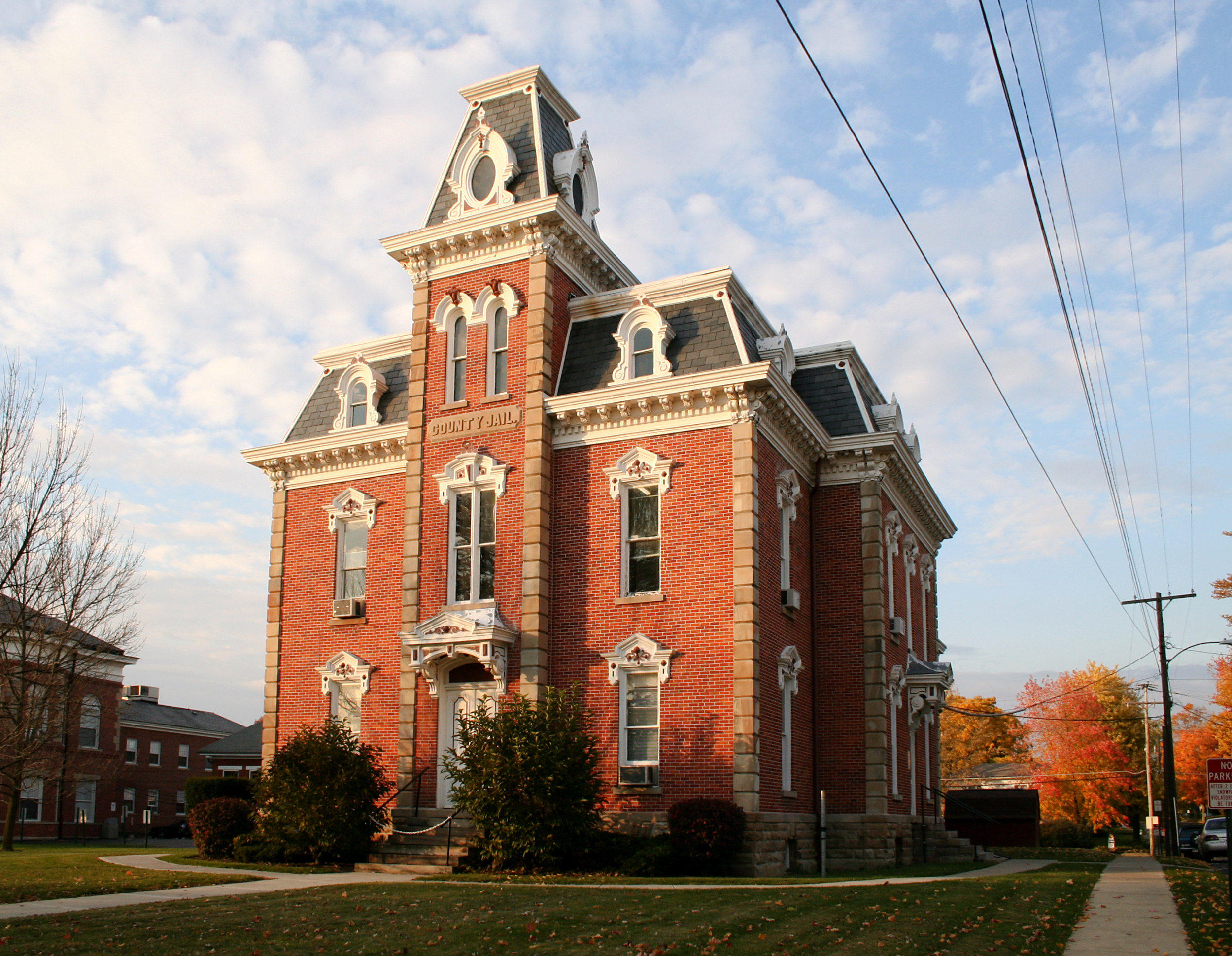
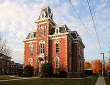 Old Morrow County Jail.
Mount Gilead is governed by a mayor and council. As of 2008, the mayor was Mike Porter, and the village council was composed of president Steve Hart and members John Curtis, Emily Shaffer, Brandon Strain, Keith Strait, and Betty Williams.[7]
Notable natives and residents
- Oswald Bruce Cooper — graphic designer
- Tim Belcher — former Major League Baseball pitcher
- Claude Dallas — self-styled mountain man convicted of involuntary manslaughter, later escaped from prison.
- C.B. Dollaway — professional mixed martial arts fighter
- Merrill Gilfillan — author
- William Vermillion Houston — president of Rice University
- Robert Byington Mitchell — soldier and governor of New Mexico
- Edwin Taylor Pollock — United States Navy Captain, Governor of U.S. Virgin Islands and American Samoa
- Dawn Powell — satirical author
- Samuel Snider — U.S. Representative from Minnesota
- Lefty Webb — baseball player for the Pittsburgh Pirates
- Samuel Newitt Wood — Kansas state legislator
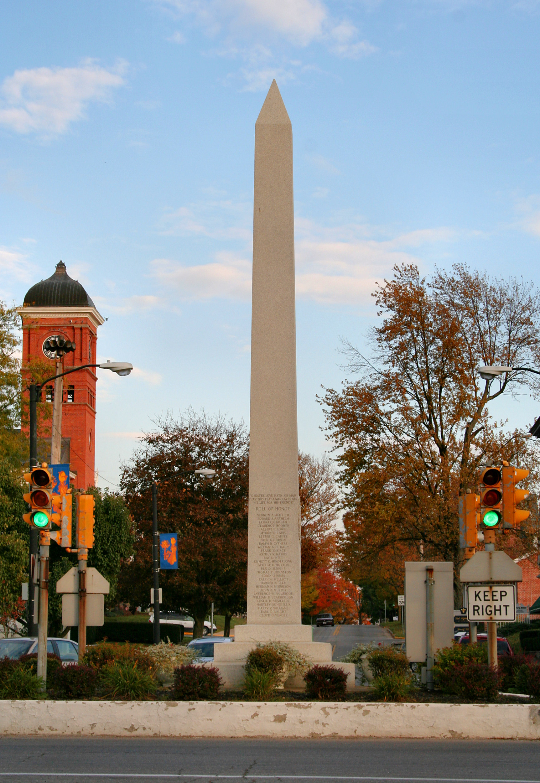
Victory Shaft
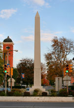 Victory Memorial Shaft.
The Victory Shaft was erected in Mount Gilead's town square in December 1919, following World War I. It was presented as a gift from the federal government to Morrow County citizens to thank them for purchasing more war bonds per capita than any other county. Warren G. Harding, a Senator at the time, was the keynote speaker at the dedication.
References
- ^ a b "US Board on Geographic Names". United States Geological Survey. 2007-10-25. http://geonames.usgs.gov. Retrieved 2008-01-31.
- ^ a b "American FactFinder". United States Census Bureau. http://factfinder.census.gov. Retrieved 2008-01-31.
- ^ "Find a County". National Association of Counties. http://www.naco.org/Counties/Pages/FindACounty.aspx. Retrieved 2011-06-07.
- ^ "National Register Information System". National Register of Historic Places. National Park Service. 2009-03-13. http://nrhp.focus.nps.gov/natreg/docs/All_Data.html.
- ^ Owen, Lorrie K., ed. Dictionary of Ohio Historic Places. Vol. 2. St. Clair Shores: Somerset, 1999, 1075.
- ^ "US Gazetteer files: 2010, 2000, and 1990". United States Census Bureau. 2011-02-12. http://www.census.gov/geo/www/gazetteer/gazette.html. Retrieved 2011-04-23.
- ^ Mount Gilead, Ohio Village Administration, Mount Gilead, 2007. Accessed 2007-10-18.
External links
Municipalities and communities of Morrow County, Ohio County seat: Mount GileadCity 
Villages Cardington | Chesterville | Edison | Fulton | Marengo | Mount Gilead | Sparta
Townships Bennington | Canaan | Cardington | Chester | Congress | Franklin | Gilead | Harmony | Lincoln | North Bloomfield | Perry | Peru | South Bloomfield | Troy | Washington | Westfield
Unincorporated
communitiesFootnotes ‡This populated place also has portions in an adjacent county or counties
Categories:

Wikimedia Foundation. 2010.