- Ohio State Route 95
-
State Route 95
Route information Maintained by ODOT Length: 89.20 mi[1] (143.55 km) Existed: 1926 – present Major junctions West end:  SR 37 in LaRue
 US 23 near Marion
 I-71 near Mount Gilead
East end:  SR 3 near Wooster
Location Counties: Marion, Morrow, Knox, Richland, Ashland, Wayne Highway system Ohio highways
Interstates • U.S. Routes • State Routes←  SR 94
SR 94SR 96  →
→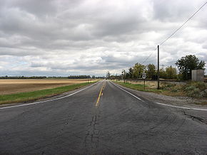 State Route 95 in rural western Marion County
State Route 95 is an east–west state highway in the central part of the U.S. state of Ohio. Its western terminus is in LaRue at State Route 37 and its eastern terminus is at State Route 3 just south of Wooster.
Route 95A
Route 95A is an 1.14-mile[1] alternate route of SR 95 in downtown Mount Gilead. SR 95 splits at the intersection of High Street and Marion Street in Mount Gilead. SR 95 runs east through Mount Gilead as High Street while Route 95A runs east through Mount Gilead as Marion Street, just a few blocks south of High Street. The two routes then intersect again, with Route 95A ending at SR 95 near River Cliff Cemetery.
References
- ^ a b Ohio Department of Transportation. "Technical Services Straight Line Diagrams". http://www.odotonline.org/techservapps/SLD/default.htm. Retrieved April 30, 2010.
Categories:- State highways in Ohio
- Transportation in Marion County, Ohio
- Transportation in Morrow County, Ohio
- Transportation in Knox County, Ohio
- Transportation in Ashland County, Ohio
- Transportation in Wayne County, Ohio
- Transportation in Richland County, Ohio

Wikimedia Foundation. 2010.