- Clark Township, Brown County, Ohio
-
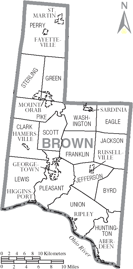
Clark Township, Brown County, Ohio — Township — Municipalities and townships of Brown County.
Coordinates: 38°55′27″N 83°59′26″W / 38.92417°N 83.99056°WCoordinates: 38°55′27″N 83°59′26″W / 38.92417°N 83.99056°W Country United States State Ohio County Brown Area – Total 30.1 sq mi (78.1 km2) – Land 30.1 sq mi (78.0 km2) – Water 0.0 sq mi (0.0 km2) Elevation[1] 968 ft (295 m) Population (2000) – Total 3,165 – Density 105.0/sq mi (40.6/km2) Time zone Eastern (EST) (UTC-5) – Summer (DST) EDT (UTC-4) FIPS code 39-15224[2] GNIS feature ID 1085793[1] Clark Township is one of the sixteen townships of Brown County, Ohio, United States. The 2000 census found 3,165 people in the township, 2,650 of whom lived in the unincorporated portions of the township.[3]
Contents
Geography
Located in the western part of the county, it borders the following townships:
- Pike Township - north
- Scott Township - east
- Pleasant Township - southeast
- Lewis Township - south
- Tate Township, Clermont County - west
- Williamsburg Township, Clermont County - northwest corner
The village of Hamersville is located in central Clark Township.
Name and history
Statewide, other Clark Townships are located in Clinton, Coshocton, and Holmes Counties.
Government
The township is governed by a three-member board of trustees, who are elected in November of odd-numbered years to a four-year term beginning on the following January 1. Two are elected in the year after the presidential election and one is elected in the year before it. There is also an elected township fiscal officer,[4] who serves a four-year term beginning on April 1 of the year after the election, which is held in November of the year before the presidential election. Vacancies in the fiscal officership or on the board of trustees are filled by the remaining trustees.
References
- ^ a b "US Board on Geographic Names". United States Geological Survey. 2007-10-25. http://geonames.usgs.gov. Retrieved 2008-01-31.
- ^ "American FactFinder". United States Census Bureau. http://factfinder.census.gov. Retrieved 2008-01-31.
- ^ Brown County, Ohio — Population by Places Estimates Ohio State University, 2007. Accessed 15 May 2007.
- ^ §503.24, §505.01, and §507.01 of the Ohio Revised Code. Accessed 4/30/2009.
External links
Municipalities and communities of Brown County, Ohio Villages Aberdeen | Fayetteville | Georgetown | Hamersville | Higginsport | Mount Orab | Ripley | Russellville | Sardinia‡ | St. Martin

Townships Unincorporated
communitiesFootnotes ‡This populated place also has portions in an adjacent county or counties
Categories:- Townships in Brown County, Ohio

Wikimedia Foundation. 2010.