- Obion River
-
Obion River 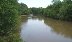
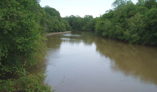
The Obion River near Obion, TennesseeMouth Mississippi River on the border of Dyer and Lauderdale counties. Basin countries USA Mouth elevation 230 ft (70 m) The Obion River system is the primary surface water drainage system of northwestern Tennessee.
The Obion has four major forks, the North Fork, Middle Fork, South Fork and Rutherford Fork (the last being named for the town of Rutherford). The confluences of these forks are only a few miles above the mouth of the Obion's discharge into the Mississippi River. For the majority of their lengths, the forks exist as separate streams.
In the mid-20th century, the Obion system was largely channelized for agricultural purposes, under the auspices of the Obion-Forked Deer Basin Authority, a Tennessee state agency which coordinated this work with the United States Army Corps of Engineers. Some of the results of channelization included increasing erosion, loss of wildlife habitat, and increased flooding downstream. Now this process has been halted, and, in a few places, even somewhat reversed, with the restoration of wetlands.
The origin of the name "Obion" is obscure, with some contending that it derives from a Native American word and others that it represents a corruption of the name of an Irish trapper, O'Bion or, perhaps, O'Brien.
Obion County, Tennessee, is named after the Obion River.
After the 1818 Chickasaw cession of West Tennessee (known in Kentucky as Jackson Purchase) Davy Crockett moved to the South Fork Obion River, until his later move to Texas.
See also
- List of Tennessee rivers
External links
Categories:- Rivers of Tennessee
- Tributaries of the Mississippi River
- Geography of Dyer County, Tennessee
- Geography of Gibson County, Tennessee
- Geography of Lauderdale County, Tennessee
- Geography of Obion County, Tennessee
Wikimedia Foundation. 2010.